File:American Central Railway, 1866. LOC 98688576.jpg
Jump to navigation
Jump to search

Size of this preview: 799 × 290 pixels. Other resolutions: 320 × 116 pixels | 640 × 232 pixels | 1,024 × 372 pixels | 1,280 × 465 pixels | 2,560 × 929 pixels | 14,031 × 5,093 pixels.
Original file (14,031 × 5,093 pixels, file size: 7.95 MB, MIME type: image/jpeg)
Captions
Captions
Add a one-line explanation of what this file represents
Summary[edit]
| Description |
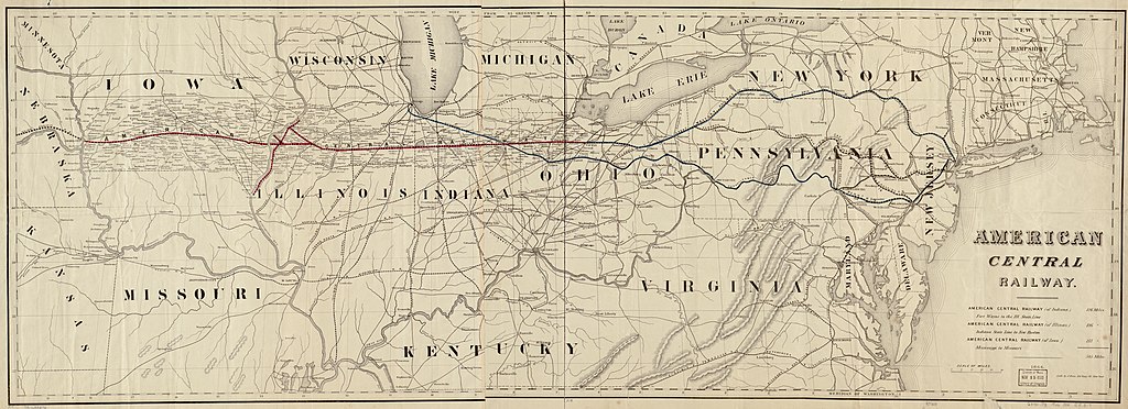
English: Outline map of the northeastern United States showing relief by hachures, drainage, and place names concentrated along the main line between Omaha City and Tifflin, Ohio; shows connections of the American Central Railway with the railroad network. |
||
| Title | American Central Railway, 1866. | ||
| Shelf ID | G3701.P3 1866 .B54 | ||
| Date | |||
| Source | https://www.loc.gov/item/98688576/ | ||
| Author | Bien, Julius; American Central Railway | ||
| Permission (Reusing this file) |
|
||
| Other versions |
|
||
| Location | United States | ||
| Part of | American Memory · Catalog · Railroad Maps, 1828-1900 · Geography And Map Division · Transportation And Communication | ||
| Subject | United States · Railroads · American Central Railway · Maps |

Licensing[edit]
|
This is a faithful photographic reproduction of a two-dimensional, public domain work of art. The work of art itself is in the public domain for the following reason:
The official position taken by the Wikimedia Foundation is that "faithful reproductions of two-dimensional public domain works of art are public domain".
This photographic reproduction is therefore also considered to be in the public domain in the United States. In other jurisdictions, re-use of this content may be restricted; see Reuse of PD-Art photographs for details. | ||||
File history
Click on a date/time to view the file as it appeared at that time.
| Date/Time | Thumbnail | Dimensions | User | Comment | |
|---|---|---|---|---|---|
| current | 00:23, 8 June 2018 | 14,031 × 5,093 (7.95 MB) | Fæ (talk | contribs) | LOC Maps https://www.loc.gov/item/98688576/ #23238 |
You cannot overwrite this file.
File usage on Commons
The following page uses this file: