File:An accurate map of North and South Carolina with their Indian frontiers, shewing in a distinct manner all the mountains, rivers, swamps, marshes, bays, creeks, harbours, sandbanks and soundings on the LOC 74692513.jpg
Jump to navigation
Jump to search

Size of this preview: 800 × 588 pixels. Other resolutions: 320 × 235 pixels | 640 × 471 pixels | 1,024 × 753 pixels | 1,280 × 941 pixels | 2,560 × 1,883 pixels | 16,904 × 12,431 pixels.
Original file (16,904 × 12,431 pixels, file size: 32.4 MB, MIME type: image/jpeg)
Captions
Captions
Add a one-line explanation of what this file represents
Summary[edit]
| Warning | The original file is very high-resolution. It might not load properly or could cause your browser to freeze when opened at full size. |
|---|
| Description |
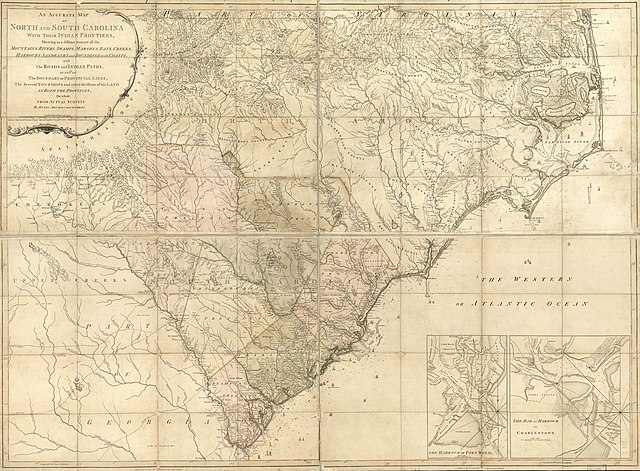
English: Scale ca. 1:530,000. Hand colored. LC copy sectioned and mounted on cloth backing. LC copy imperfect: Deteriorated along folds. "Longitude west from London." Relief shown by hachures. Depths shown by soundings. Shows precinct boundaries. Insets: The harbour of Port Royal [ca. 1:200,000]--The bar and harbour of Charlestown [ca. 1:75,000] LC Maps of North America, 1750-1789, 1394 Available also through the Library of Congress Web site as a raster image. Vault AACR2 |
||
| Title | An accurate map of North and South Carolina with their Indian frontiers, shewing in a distinct manner all the mountains, rivers, swamps, marshes, bays, creeks, harbours, sandbanks and soundings on the coasts; with the roads and Indian paths; as well as the boundary of provincial lines, the several townships and other divisions of the land in both the provinces; | ||
| Shelf ID | G3900 1775 .M6 | ||
| Date | |||
| Source | https://www.loc.gov/item/74692513/ | ||
| Author | Mouzon, Henry; Robert Sayer And John Bennett (Firm) | ||
| Permission (Reusing this file) |
|
||
| Location | North Carolina. · South Carolina. · Beaufort. · Sea Islands · North Carolina · United States · South Carolina · Charleston Harbor · Sea Islands. · South Carolina · Charleston · Charleston. · Beaufort · United States | ||
| Part of | Military Battles And Campaigns · American Memory · Catalog · Geography And Map Division · American Revolution And Its Era: Maps And Charts Of North America And The West Indies, 1750-1789 | ||
| Subject | Sea Islands · North Carolina · United States · Maps · Early Works To 1800 · Charleston Harbor (S.C.) · Beaufort · Administrative And Political Divisions · South Carolina · Charleston · Harbors |

Licensing[edit]
|
This is a faithful photographic reproduction of a two-dimensional, public domain work of art. The work of art itself is in the public domain for the following reason:
The official position taken by the Wikimedia Foundation is that "faithful reproductions of two-dimensional public domain works of art are public domain".
This photographic reproduction is therefore also considered to be in the public domain in the United States. In other jurisdictions, re-use of this content may be restricted; see Reuse of PD-Art photographs for details. | ||||
File history
Click on a date/time to view the file as it appeared at that time.
| Date/Time | Thumbnail | Dimensions | User | Comment | |
|---|---|---|---|---|---|
| current | 22:11, 15 May 2018 | | 16,904 × 12,431 (32.4 MB) | Fæ (talk | contribs) | LOC Maps https://www.loc.gov/item/74692513/ #725 |
You cannot overwrite this file.
File usage on Commons
There are no pages that use this file.