File:Blaeu 1645 - Lutzenburg Ducatus.jpg
Jump to navigation
Jump to search
Size of this preview: 783 × 599 pixels. Other resolutions: 314 × 240 pixels | 627 × 480 pixels | 1,004 × 768 pixels | 1,280 × 980 pixels | 2,560 × 1,959 pixels | 2,966 × 2,270 pixels.
Original file (2,966 × 2,270 pixels, file size: 2.37 MB, MIME type: image/jpeg)
Captions
Captions
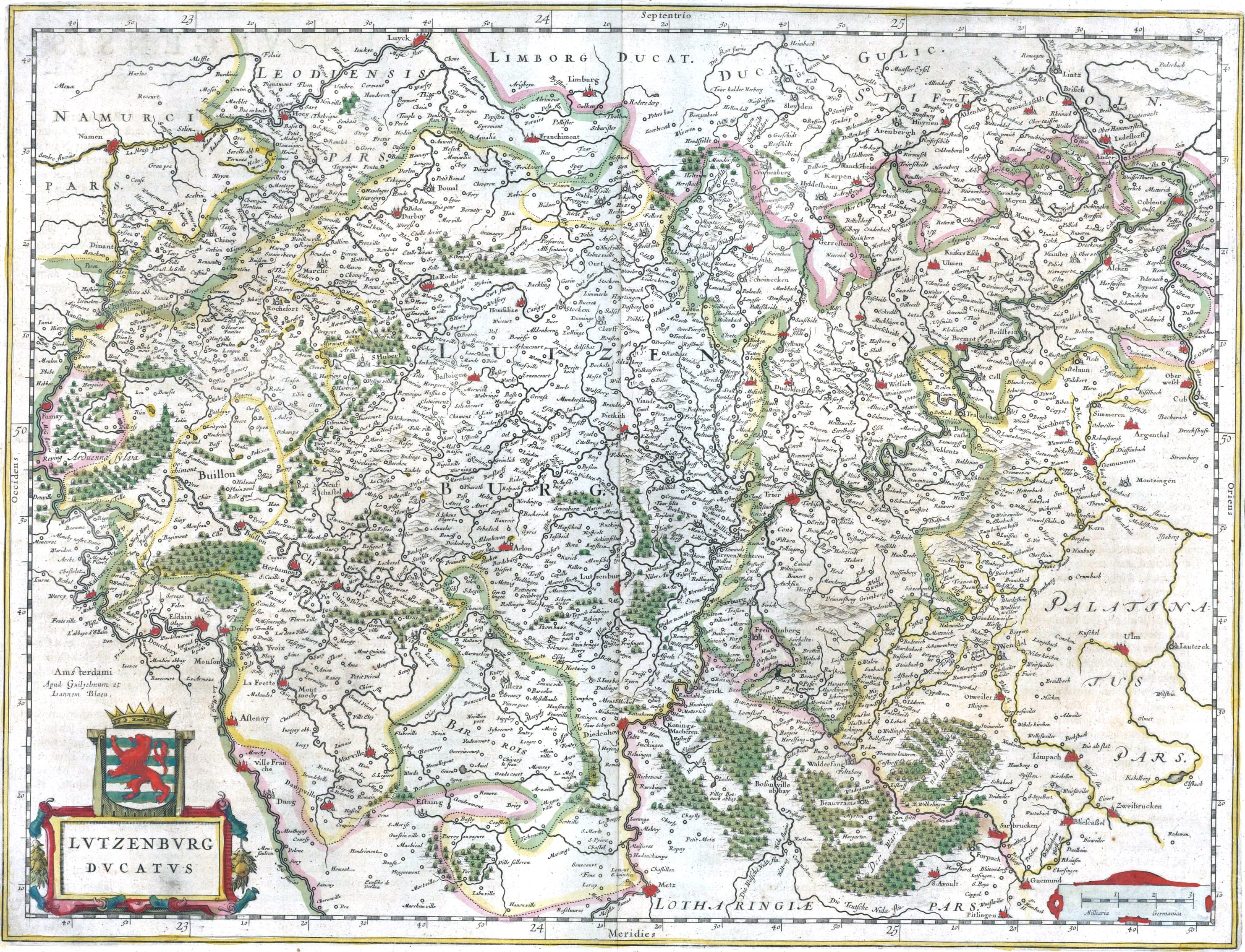
Map of the Duchy of Luxembourg in 1645
Summary[edit]
| Description |
Latina: Lutzenburg Ducatus
English: Map of the Duchy of Luxembourg in 1645.
Français : Carte du duché de Luxembourg en 1645. |
| Date | |
| Source |
|
| Author |
Latina: Editæ a Guiljel et Ioanne Blaeu English: Edited by Willem and Joan Blaeu |
| Other versions |
.jpg) |
Licensing[edit]
|
This work is in the public domain in its country of origin and other countries and areas where the copyright term is the author's life plus 100 years or fewer. | |
| This file has been identified as being free of known restrictions under copyright law, including all related and neighboring rights. | |
File history
Click on a date/time to view the file as it appeared at that time.
| Date/Time | Thumbnail | Dimensions | User | Comment | |
|---|---|---|---|---|---|
| current | 12:08, 29 January 2019 | | 2,966 × 2,270 (2.37 MB) | Gryffindor (talk | contribs) | {{Information |Description= |Source={{own}} |Date= |Author= Gryffindor |Permission= |other_versions= }} |
| 13:12, 17 January 2007 |  | 3,637 × 3,041 (1.56 MB) | Simplicius (talk | contribs) | == Summary == ; Title : '''''Lutzenburg Ducatus''''' (''Duchy of Luxembourg'')<br>from<br>"Theatrum Orbis Terrarum, sive Atlas Novus in quo Tabulæ et Descriptiones Omnium Regionum, Editæ a Guiljel et Ioanne Blaeu"<br>(''Theater of the World, or a New At |
You cannot overwrite this file.
File usage on Commons
The following 5 pages use this file:
File usage on other wikis
The following other wikis use this file:
- Usage on ar.wikipedia.org
- Usage on de.wikipedia.org
- Usage on en.wikipedia.org
- Usage on fr.wikipedia.org
- Usage on lb.wikipedia.org
- Usage on mk.wikipedia.org
- Usage on pl.wikipedia.org
- Usage on zh.wikipedia.org