File:Borneo coastal terrain LOC 2014585446.jpg
Jump to navigation
Jump to search

Size of this preview: 520 × 599 pixels. Other resolutions: 208 × 240 pixels | 416 × 480 pixels | 666 × 768 pixels | 888 × 1,024 pixels | 1,777 × 2,048 pixels | 3,888 × 4,482 pixels.
Original file (3,888 × 4,482 pixels, file size: 2.34 MB, MIME type: image/jpeg)
Captions
Captions
Add a one-line explanation of what this file represents
Summary[edit]
| Description |
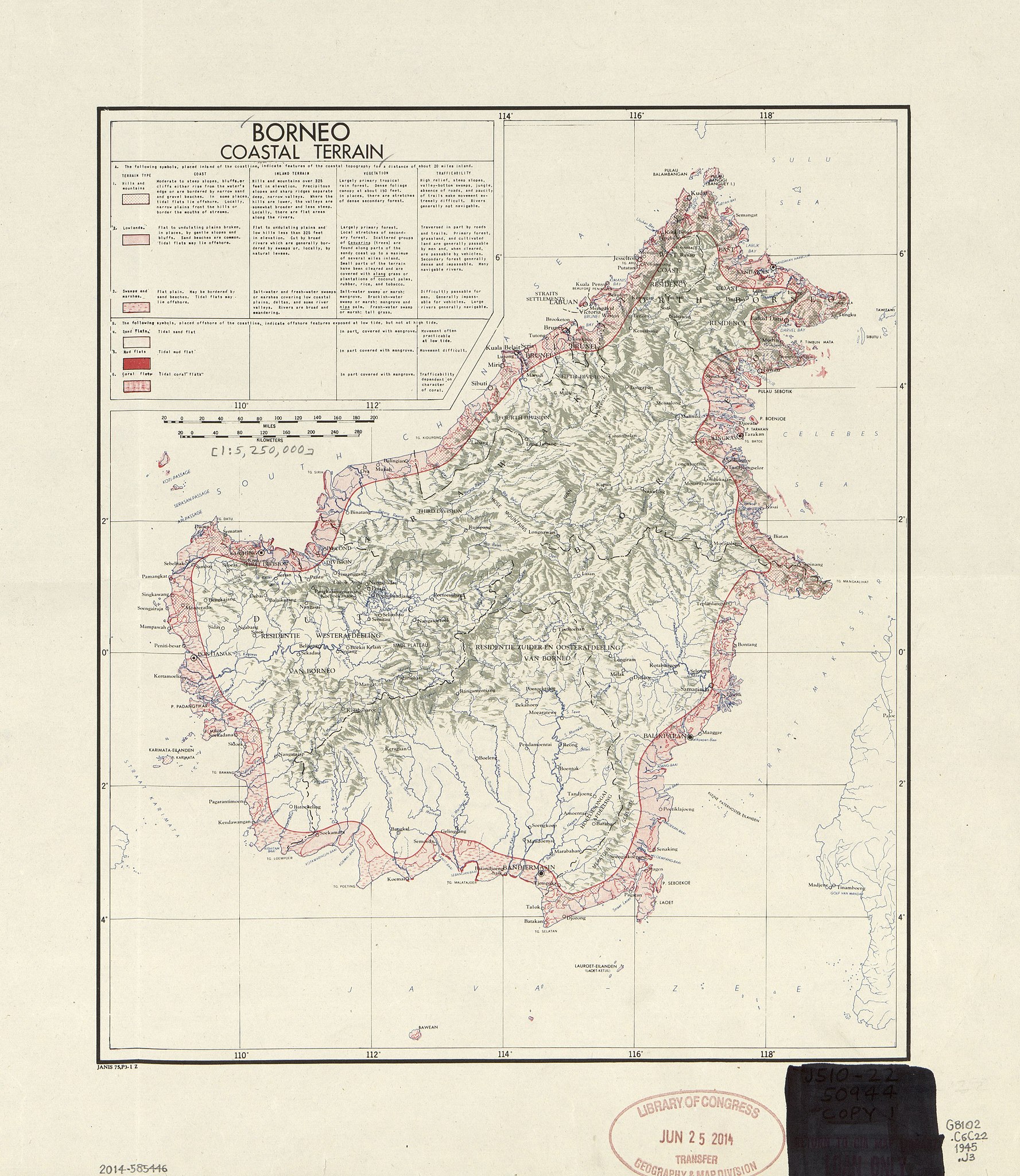
English: Identifies coastal districts as mountains, swamps, marshes, tidal sand flats, tidal mud flats, or tidal coral flats. Covers entire island (including Sarawak and Sabah) Relief shown by shading. LC copy imperfect: Rubber-stamped, annotated in black marker ink/lead-pencil, possibly prepared for inclusion in textual publication. Includes descriptive text in legend. Available also through the Library of Congress Web site as a raster image. |
||
| Title | Borneo coastal terrain | ||
| Shelf ID | G8102.C6C22 1945 .J3 | ||
| Date | |||
| Source | https://www.loc.gov/item/2014585446/ | ||
| Author | Janis (Organization) | ||
| Permission (Reusing this file) |
|
||
| Other versions |
|
||
| Location | Borneo. · Borneo | ||
| Part of | American Memory · General Maps · Catalog · Geography And Map Division | ||
| Subject | Maps · Borneo · Coasts · Landforms · Physical Maps · Seashore |


Licensing[edit]
| This work is from the Library of Congress. According to the library, there are no known copyright restrictions on the use of this work. |  |
File history
Click on a date/time to view the file as it appeared at that time.
| Date/Time | Thumbnail | Dimensions | User | Comment | |
|---|---|---|---|---|---|
| current | 04:48, 21 May 2018 | | 3,888 × 4,482 (2.34 MB) | Fæ (talk | contribs) | LOC Maps https://www.loc.gov/item/2014585446/ #603 |
You cannot overwrite this file.
File usage on Commons
The following page uses this file: