File:Boundary, Gauley River National Recreation Area - exhibit "A" LOC 2007626188.jpg
Jump to navigation
Jump to search

Size of this preview: 800 × 545 pixels. Other resolutions: 320 × 218 pixels | 640 × 436 pixels | 1,024 × 698 pixels | 1,280 × 872 pixels | 2,560 × 1,744 pixels | 11,114 × 7,573 pixels.
Original file (11,114 × 7,573 pixels, file size: 16.6 MB, MIME type: image/jpeg)
Captions
Captions
Add a one-line explanation of what this file represents
Summary[edit]
| Warning | The original file is very high-resolution. It might not load properly or could cause your browser to freeze when opened at full size. |
|---|
| Description |
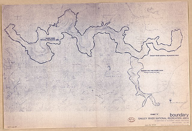
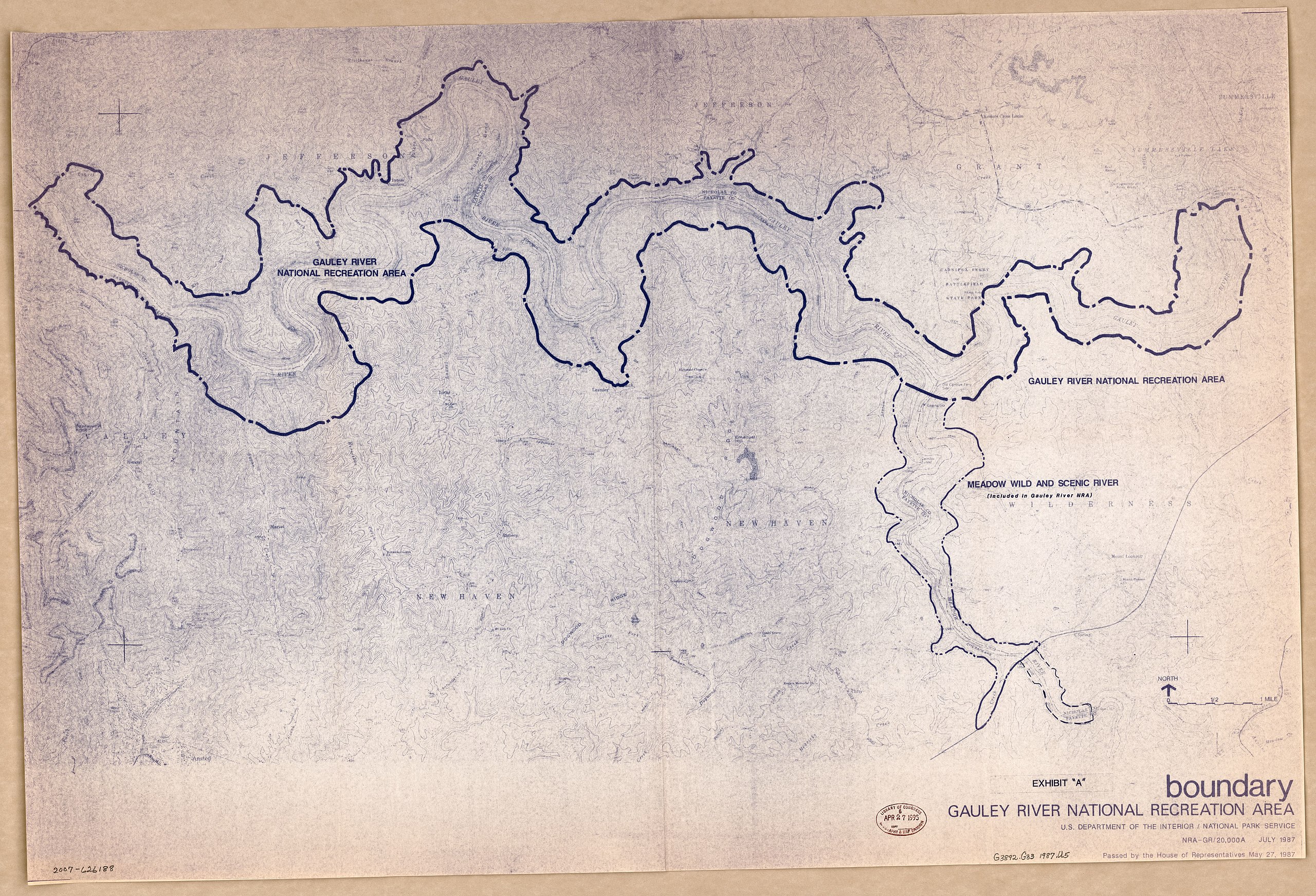
English: "July 1987." Relief shown by contours and spot heights. At lower right: Passed by the House of Representatives May 27,1987. Blue line print. "NRA-GR/20,000A." Available also through the Library of Congress Web site as a raster image. |
||
| Title | Boundary, Gauley River National Recreation Area : exhibit "A" | ||
| Shelf ID | G3892.G33 1987 .U5 | ||
| Date | |||
| Source | https://www.loc.gov/item/2007626188/ | ||
| Author | United States. National Park Service | ||
| Permission (Reusing this file) |
|
||
| Other versions |
|
||
| Location | United States · Gauley River National Recreation Area · West Virginia | ||
| Part of | American Memory · General Maps · Catalog · Geography And Map Division | ||
| Subject | United States · Maps · West Virginia · Gauley River National Recreation Area · Gauley River National Recreation Area (W. Va.) |


Licensing[edit]
| This image or media file contains material based on a work of a National Park Service employee, created as part of that person's official duties. As a work of the U.S. federal government, such work is in the public domain in the United States. See the NPS website and NPS copyright policy for more information. |
File history
Click on a date/time to view the file as it appeared at that time.
| Date/Time | Thumbnail | Dimensions | User | Comment | |
|---|---|---|---|---|---|
| current | 12:53, 6 June 2018 | | 11,114 × 7,573 (16.6 MB) | Fæ (talk | contribs) | LOC Maps https://www.loc.gov/item/2007626188/ #6605 |
You cannot overwrite this file.
File usage on Commons
The following page uses this file: