File:Camp Obihiro Tokachi Airfield Aerial photograph.1977.jpg
Jump to navigation
Jump to search
Size of this preview: 800 × 580 pixels. Other resolutions: 320 × 232 pixels | 640 × 464 pixels | 1,024 × 742 pixels | 1,280 × 927 pixels | 2,560 × 1,855 pixels | 3,906 × 2,830 pixels.
Original file (3,906 × 2,830 pixels, file size: 7.55 MB, MIME type: image/jpeg)
Captions
Captions
Add a one-line explanation of what this file represents
Summary
[edit]
| Description |
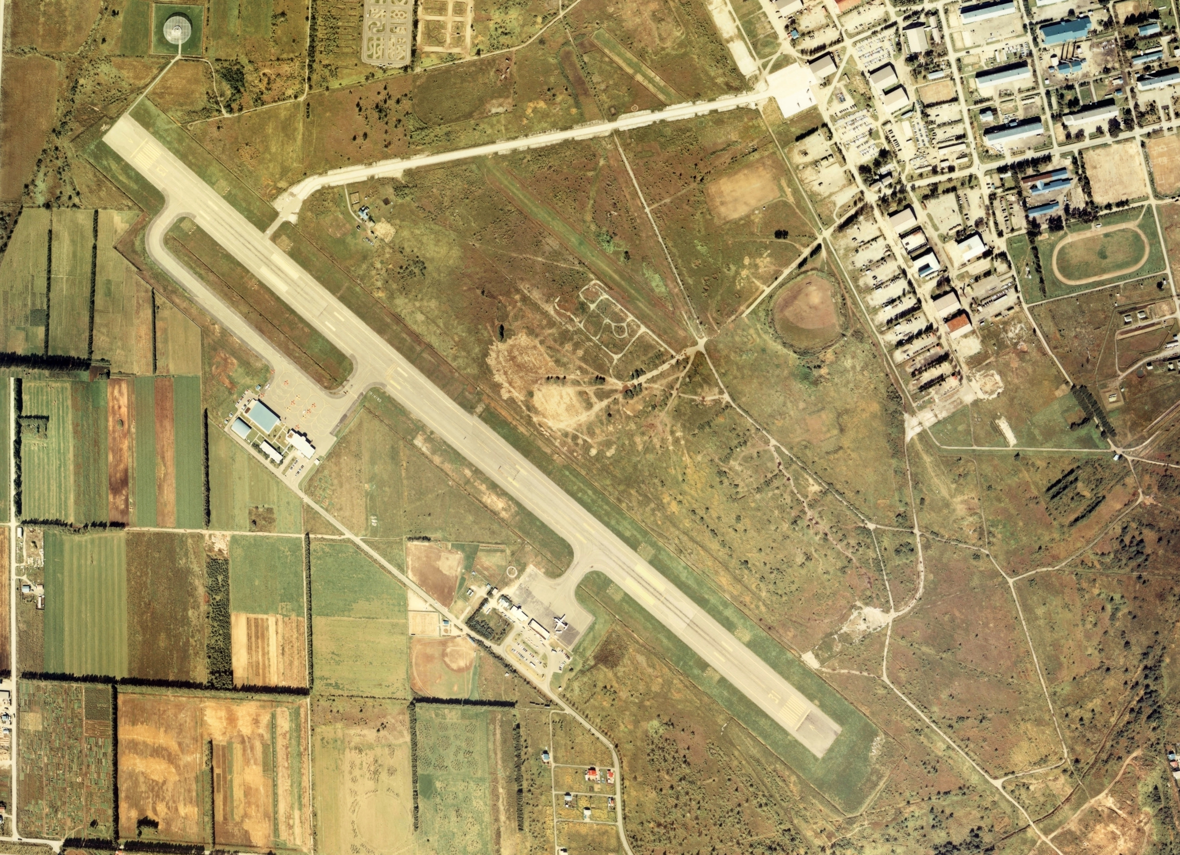
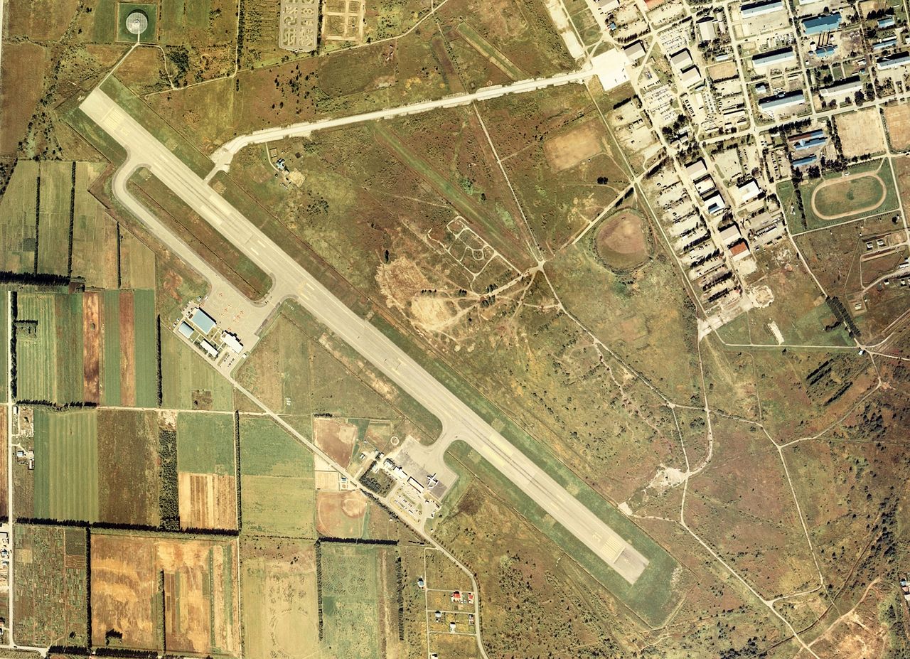
English: Camp Obihiro Tokachi Airfield Aerial photograph.1977
日本語: 帯広駐屯地十勝飛行場の空中写真。cho-77-49_c10bの24,25、cho-77-49_c11の26,27、合計4枚を合成作成。 |
| Date | |
| Source | 国土情報ウェブマッピングシステム |
| Author | 国土交通省 |
Licensing
[edit]

|
The copyright holder of this file, the Ministry of Land, Infrastructure, Transport and Tourism of Japan, allows anyone to use it for any purpose, provided that the copyright holder is properly attributed. Redistribution, derivative work, commercial use, and all other use is permitted. |
Attribution:
Copyright © National Land Image Information (Color Aerial Photographs), Ministry of Land, Infrastructure, Transport and Tourism
|
 |
This image is copyrighted by the Ministry of Land, Infrastructure, Transport and Tourism of Japan. For terms of use, see the stipulation to use of National Land Information (in Japanese) and message from MLIT (in Japanese and English). When you display this image on an article, include the following phrase in the description: "Made based on National Land Image Information (Color Aerial Photographs), Ministry of Land, Infrastructure, Transport and Tourism".
|
File history
Click on a date/time to view the file as it appeared at that time.
| Date/Time | Thumbnail | Dimensions | User | Comment | |
|---|---|---|---|---|---|
| current | 15:27, 26 August 2013 | | 3,906 × 2,830 (7.55 MB) | さかおり (talk | contribs) | {{Information |Description ={{en|1=Camp Obihiro Tokachi Airfield Aerial photograph.1977}} {{ja|1=帯広駐屯地十勝飛行場の空中写真。cho-77-49_c10bの24,25、cho-77-49_c11の26,27、合計4枚を合成作成。}} |Source =国土... |
You cannot overwrite this file.
File usage on Commons
The following page uses this file:
File usage on other wikis
The following other wikis use this file:
- Usage on ceb.wikipedia.org
- Usage on fa.wikipedia.org
- Usage on ja.wikipedia.org
- Usage on www.wikidata.org