File:Carte topo-administrative du Sarawak 1944-45.pdf
Jump to navigation
Jump to search

Size of this JPG preview of this PDF file: 800 × 450 pixels. Other resolutions: 320 × 180 pixels | 640 × 360 pixels | 1,024 × 575 pixels | 1,500 × 843 pixels.
Original file (1,500 × 843 pixels, file size: 3.12 MB, MIME type: application/pdf)
Captions
Captions
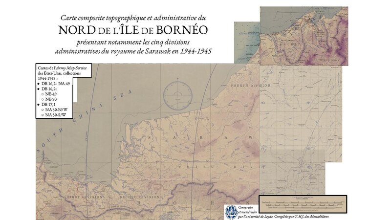
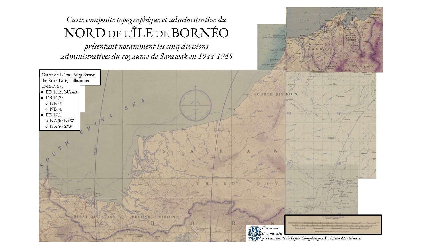
Topographical and administrative composite map of the North of the island of Borneo showing the five administrative divisions of the Kingdom of Sarawak in 1944-1945
Summary
[edit]| Description |
English: Topographical and administrative composite map of the North of the island of Borneo showing the five administrative divisions of the Kingdom of Sarawak in 1944-1945
Français : Carte composite topographique et administrative du Nord de l'île de Bornéo présentant notamment les cinq divisions administratives du royaume de Sarawak en 1944-1945 |
| Date | |
| Source | www.digitalcollections.universiteitleiden.nl |
| Author | Collectif (Army Map Service) |
Licensing
[edit]This work is in the public domain in the United States because it is a work prepared by an officer or employee of the United States Government as part of that person’s official duties under the terms of Title 17, Chapter 1, Section 105 of the US Code.
Note: This only applies to original works of the Federal Government and not to the work of any individual U.S. state, territory, commonwealth, county, municipality, or any other subdivision. This template also does not apply to postage stamp designs published by the United States Postal Service since 1978. (See § 313.6(C)(1) of Compendium of U.S. Copyright Office Practices). It also does not apply to certain US coins; see The US Mint Terms of Use.
|
 | |
| This file has been identified as being free of known restrictions under copyright law, including all related and neighboring rights. | ||
This media file is in the public domain in the United States. This applies to U.S. works where the copyright has expired, often because its first publication occurred prior to January 1, 1929, and if not then due to lack of notice or renewal. See this page for further explanation.
|
 | |
 |
This image might not be in the public domain outside of the United States; this especially applies in the countries and areas that do not apply the rule of the shorter term for US works, such as Canada, Mainland China (not Hong Kong or Macao), Germany, Mexico, and Switzerland. The creator and year of publication are essential information and must be provided. See Wikipedia:Public domain and Wikipedia:Copyrights for more details.
|
File history
Click on a date/time to view the file as it appeared at that time.
| Date/Time | Thumbnail | Dimensions | User | Comment | |
|---|---|---|---|---|---|
| current | 11:32, 12 April 2024 |  | 1,500 × 843 (3.12 MB) | Yanice HaJo (talk | contribs) | Uploaded a work by Collectif (Army Map Service) from www.digitalcollections.universiteitleiden.nl with UploadWizard |
You cannot overwrite this file.
File usage on Commons
The following page uses this file: