File:Catoctin Mountain Park - Existing Conditions Site Plan- Map C (7939f83c-e298-4fda-9ed0-eea7e07590e1).pdf
Jump to navigation
Jump to search

Size of this JPG preview of this PDF file: 800 × 518 pixels. Other resolutions: 320 × 207 pixels | 640 × 414 pixels | 1,024 × 663 pixels | 1,280 × 828 pixels | 2,550 × 1,650 pixels.
Original file (2,550 × 1,650 pixels, file size: 648 KB, MIME type: application/pdf)
Captions
Captions
Add a one-line explanation of what this file represents

|
The categories of this image need checking. You can do so here.
|
Summary[edit]
| English: Catoctin Mountain Park - Existing Conditions Site Plan: Map C | ||||
|---|---|---|---|---|
| Photographer |
English: NPS |
|||
| Title |
English: Catoctin Mountain Park - Existing Conditions Site Plan: Map C |
|||
| Publisher |
English: U.S. Department of the Interior, National Park Service |
|||
| Description |
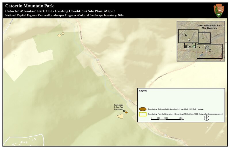
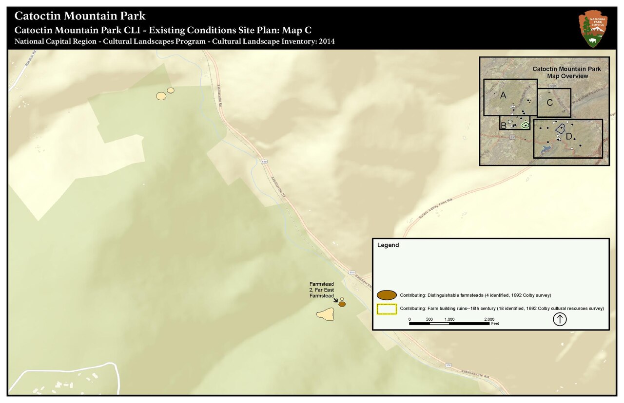
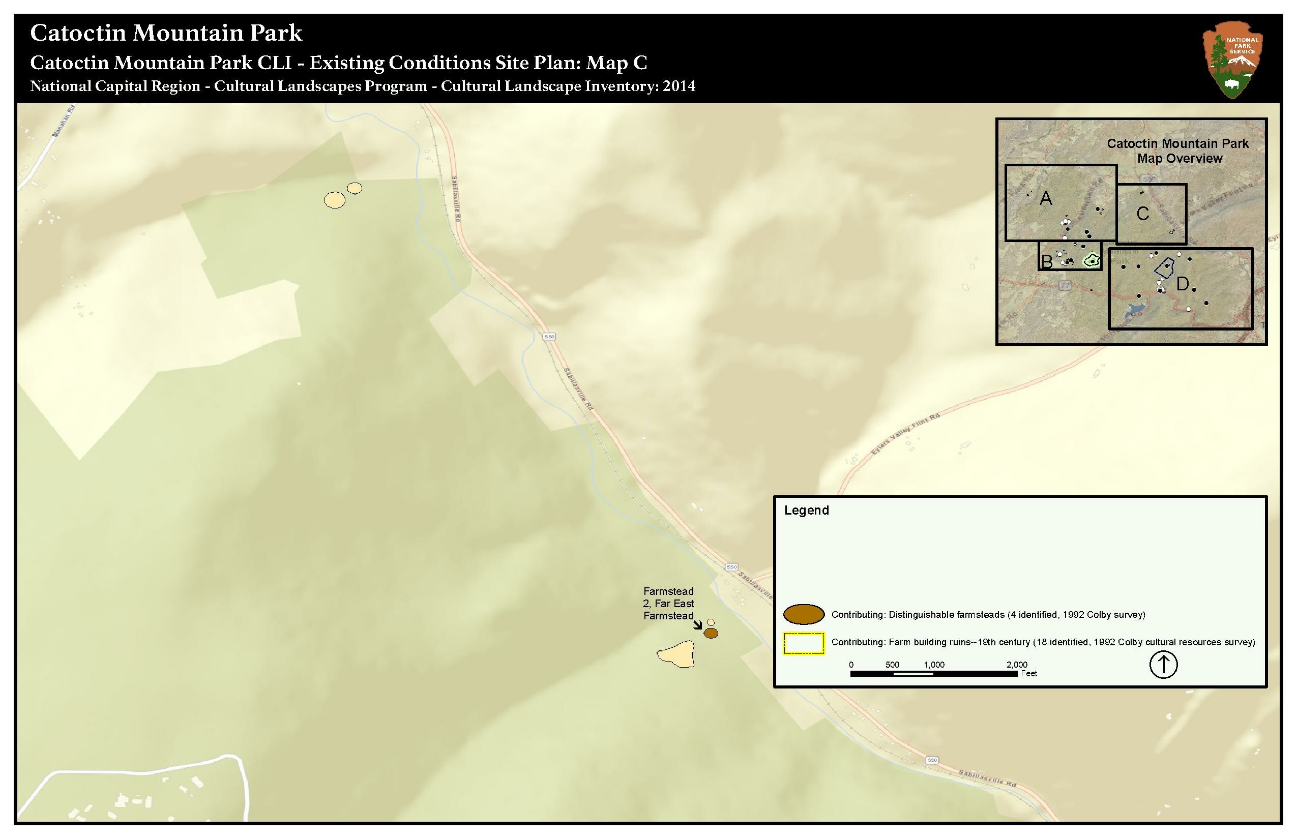
English: Map of existing conditions in one section of Catoctin Mountain Park (Map C), showing resources that are contributing to the historic significance of the cultural landscape. Map of features and contributing resources at Catoctin Mountain Park cultural landscape. Map C shows details for one of four sections.
|
|||
| Depicted place |
English: Catoctin Mountain Park, Maryland |
|||
| Accession number | ||||
| Source |
English: NPGallery |
|||
| Permission (Reusing this file) |
|
|||
| Contacts | English: Person: Daniel Weldon Email: daniel_weldon@nps.gov |
|||
| NPS Unit Code | CATO, NCR | |||
File history
Click on a date/time to view the file as it appeared at that time.
| Date/Time | Thumbnail | Dimensions | User | Comment | |
|---|---|---|---|---|---|
| current | 06:08, 15 January 2022 |  | 2,550 × 1,650 (648 KB) | BMacZeroBot (talk | contribs) | Batch upload (Commons:Batch uploading/NPGallery) |
You cannot overwrite this file.
File usage on Commons
The following page uses this file: