File:Cedar Hill through the trees.jpg
Jump to navigation
Jump to search

Size of this preview: 800 × 532 pixels. Other resolutions: 320 × 213 pixels | 640 × 426 pixels | 1,024 × 681 pixels | 1,280 × 851 pixels | 2,560 × 1,702 pixels | 6,016 × 4,000 pixels.
Original file (6,016 × 4,000 pixels, file size: 6.51 MB, MIME type: image/jpeg)
Captions
Captions
Add a one-line explanation of what this file represents
|
This is an image of a place or building that is listed on the National Register of Historic Places in the United States of America. Its reference number is 94000726. |
| Camera location | | View this and other nearby images on: OpenStreetMap |
|---|
| Description |
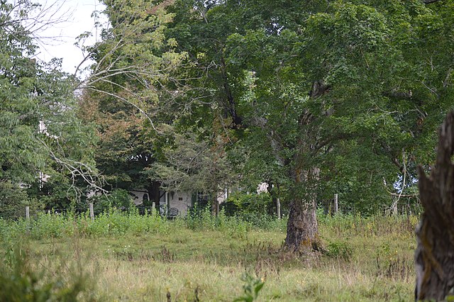
English: Through-the-trees view of Cedar Hill, located on Forge Road west of Buena Vista in Rockbridge County, Virginia, United States. Built in 1821, it is listed on the National Register of Historic Places. |
||
| Date | Taken on 6 August 2017 | ||
| Source | Own work | ||
| Author | Nyttend | ||
| Permission (Reusing this file) |
|
File history
Click on a date/time to view the file as it appeared at that time.
| Date/Time | Thumbnail | Dimensions | User | Comment | |
|---|---|---|---|---|---|
| current | 01:45, 28 August 2017 | | 6,016 × 4,000 (6.51 MB) | Nyttend (talk | contribs) | {{NRHP|94000726}} {{Location|37|43|5|N|79|23|57|W}} {{Information |Description={{en|Through-the-trees view of {{w|Cedar Hill (Buena Vista, Virginia)|Cedar Hill}}, located on Forge Road west of {{w|Buena Vista, Virginia|Buena Vista}} in {{w|Rockbridge C... |
You cannot overwrite this file.
File usage on Commons
There are no pages that use this file.
File usage on other wikis
The following other wikis use this file:
- Usage on en.wikipedia.org