File:Clear Skies over the Pacific Northwest (MODIS 2024-03-24).jpg

Original file (1,572 × 1,271 pixels, file size: 359 KB, MIME type: image/jpeg)
Captions
Captions
Summary[edit]
.jpg&action=edit§ion=1)
| Description |
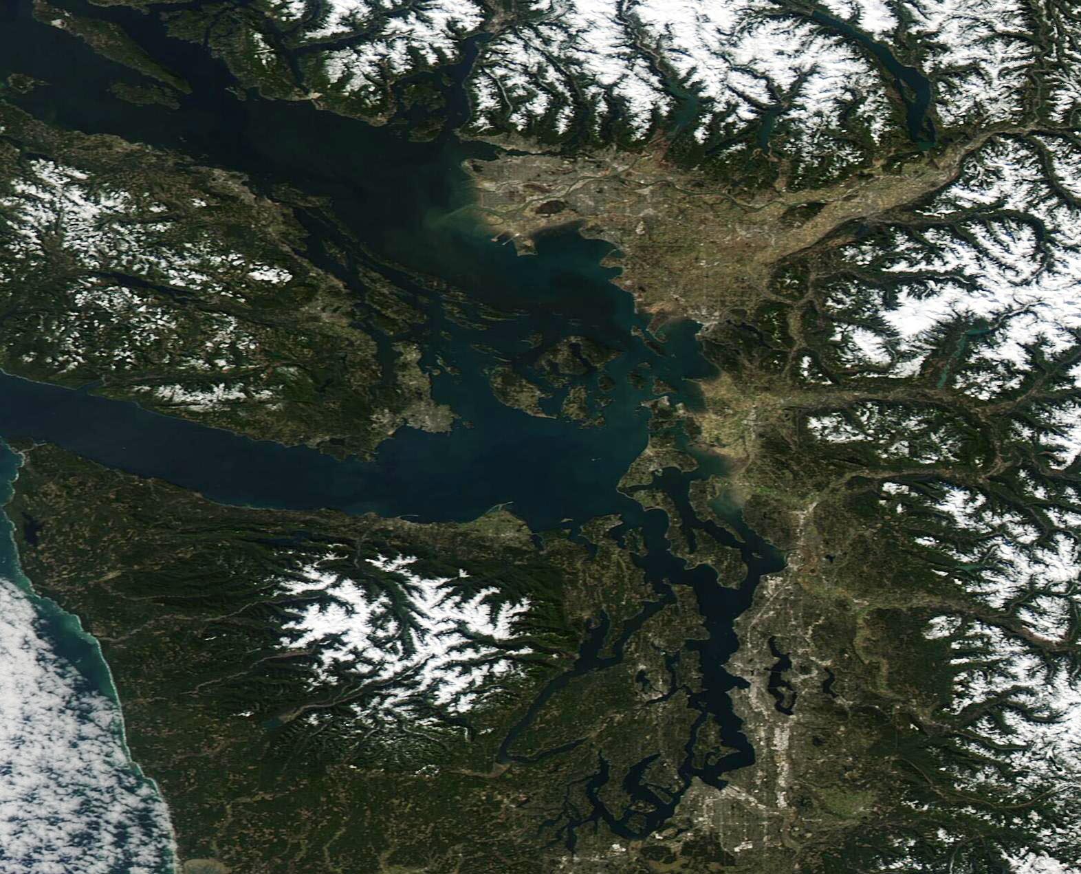
English: On March 17, 2024, the Moderate Resolution Imaging Spectroradiometer (MODIS) on NASA’s Aqua satellite acquired a true-color image of a portion of the Pacific Northwest that is shared by both Canada and the United States.
The image centers on the San Juan Islands, an archipelago located in the state of Washington, USA. To the south, snow tops the Olympic Mountains in mainland Washington state. To the north, the tan and gray pixels mark the large city of Vancouver, Canada. It is one of the most densely populated of Canada’s cities and a thriving seaport located in the province of British Columbia. Vancouver Island, the largest island on the Pacific Coast of North America. The lacework of water surrounding Vancouver Island and the San Juan Islands is known as the Salish Sea. This includes the Strait of Georgia (north), Strait of San Juan de Fuca, and Puget Sound. The Strait of Georgia and the waters off the west coast of Vancouver Island are sensitive spawning grounds for herring, a small fish that provides food for many species, such as cod, salmon, and tuna as well as humans. Herring migrate into the Georgia Strait in the autumn and most leave after spawning, usually in late March or early April. The herring population was depleted in the late 1960s due to overfishing, prompting regulations and efforts to restore a robust population. The herring spawn this year was reported as “pretty encouraging” by Fisheries and Oceans Canada, with the total allowable catch in the Strait of Georgia set at 9,251 tonnes (10,197.5 tons) which is an increase from last year. The annual catch limit is set based on estimated population. |
||
| Date | Taken on 17 March 2024 | ||
| Source |
Clear Skies over the Pacific Northwest (direct link)
|
||
| Author | MODIS Land Rapid Response Team, NASA GSFC |
| This media is a product of the Aqua mission Credit and attribution belongs to the mission team, if not already specified in the "author" row |
Licensing[edit]
.jpg&action=edit§ion=2)
| This file is in the public domain in the United States because it was solely created by NASA. NASA copyright policy states that "NASA material is not protected by copyright unless noted". (See Template:PD-USGov, NASA copyright policy page or JPL Image Use Policy.) | ||
 |
Warnings:
|
File history
Click on a date/time to view the file as it appeared at that time.
| Date/Time | Thumbnail | Dimensions | User | Comment | |
|---|---|---|---|---|---|
| current | 21:33, 25 March 2024 | | 1,572 × 1,271 (359 KB) | OptimusPrimeBot (talk | contribs) | #Spacemedia - Upload of http://modis.gsfc.nasa.gov/gallery/images/image03242024_250m.jpg via Commons:Spacemedia |
You cannot overwrite this file.
File usage on Commons
There are no pages that use this file.
.jpg&oldid=863444482)