File:Deutsches Reich DDR Karte.png
Jump to navigation
Jump to search
Size of this preview: 522 × 599 pixels. Other resolutions: 209 × 240 pixels | 593 × 681 pixels.
Original file (593 × 681 pixels, file size: 861 KB, MIME type: image/png)
Captions
Captions
Add a one-line explanation of what this file represents
Summary[edit]
| Description |
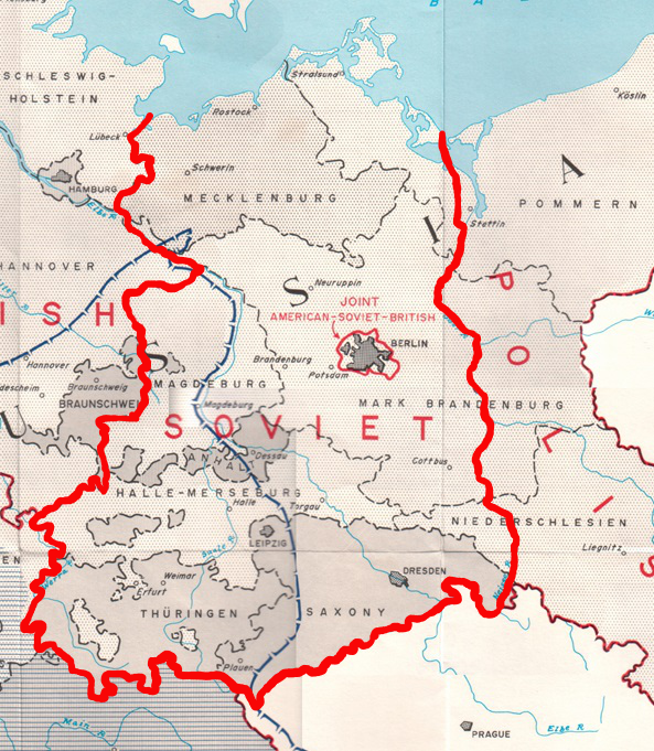
English: Map of the occupation zones of Germany in 1945. From Earl F. Ziemke, The U.S. Army in the Occupation of Germany, 1975. Library of Congress Catalog Card Number 75-619027 |
| Date | |
| Source | http://www.globalsecurity.org/military/library/report/other/us-army_germany_1944-46_map3.htm |
| Author | US Army |
Licensing[edit]
This file is a work of a U.S. Army soldier or employee, taken or made as part of that person's official duties. As a work of the U.S. federal government, it is in the public domain in the United States.
|
 |
File history
Click on a date/time to view the file as it appeared at that time.
| Date/Time | Thumbnail | Dimensions | User | Comment | |
|---|---|---|---|---|---|
| current | 16:45, 13 June 2015 | | 593 × 681 (861 KB) | Charmbook (talk | contribs) | User created page with UploadWizard |
You cannot overwrite this file.
File usage on Commons
There are no pages that use this file.
File usage on other wikis
The following other wikis use this file:
- Usage on be.wikipedia.org
- Usage on de.wikipedia.org
- Usage on et.wikipedia.org
- Usage on ja.wikipedia.org
- Usage on kk.wikipedia.org
- Usage on ru.wikipedia.org
- Usage on uk.wikipedia.org