File:Enterprise-Ozark Micropolitan Area.png
Jump to navigation
Jump to search
No higher resolution available.
Enterprise-Ozark_Micropolitan_Area.png (245 × 385 pixels, file size: 18 KB, MIME type: image/png)
Captions
Captions
Add a one-line explanation of what this file represents

|
File:Enterprise-Ozark, Alabama Micropolitan Statistical Area.svg is a vector version of this file. It should be used in place of this PNG file when not inferior.
File:Enterprise-Ozark Micropolitan Area.png → File:Enterprise-Ozark, Alabama Micropolitan Statistical Area.svg
For more information, see Help:SVG. |
 |
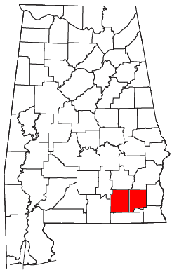
| Description | Locator map of the Enterprise-Ozark Micropolitan Statistical Area in the southeastern part of the U.S. state of Alabama. | ||
| Date | |||
| Source | Modified from this United States Census Bureau file, based on this Census definitions list. | ||
| Author | User:Nyttend | ||
| Permission (Reusing this file) |
US Government work is public domain, and my work is
|
File history
Click on a date/time to view the file as it appeared at that time.
| Date/Time | Thumbnail | Dimensions | User | Comment | |
|---|---|---|---|---|---|
| current | 04:50, 27 July 2008 | | 245 × 385 (18 KB) | Nyttend (talk | contribs) | {{Information |Description=Locator map of the {{w|Enterprise-Ozark micropolitan area|Enterprise-Ozark Micropolitan Statistical Area}} in the southeastern part of the {{w|U.S. state}} of {{w|Alabama}}. |Source=Modified from [http://www2.census.gov/geo/maps |
You cannot overwrite this file.
File usage on Commons
There are no pages that use this file.