File:Environment Agency 170114 103858a.jpg
Original file (7,360 × 4,912 pixels, file size: 6.05 MB, MIME type: image/jpeg)
Captions
Summary[edit]
DescriptionEnvironment Agency 170114 103858a.jpg |
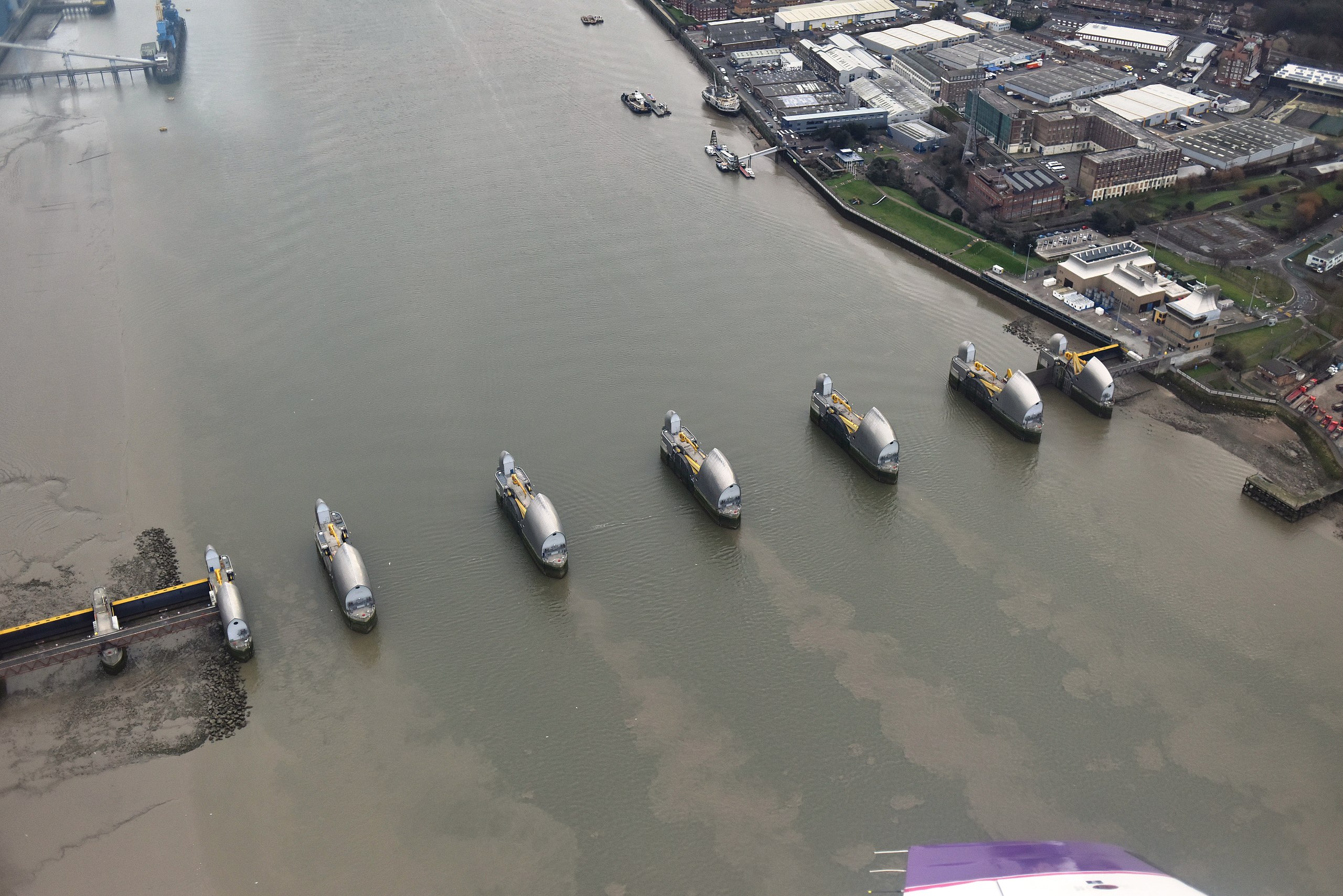
English: Environment Agency aerial photography of the Thames Barrier (lowered) |
Date | |
Source | Defra Data Services Platform |
Author | Environment Agency |
Camera location | 51° 29′ 27.08″ N, 0° 02′ 17.42″ E | View this and other nearby images on: OpenStreetMap | 51.490856; 0.038171 |
---|
Licensing[edit]
This file is licensed under the United Kingdom Open Government Licence v3.0. | |
See also: Meta for information on usage on Wikimedia wikis. Open Government License 3OGL 3http://www.nationalarchives.gov.uk/doc/open-government-licence/version/3true
|
File history
Click on a date/time to view the file as it appeared at that time.
Date/Time | Thumbnail | Dimensions | User | Comment | |
---|---|---|---|---|---|
current | 21:26, 28 January 2019 | 7,360 × 4,912 (6.05 MB) | Nilfanion (talk | contribs) | User created page with UploadWizard |
You cannot overwrite this file.
File usage on Commons
The following 3 pages use this file:
File usage on other wikis
The following other wikis use this file:
- Usage on en.wikipedia.org
- Usage on nl.wikipedia.org
- Usage on sl.wikipedia.org
Metadata
This file contains additional information such as Exif metadata which may have been added by the digital camera, scanner, or software program used to create or digitize it. If the file has been modified from its original state, some details such as the timestamp may not fully reflect those of the original file. The timestamp is only as accurate as the clock in the camera, and it may be completely wrong.
Image title |
|
---|---|
Camera manufacturer | NIKON CORPORATION |
Camera model | NIKON D810 |
Copyright holder |
|
Exposure time | 1/4,000 sec (0.00025) |
F-number | f/3.2 |
ISO speed rating | 720 |
Date and time of data generation | 10:38, 14 January 2017 |
Lens focal length | 35 mm |
Latitude | 51° 29′ 27.08″ N |
Longitude | 0° 2′ 17.42″ E |
Altitude | 376.25 meters above sea level |
Short title |
|
Orientation | Normal |
Software used | Ver.1.10 |
File change date and time | 10:38, 14 January 2017 |
Y and C positioning | Co-sited |
Exposure Program | Aperture priority |
Exif version | 2.3 |
Date and time of digitizing | 10:38, 14 January 2017 |
Meaning of each component |
|
Image compression mode | 1 |
APEX exposure bias | −1 |
Maximum land aperture | 2 APEX (f/2) |
Metering mode | Pattern |
Light source | Unknown |
Flash | Flash did not fire, compulsory flash suppression |
DateTime subseconds | 80 |
DateTimeOriginal subseconds | 80 |
DateTimeDigitized subseconds | 80 |
Supported Flashpix version | 1 |
Color space | sRGB |
Sensing method | One-chip color area sensor |
File source | Digital still camera |
Scene type | A directly photographed image |
Custom image processing | Normal process |
Exposure mode | Auto exposure |
White balance | Auto white balance |
Digital zoom ratio | 1 |
Focal length in 35 mm film | 35 mm |
Scene capture type | Standard |
Scene control | Low gain up |
Contrast | Normal |
Saturation | Normal |
Sharpness | Normal |
Subject distance range | Unknown |
GPS tag version | 2.3.0.0 |