File:Farad powerhouse.jpg
Jump to navigation
Jump to search
Size of this preview: 800 × 534 pixels. Other resolutions: 320 × 213 pixels | 640 × 427 pixels | 1,024 × 683 pixels | 1,400 × 934 pixels.
Original file (1,400 × 934 pixels, file size: 1.79 MB, MIME type: image/jpeg)
Captions
Captions
Add a one-line explanation of what this file represents
| Description |
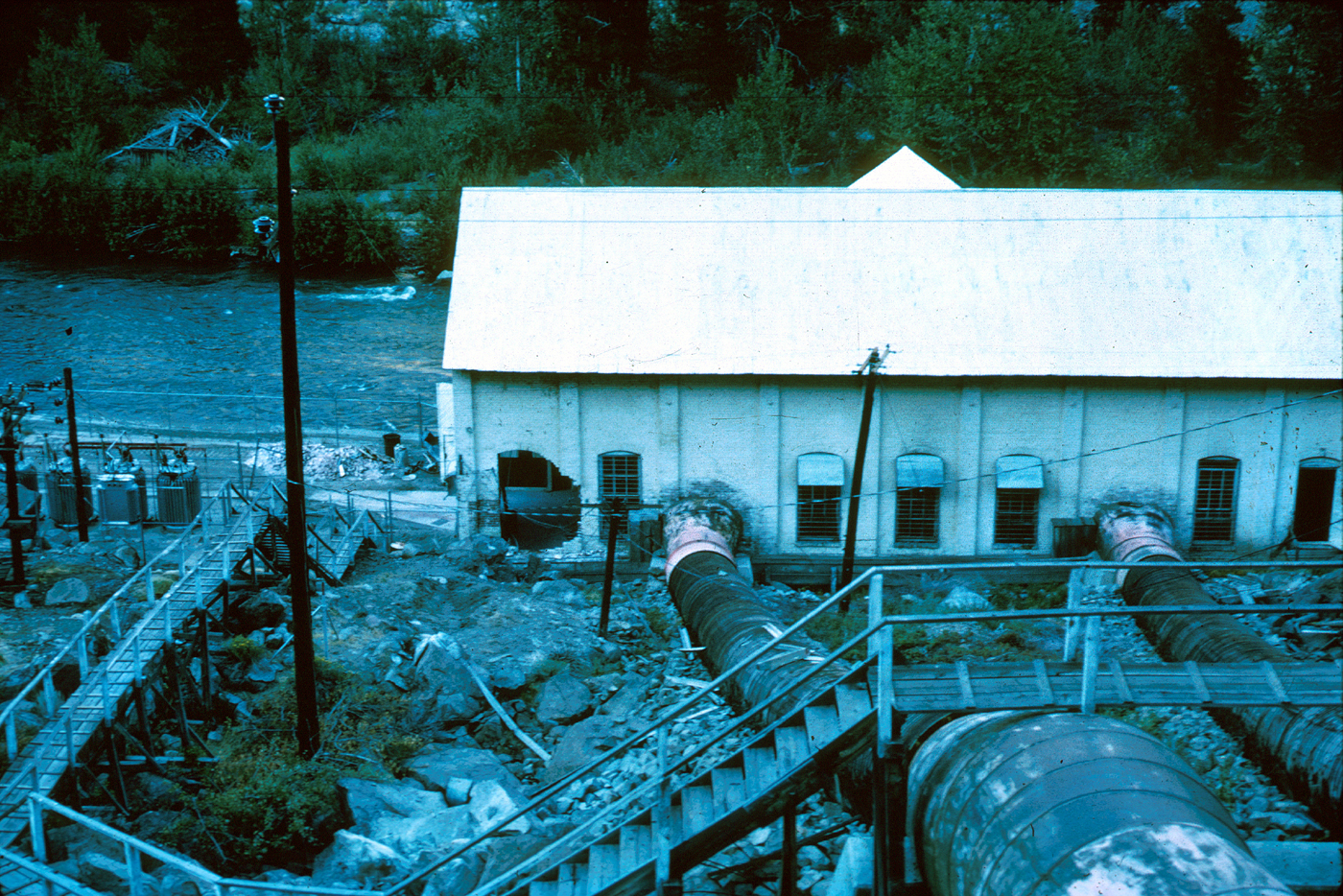
English: Small powerhouse at Farad on the Truckee River. Shows a near-circular hole about 9 feet in diameter from a large falling boulder in the aftermath of the Truckee, CA earthquake of 1966. |
|||
| Date | created Sept. 1966 | |||
| Source | http://libraryphoto.cr.usgs.gov/cgi-bin/show_picture.cgi?ID=ID.%20Kachadoorian,%20R.%20328ct | |||
| Author | USGS | |||
| Permission (Reusing this file) |
|
File history
Click on a date/time to view the file as it appeared at that time.
| Date/Time | Thumbnail | Dimensions | User | Comment | |
|---|---|---|---|---|---|
| current | 10:00, 3 December 2012 | | 1,400 × 934 (1.79 MB) | Philosophistry (talk | contribs) | {{Information |Description = Small powerhouse at Farad on the Truckee River. Shows a near-circular hole about 9 feet in diameter from a large falling boulder in the aftermath of the Truckee, CA earthquake of 1966. |Source = http://libraryphoto.cr.usgs.... |
You cannot overwrite this file.
File usage on Commons
There are no pages that use this file.