File:FaubourgStMarie1807Batture.jpg
FaubourgStMarie1807Batture.jpg (600 × 387 pixels, file size: 48 KB, MIME type: image/jpeg)
Captions
Captions
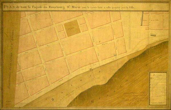
| DescriptionFaubourgStMarie1807Batture.jpg | New Orleans: Map showing riverfront section of Faubourg St. Marie (now in the Central Business District), 1807, by Mansuy-Pellitier. Note the park which would be named Lafayette Square just left and above center, the open Commons at right of map between Canal and Common Streets, and the wide riverfront bature with no structures. | |||||
| Date | ||||||
| Source | Plan by Mansuy-Pellitier via [1] | |||||
| Author | Mansuy-Pellitier | |||||
| Permission (Reusing this file) |
|
|||||
File history
Click on a date/time to view the file as it appeared at that time.
| Date/Time | Thumbnail | Dimensions | User | Comment | |
|---|---|---|---|---|---|
| current | 17:58, 5 January 2008 |  | 600 × 387 (48 KB) | Infrogmation (talk | contribs) | {{Information |Description= New Orleans: Map showing riverfront section of Faubourg St. Marie (now in the Central Business District), 1807, by Mansuy-Pellitier. Note the park which would be named Lafayette Square just left and above center, the open C |
You cannot overwrite this file.
File usage on Commons
There are no pages that use this file.
Metadata
This file contains additional information such as Exif metadata which may have been added by the digital camera, scanner, or software program used to create or digitize it. If the file has been modified from its original state, some details such as the timestamp may not fully reflect those of the original file. The timestamp is only as accurate as the clock in the camera, and it may be completely wrong.
| _error | 0 |
|---|
