File:Fires and Snow in the Pyrénées Mountains (MODIS 2019-02-20).jpg
Jump to navigation
Jump to search

Size of this preview: 722 × 600 pixels. Other resolutions: 289 × 240 pixels | 578 × 480 pixels | 924 × 768 pixels | 1,233 × 1,024 pixels | 2,507 × 2,083 pixels.
Original file (2,507 × 2,083 pixels, file size: 715 KB, MIME type: image/jpeg)
Captions
Captions
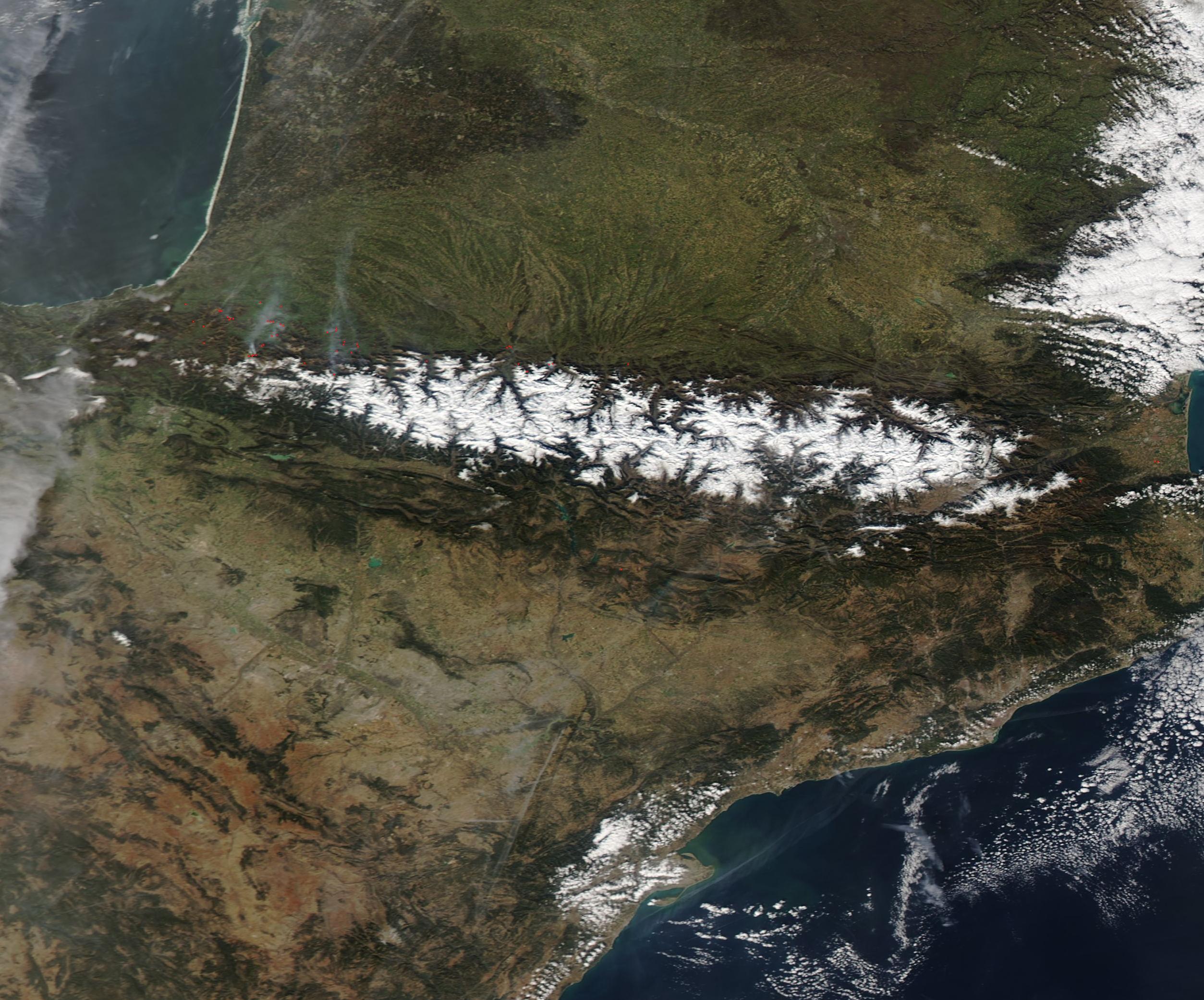
The Moderate Resolution Imaging Spectroradiometer (MODIS) on board NASA’s Aqua satellite acquired a true-color image of the mountainous region on February 18.
Summary
[edit].jpg&action=edit§ion=1)
| Description |
English: A number of fires burned along the foothills of the snow-capped Pyrenees Mountains in mid-February, 2019. The Moderate Resolution Imaging Spectroradiometer (MODIS) on board NASA’s Aqua satellite acquired a true-color image of the mountainous region on February 18.
Each red “hot spot” marks an area where the thermal bands on the MODIS instrument detected high temperatures. When combined with typical smoke, as in this image, such hot spots mark actively burning fire. Most of the fires occur in southwestern France, although a few can be seen in France east of the Pyrénées and along the southern slope in Spain. Haze hangs in the air over southwestern France, likely the result of the fires. While it is not possible to determine the cause of fires in a satellite image, given the time of year and location, most of these fires are likely agricultural in origin, which means they have been deliberately set to manage land. Called “écobuage” in this area (or “controlled burn” in English), such fires are often used to enhance productivity in croplands or renew pasture. In many areas, such as the Pyrénées, such fires fall under strong legal control, with farmers being required to obtain a license before igniting a burn. On February 18, the weather in the region was sunny with little wind – ideal conditions for igniting and managing agricultural burns. |
||
| Date | Taken on 18 February 2019 | ||
| Source |
Fires and Snow in the Pyrénées Mountains (direct link)
|
||
| Author | MODIS Land Rapid Response Team, NASA GSFC |
| This media is a product of the Aqua mission Credit and attribution belongs to the mission team, if not already specified in the "author" row |
Licensing
[edit].jpg&action=edit§ion=2)
| This file is in the public domain in the United States because it was solely created by NASA. NASA copyright policy states that "NASA material is not protected by copyright unless noted". (See Template:PD-USGov, NASA copyright policy page or JPL Image Use Policy.) | ||
 |
Warnings:
|
File history
Click on a date/time to view the file as it appeared at that time.
| Date/Time | Thumbnail | Dimensions | User | Comment | |
|---|---|---|---|---|---|
| current | 03:30, 17 February 2024 | | 2,507 × 2,083 (715 KB) | OptimusPrimeBot (talk | contribs) | #Spacemedia - Upload of http://modis.gsfc.nasa.gov/gallery/images/image02202019_250m.jpg via Commons:Spacemedia |
You cannot overwrite this file.
File usage on Commons
There are no pages that use this file.
.jpg&oldid=852730481)