File:Fires in central Chile (MODIS 2015-05-16).jpg

Original file (1,800 × 2,400 pixels, file size: 1.12 MB, MIME type: image/jpeg)
Captions
Captions
Summary
[edit].jpg&action=edit§ion=1)
| Description |
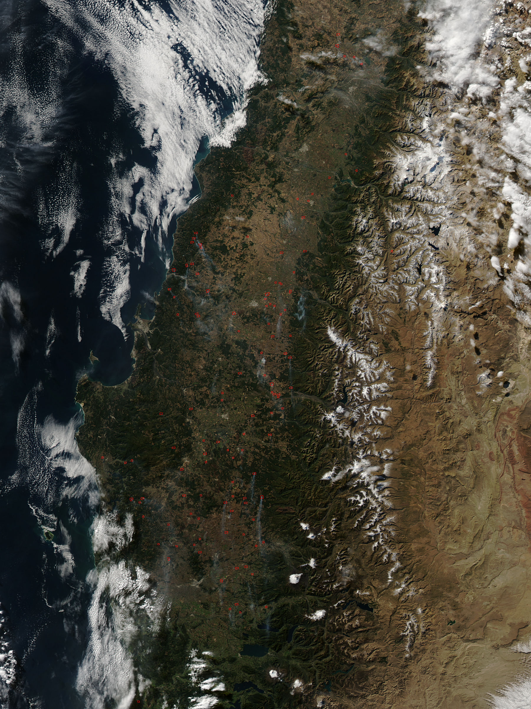
English: After years of drought, central Chile is proving to be a tinderbox in the fall of 2015. In March 2015, firefighters battled blazes across the entire Araucania Region of Chile, but especially in protected nature reserve areas of China Muerta National Reserve, Reserva Nacional Nalcas, and Conguillio National Park. Fires continued to burn across central Chile in early May, 2015. The Moderate Resolution Imaging Spectroradiometer (MODIS) aboard NASA�s Aqua satellite acquired this true-color image of dozens of fires on May 7.
The fires are having considerable impact on a tall evergreen tree species native to central and southern Chile. The �monkey puzzle� tree (Araucaria araucana) is also called Chilean Pine, and is the national tree of Chile. It is an ancient tree, but is in decline. In 2013, the International Union for Conservation of Nature IUCN changed the conservation status to �Endangered�. The Chilean Pine grows in the parks damaged by fire this fall. Conguill�o National Park is located in the Andes, in the provinces of Caut�n and Malleco, in the Araucan�a Region of Chile also known as Region IX. Its name derives from the Mapuche word for "water with Araucaria seeds." Conguillio's main attractions are volcanoes and monkey puzzle trees. Since the initial fire outbreak over one million of these trees have been reported as burned in Chile�s China Muerta National Park. The widespread nature of the red hotspots suggests that most of these blazes may have been set deliberately to manage land. Called agricultural fires, they are commonly used to clear previous crops, to prepare soils for planting, to open new agricultural land, and to renew pastures. Agricultural fires, especially combined with drought and wind, can easily get out of hand, and turn into vegetation-consuming wildfires. Other sources of ignition are human activity (such as campfires, smoking, and industry) and natural sources, most commonly dry lightning. One unusual source of potential ignition in this region is volcanic. The Calbuco volcano has been erupting in this region, and it is possible that bits of the extremely hot material ejected may play a role in ignition of a few of these fires. |
||
| Date | Taken on 7 May 2015 | ||
| Source |
Fires in central Chile (direct link)
|
||
| Author | Jeff Schmaltz, MODIS Land Rapid Response Team, NASA GSFC |
| This media is a product of the Aqua mission Credit and attribution belongs to the mission team, if not already specified in the "author" row |
Licensing
[edit].jpg&action=edit§ion=2)
| This file is in the public domain in the United States because it was solely created by NASA. NASA copyright policy states that "NASA material is not protected by copyright unless noted". (See Template:PD-USGov, NASA copyright policy page or JPL Image Use Policy.) | ||
 |
Warnings:
|
File history
Click on a date/time to view the file as it appeared at that time.
| Date/Time | Thumbnail | Dimensions | User | Comment | |
|---|---|---|---|---|---|
| current | 21:38, 14 February 2024 | | 1,800 × 2,400 (1.12 MB) | OptimusPrimeBot (talk | contribs) | #Spacemedia - Upload of http://modis.gsfc.nasa.gov/gallery/images/image05162015_250m.jpg via Commons:Spacemedia |
You cannot overwrite this file.
File usage on Commons
There are no pages that use this file.
.jpg&oldid=851753117)