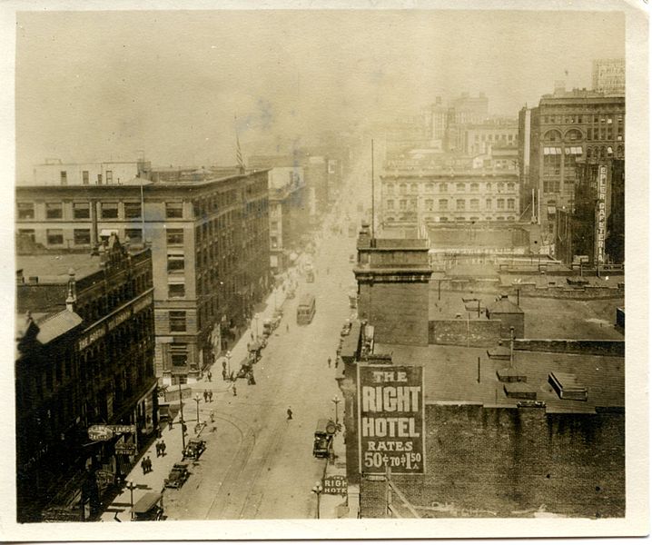
File:First Avenue, Seattle, circa 1915 (5545331248).jpg

Original file (1,600 × 1,336 pixels, file size: 319 KB, MIME type: image/jpeg)
Captions
Captions
Summary[edit]
| DescriptionFirst Avenue, Seattle, circa 1915 (5545331248).jpg |
English: Unlabeled and undated, this photo was taken from the Lowman Building on First and Cherry, Seattle, Washington in 1915. We're looking north. The clock on the right gives us an early bound. That clock belonged to Burnett Bros Jewelers, who opened here in 1906. We saw this clock a few years earlier recently (note the horses). We're looking at post-1906. |
| Date |
circa 1915 date QS:P,+1915-00-00T00:00:00Z/9,P1480,Q5727902 |
| Source | First Avenue, Seattle, circa 1915 |
| Author | Rob Ketcherside from Seattle, usa |
| Permission (Reusing this file) |
Should be PD-1923 |
| Camera location | 47° 36′ 09.11″ N, 122° 20′ 02.5″ W | View this and other nearby images on: OpenStreetMap |
|---|
Licensing[edit]
- You are free:
- to share – to copy, distribute and transmit the work
- to remix – to adapt the work
- Under the following conditions:
- attribution – You must give appropriate credit, provide a link to the license, and indicate if changes were made. You may do so in any reasonable manner, but not in any way that suggests the licensor endorses you or your use.
| This image was originally posted to Flickr by Rob Ketcherside at https://www.flickr.com/photos/29056926@N02/5545331248. It was reviewed on 23 January 2015 by FlickreviewR and was confirmed to be licensed under the terms of the cc-by-2.0. |
23 January 2015
| Annotations InfoField | This image is annotated: View the annotations at Commons |
Colman Building, still there as of 2015.
Sullivan Building
Postal Telegraph Building
File history
Click on a date/time to view the file as it appeared at that time.
| Date/Time | Thumbnail | Dimensions | User | Comment | |
|---|---|---|---|---|---|
| current | 06:13, 23 January 2015 |  | 1,600 × 1,336 (319 KB) | Jmabel (talk | contribs) | Transferred from Flickr via Flickr2Commons |
You cannot overwrite this file.
File usage on Commons
There are no pages that use this file.
Metadata
This file contains additional information such as Exif metadata which may have been added by the digital camera, scanner, or software program used to create or digitize it. If the file has been modified from its original state, some details such as the timestamp may not fully reflect those of the original file. The timestamp is only as accurate as the clock in the camera, and it may be completely wrong.
| Color space | sRGB |
|---|---|
| Rating (out of 5) | 3 |