File:Footbridge on Cycle Route - geograph-1906602-by-Lairich-Rig.jpg
Jump to navigation
Jump to search
No higher resolution available.
Footbridge_on_Cycle_Route_-_geograph-1906602-by-Lairich-Rig.jpg (800 × 600 pixels, file size: 118 KB, MIME type: image/jpeg)
Captions
Captions
Add a one-line explanation of what this file represents
| Description |
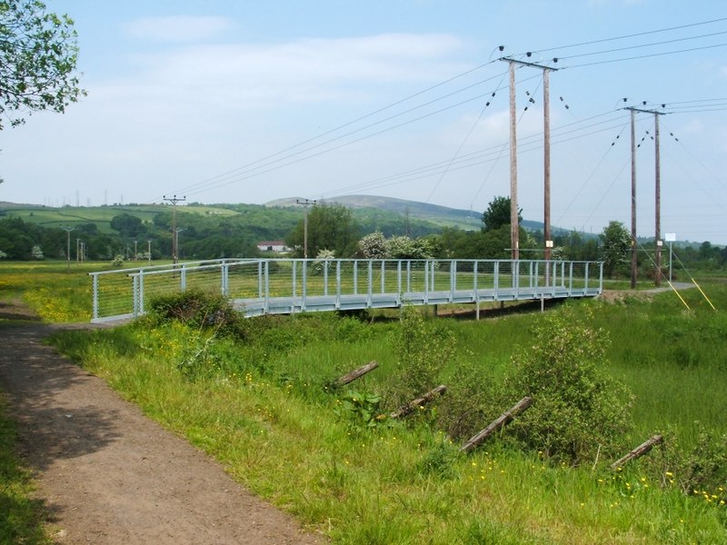
English: This new footbridge, with metal sides, is located on National Cycle Network Route 7. It replaces a wooden one that was shown in NS3977 : Footbridge on Cycle Route.
Although covered with metal mesh, the wooden walkway of the former bridge tended to deteriorate as a result of the very wet climate here, and from frequent use (it was sometimes used by the cows that are often in this field, as well as by pedestrians and cyclists). Another wooden footbridge, only a short distance further along the cycle path, was also replaced with a bridge built along the same lines: NS3977 : Footbridge on Cycle Route. National Cycle Network Route 7 :: NX7662 The Lochs and Glens (North) route covers 214 miles from Inverness to Glasgow. The Lochs and Glens (South) covers 193 miles from Glasgow and Carlisle via the Ayrshire coast, Kirkcudbright and Dumfries. It continues east as the Coast to Coast C2C route to Sunderland. |
||
| Date | |||
| Source | Link | ||
| Author | Lairich Rig | ||
| Permission (Reusing this file) |
This file is licensed under the Creative Commons Attribution-Share Alike 2.0 Generic license. Attribution: Lairich Rig
|
||
| Attribution (required by the license) | Lairich Rig / Footbridge on Cycle Route / | ||

| Camera location | | View this and other nearby images on: OpenStreetMap |
|---|
_heading:337.00&language=en)
| Object location | | View this and other nearby images on: OpenStreetMap |
|---|
_heading:337.00&language=en)
File history
Click on a date/time to view the file as it appeared at that time.
| Date/Time | Thumbnail | Dimensions | User | Comment | |
|---|---|---|---|---|---|
| current | 17:55, 30 October 2015 | | 800 × 600 (118 KB) | Rodhullandemu (talk | contribs) | {{Information |Description ={{en|1=This new footbridge, with metal sides, is located on National Cycle Network Route 7. It replaces a wooden one that was shown in NS3977 : Footbridge on Cycle Route. Although covered with metal mesh, the wooden walk... |
You cannot overwrite this file.
File usage on Commons
The following page uses this file: