File:GRAVIER(1896) p063 Martin Behaim, le Globe de 1492.jpg

Original file (2,163 × 1,646 pixels, file size: 2.2 MB, MIME type: image/jpeg)
Captions
Captions
| Date | 1896 | ||||
| Accession number |
British Library HMNTS 010095.g.13. |
||||
| Source/Photographer |
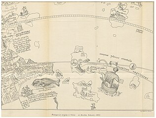
Image extracted from page 063 of La Cartographie de Madagascar, by GRAVIER, Gabriel. Original held and digitised by the British Library. Copied from Flickr. Note: The colours, contrast and appearance of these illustrations are unlikely to be true to life. They are derived from scanned images that have been enhanced for machine interpretation and have been altered from their originals.
|
||||
| Permission (Reusing this file) |
|
||||

File history
Click on a date/time to view the file as it appeared at that time.
| Date/Time | Thumbnail | Dimensions | User | Comment | |
|---|---|---|---|---|---|
| current | 19:52, 12 November 2014 | | 2,163 × 1,646 (2.2 MB) | Metilsteiner (talk | contribs) | User created page with UploadWizard |
You cannot overwrite this file.
File usage on Commons
The following page uses this file:
_p063_Martin_Behaim,_le_Globe_de_1492.jpg)
_p063_Martin_Behaim,_le_Globe_de_1492.jpg&oldid=751678330)
- Maps from the Mechanical Curator collection
- Maps from the Mechanical Curator collection available to georeference
- La Cartographie de Madagascar (1896) by GRAVIER
- 1492 maps of Africa
- 15th-century maps of Madagascar
- German-language maps of Africa
- Reproductions of Behaim's globe (Erdapfel)
- Old maps of Zanzibar