File:Gas hydrates 1996.svg
Jump to navigation
Jump to search

Size of this PNG preview of this SVG file: 800 × 406 pixels. Other resolutions: 320 × 162 pixels | 640 × 325 pixels | 1,024 × 520 pixels | 1,280 × 650 pixels | 2,560 × 1,299 pixels | 940 × 477 pixels.
Original file (SVG file, nominally 940 × 477 pixels, file size: 1.58 MB)
Captions
Captions
Add a one-line explanation of what this file represents
Summary[edit]
| Description |
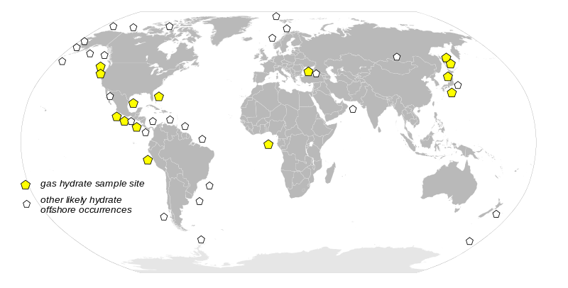
English: Worldwide distribution of confirmed or inferred offshore gas hydrate-bearing sediments. |
| Source | USGS Open-File Report 96-272. http://pubs.usgs.gov/of/1996/of96-272/fig2.html |
| Author | US Gov, recreated by me |
| Other versions |
Derivative works of this file: Gashydrate 1996.svg  |
Image recreated using vector map of world from usgs source.
Licensing[edit]
This image is in the public domain in the United States because it only contains materials that originally came from the United States Geological Survey, an agency of the United States Department of the Interior. For more information, see the official USGS copyright policy.
|
File history
Click on a date/time to view the file as it appeared at that time.
| Date/Time | Thumbnail | Dimensions | User | Comment | |
|---|---|---|---|---|---|
| current | 19:41, 24 May 2008 | | 940 × 477 (1.58 MB) | Zeimusu (talk | contribs) | |
| 19:33, 24 May 2008 |  | 940 × 477 (1.58 MB) | Zeimusu (talk | contribs) | {{Information |Description=Worldwide distribution of confirmed or inferred offshore gas hydrate-bearing sediments. |Source=USGS Open-File Report 96-272. http://pubs.usgs.gov/of/1996/of96-272/fig2.html |Date= |Author= |Permission= |other_versions= }} I |
You cannot overwrite this file.
File usage on Commons
The following 3 pages use this file:
File usage on other wikis
The following other wikis use this file:
- Usage on ar.wikipedia.org
- Usage on be.wikipedia.org
- Usage on bn.wikipedia.org
- Usage on ca.wikipedia.org
- Usage on cs.wikipedia.org
- Usage on el.wikipedia.org
- Usage on en.wikipedia.org
- Usage on eu.wikipedia.org
- Usage on fa.wikipedia.org
- Usage on fr.wikipedia.org
- Usage on gl.wikipedia.org
- Usage on it.wikipedia.org
- Usage on ja.wikipedia.org
- Usage on ko.wikipedia.org
- Usage on ru.wikipedia.org
- Usage on uk.wikipedia.org
- Usage on vi.wikipedia.org
- Usage on www.wikidata.org