File:General soil map, Polk County, Tennessee LOC 87693822.jpg
Jump to navigation
Jump to search
Size of this preview: 800 × 514 pixels. Other resolutions: 320 × 206 pixels | 640 × 411 pixels | 1,024 × 658 pixels | 1,280 × 822 pixels | 2,560 × 1,644 pixels | 5,095 × 3,272 pixels.
Original file (5,095 × 3,272 pixels, file size: 2.16 MB, MIME type: image/jpeg)
Captions
Captions
Add a one-line explanation of what this file represents
Summary[edit]
| Description |
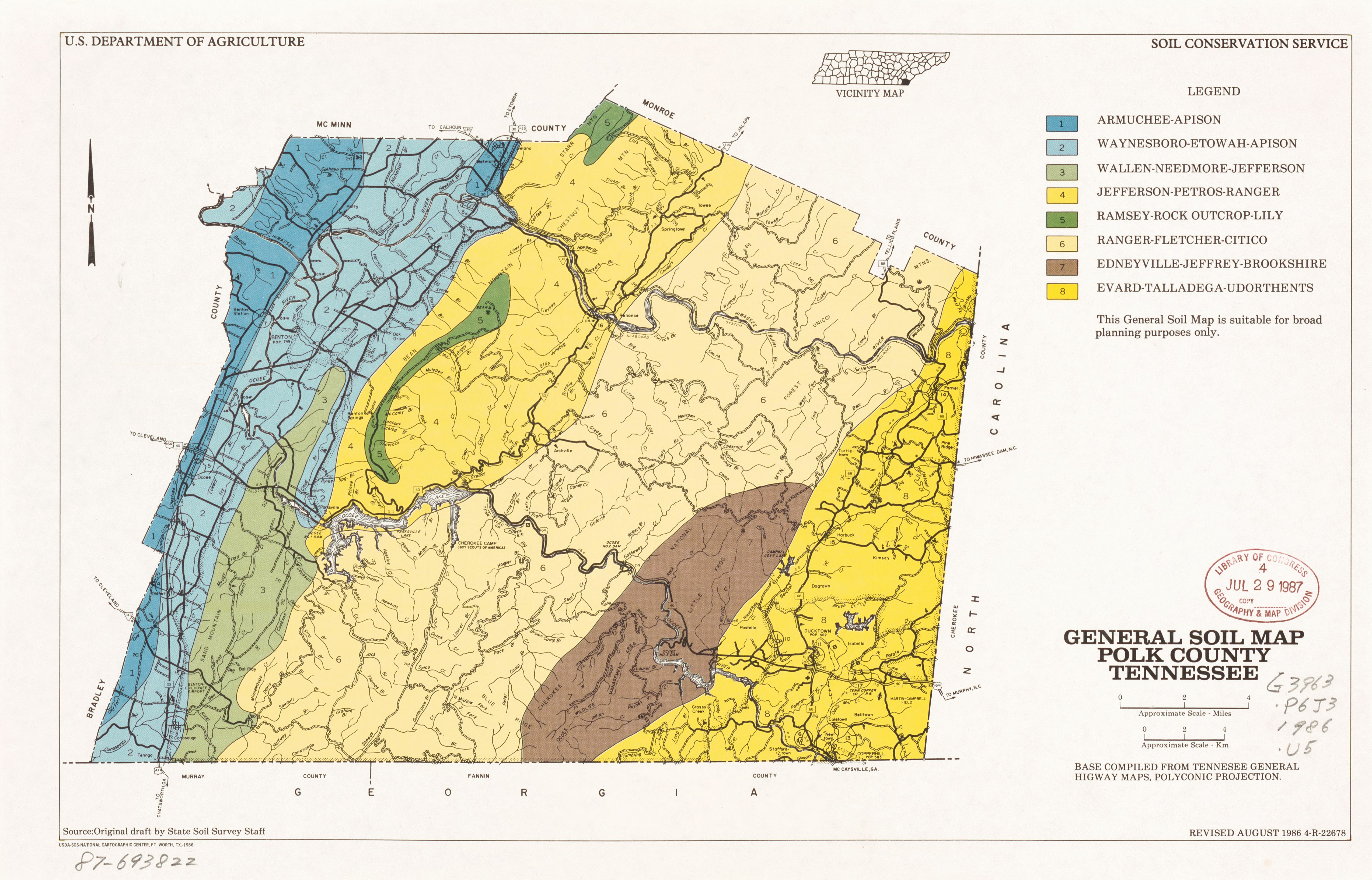
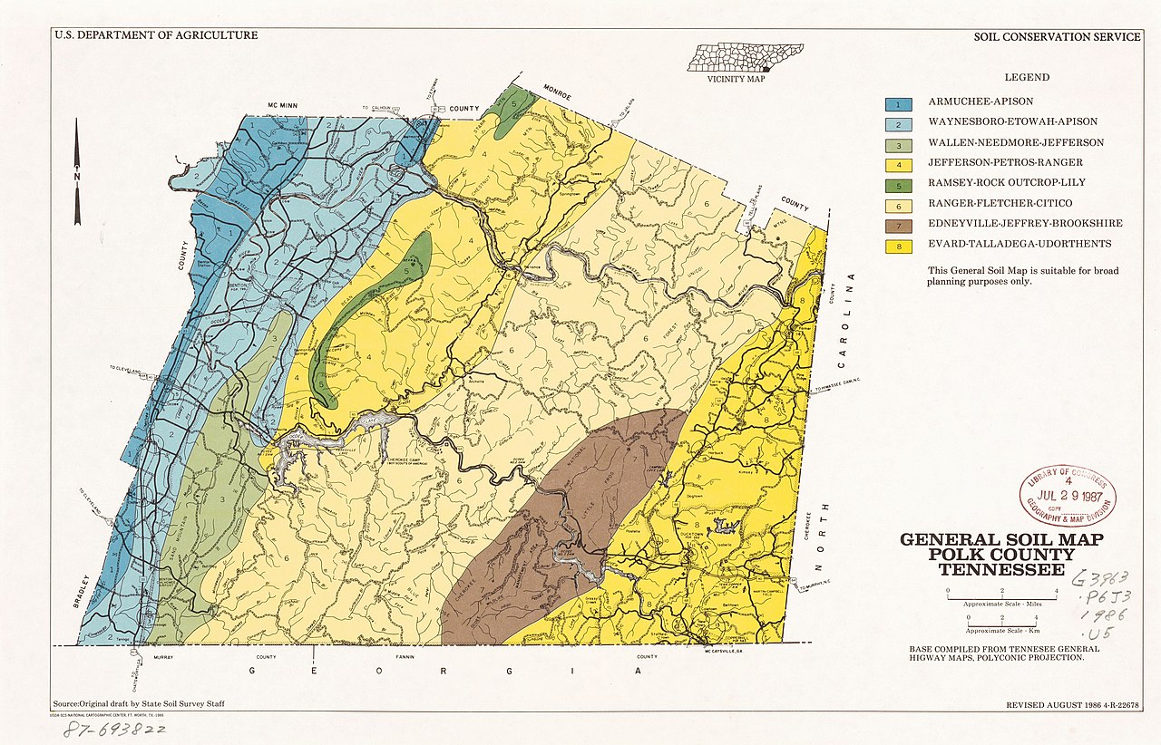
English: "This general soil map is suitable for broad planning purposes only." Depths shown by form lines. "Source: Original draft by State Soil Survey staff." "Base compiled from Tennessee general highway maps ..." Includes location map. In lower right corner: 4-R-22678. Available also through the Library of Congress Web site as a raster image. |
||
| Title | General soil map, Polk County, Tennessee | ||
| Shelf ID | G3963.P6J3 1986 .U5 | ||
| Date | |||
| Source | https://www.loc.gov/item/87693822/ | ||
| Author | United States. Soil Conservation Service; National Cartographic Center (U.S.) | ||
| Permission (Reusing this file) |
|
||
| Other versions |
|
||
| Location | Polk County. · United States · Tennessee · Polk County | ||
| Part of | American Memory · Catalog · Geography And Map Division · Additional Conservation And Environment Cartographic Items | ||
| Subject | United States · Soils · Tennessee · Polk County · Maps |


Licensing[edit]
| This work is from the Library of Congress. According to the library, there are no known copyright restrictions on the use of this work. |  |
File history
Click on a date/time to view the file as it appeared at that time.
| Date/Time | Thumbnail | Dimensions | User | Comment | |
|---|---|---|---|---|---|
| current | 18:59, 17 January 2019 | | 5,095 × 3,272 (2.16 MB) | Fæ (talk | contribs) | LOC Maps https://www.loc.gov/item/87693822/ #14484 |
You cannot overwrite this file.
File usage on Commons
The following page uses this file: