File:Geograph-5976374-by-Andrew-Wood-Andrea Geile.jpg
Jump to navigation
Jump to search
Size of this preview: 799 × 599 pixels. Other resolutions: 320 × 240 pixels | 640 × 480 pixels | 1,024 × 768 pixels | 1,280 × 960 pixels | 2,560 × 1,920 pixels | 4,930 × 3,698 pixels.
Original file (4,930 × 3,698 pixels, file size: 4.05 MB, MIME type: image/jpeg)
Captions
Captions
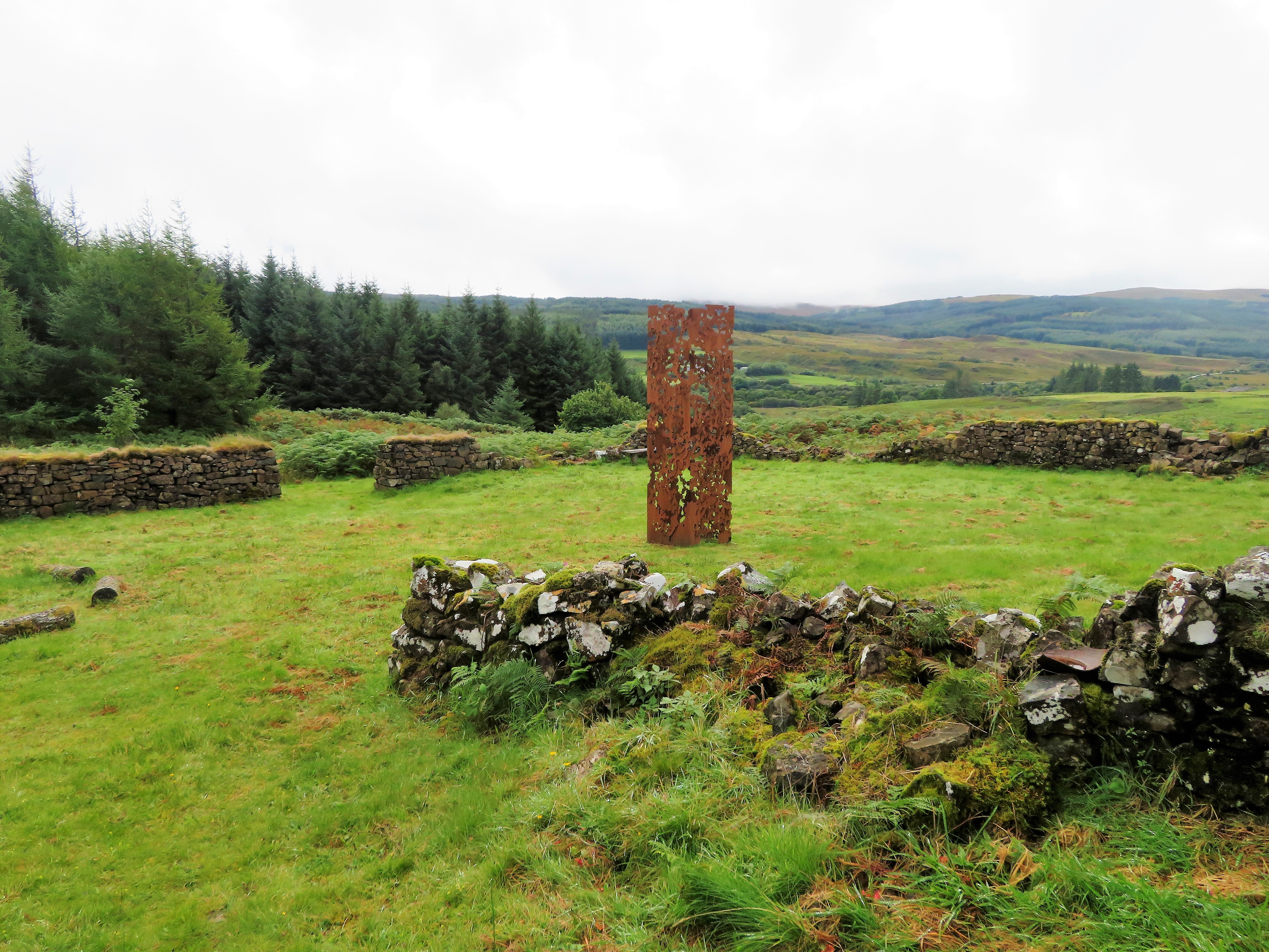
The Chlorophylls sculpture by Andrea Geile
Summary[edit]
| Description |
English: The Chlorophylls sculpture was a public art commission. It was created by Andrea Geile in 2015 and can be found in Lettermore Forest on the Isle of Mull. It is a towering structure of corten steel. |
| Date | |
| Source | https://www.geograph.org.uk/reuse.php?id=5976374 |
| Author | Andrew Woods |
| Permission (Reusing this file) |
| Camera location | | View this and other nearby images on: OpenStreetMap |
|---|
_region:GB-SCT_heading:202.00&language=en)
| Object location | | View this and other nearby images on: OpenStreetMap |
|---|
_region:GB-SCT_heading:202.00&language=en)
Licensing[edit]

|
This image was taken from the Geograph project collection. See this photograph's page on the Geograph website for the photographer's contact details. The copyright on this image is owned by Andrew Woods and is licensed for reuse under the Creative Commons Attribution-ShareAlike 2.0 license.
|
This file is licensed under the Creative Commons Attribution-Share Alike 2.0 Generic license.
Attribution: Andrew Woods
- You are free:
- to share – to copy, distribute and transmit the work
- to remix – to adapt the work
- Under the following conditions:
- attribution – You must give appropriate credit, provide a link to the license, and indicate if changes were made. You may do so in any reasonable manner, but not in any way that suggests the licensor endorses you or your use.
- share alike – If you remix, transform, or build upon the material, you must distribute your contributions under the same or compatible license as the original.
|
The photographic reproduction of this work is covered under United Kingdom law (Section 62 of the Copyright, Designs and Patents Act 1988), which states that it is not an infringement to take photographs of buildings, or of sculptures, models for buildings, or works of artistic craftsmanship permanently located in a public place or in premises open to the public. This does not apply to two-dimensional graphic works such as posters or murals. See COM:CRT/United Kingdom#Freedom of panorama for more information.
|
File history
Click on a date/time to view the file as it appeared at that time.
| Date/Time | Thumbnail | Dimensions | User | Comment | |
|---|---|---|---|---|---|
| current | 18:40, 9 October 2019 | | 4,930 × 3,698 (4.05 MB) | Bjh21 (talk | contribs) | Higher-resolution, un-watermarked version from Geograph |
| 20:09, 4 October 2019 |  | 1,024 × 768 (246 KB) | JeanFergusonScotland (talk | contribs) | User created page with UploadWizard |
You cannot overwrite this file.
File usage on Commons
There are no pages that use this file.