File:Glebe Island Bridge collapse, August 1899 (7405443204).jpg

Original file (3,543 × 2,793 pixels, file size: 522 KB, MIME type: image/jpeg)
Captions
Captions
Summary[edit]
.jpg&action=edit§ion=1)

|
The categories of this image need checking. You can do so here.
|
.jpg&action=edit&withJS=MediaWiki:Catcheck.js)
| Description |
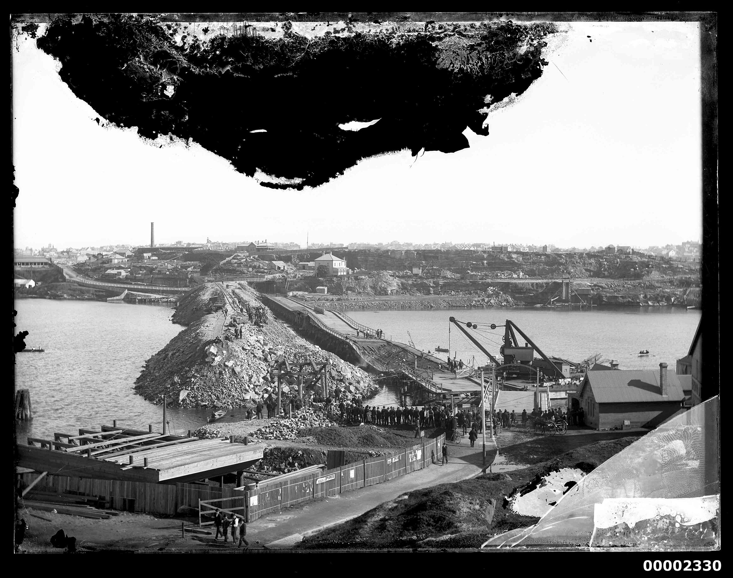
English: The Sydney Morning Herald reported that at 3am Saturday 5 August 1899, the Glebe Island Bridge, which served the road between Glebe Island and Pyrmont in Sydney since 1860, collapsed. Spectators gathered and traffic access to Balmain was halted. The Australian Town and Country Journal reported that the collapse was caused by unsecured ballast, seen in the image, that was put in place for the new swing bridge already under construction. The Glebe swing bridge eventually opened in 1903 and still exists today. The Hall collection provides an important pictorial record of recreational boating in Sydney Harbour, from the 1890s to the 1930s – from large racing and cruising yachts, to the many and varied skiffs jostling on the harbour, to the new phenomenon of motor boating in the early twentieth century. The collection also includes images of the many spectators and crowds who followed the sailing races. |
| Date | Taken in August 1899 |
| Source | https://www.flickr.com/photos/anmm_thecommons/7405443204/ |
| Author | Australian National Maritime Museum on The Commons |
| Permission (Reusing this file) |
At the time of upload, the image license was automatically confirmed using the Flickr API. For more information see Flickr API detail. |
| Flickr sets |
|
| Flickr tags |
|
| Flickr posted date | 20 June 2012 |
| Camera location | | View this and other nearby images on: OpenStreetMap |
|---|
.jpg¶ms=-33.869034_N_0151.187689_E_globe:Earth_type:camera__&language=en)
Licensing[edit]
.jpg&action=edit§ion=2)
This image was taken from Flickr's The Commons. The uploading organization may have various reasons for determining that no known copyright restrictions exist, such as:
More information can be found at https://flickr.com/commons/usage/. Please add additional copyright tags to this image if more specific information about copyright status can be determined. See Commons:Licensing for more information. |
| This image was originally posted to Flickr by Australian National Maritime Museum on The Commons at https://flickr.com/photos/33147718@N05/7405443204. It was reviewed on 9 August 2015 by FlickreviewR and was confirmed to be licensed under the terms of the No known copyright restrictions. |
File history
Click on a date/time to view the file as it appeared at that time.
| Date/Time | Thumbnail | Dimensions | User | Comment | |
|---|---|---|---|---|---|
| current | 14:17, 9 August 2015 | | 3,543 × 2,793 (522 KB) | Fæ (talk | contribs) | == {{int:filedesc}} == {{subst:chc}} {{information |description={{en|1=The Sydney Morning Herald reported that at 3am Saturday 5 August 1899, the Glebe Island Bridge, which served the road between Glebe Island and Pyrmont in Sydney since 1860, collapse... |
You cannot overwrite this file.
File usage on Commons
There are no pages that use this file.
.jpg&oldid=775820743)