File:Grand Canyon (Grand Canyon National Park Service).jpg
Jump to navigation
Jump to search

Size of this preview: 800 × 422 pixels. Other resolutions: 320 × 169 pixels | 640 × 337 pixels | 1,024 × 540 pixels | 1,280 × 675 pixels | 3,691 × 1,945 pixels.
Original file (3,691 × 1,945 pixels, file size: 3.51 MB, MIME type: image/jpeg)
Captions
Captions
Add a one-line explanation of what this file represents
Summary[edit]
.jpg&action=edit§ion=1)
| Description |
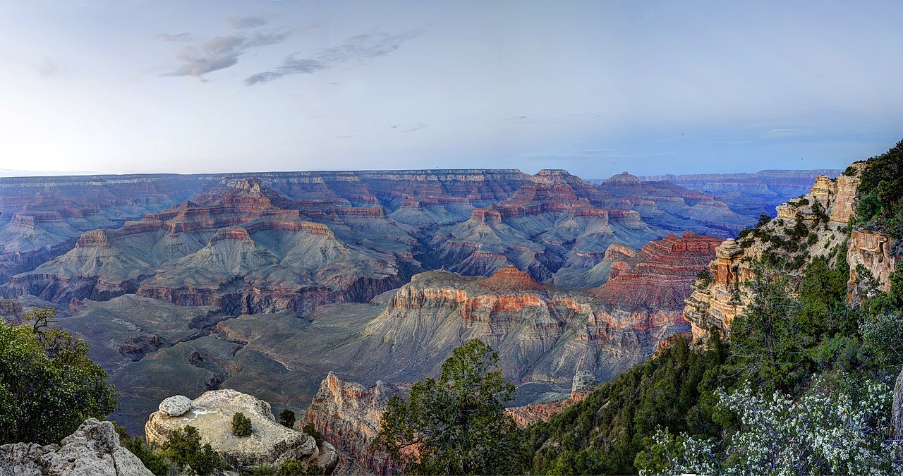
English: Yaki Point, elevation: 7262 feet (2213 m) is a quiet place from which to enjoy sunset or sunrise. There is a restroom located here. NPS photo by W. Tyson Joye.Yaki Point and the S. Kaibab Trail Parking Lot are CLOSED to private vehicle traffic. Sightseers ride the free park shuttle bus to access this area.The Kaibab/ Rim Route (orange bus) provides transportation between the Grand Canyon Visitor Center, South Kaibab Trailhead, Yaki Point, Pipe Creek Vista, Mather Point, and Yavapai Geology Museum. This is the shortest scenic bus route and the only access to Yaki Point, the South Kaibab Trailhead and the Yavapai Geology Museum. Read more about free shuttle buses here: http://www.nps.gov/grca/planyourvisit/shuttle-buses.htmAt Yaki Point, sea shells and corals are abundant in the limestone which forms the upper layer of the Grand Canyon walls and may be seen in the rocks at Yaki Point. As similar animals are found living only in the sea, it is evident that this layer is the relic of an ancient sea bottom. The corals indicate that the sea was clear and warm. Today, Yaki Point, once below sea level, is 7,260 feet above sea level. This relationship is accounted for by uplift of the land. The earth’s crust is almost constantly moving up or down, although so slowly that in our short lifetime we may not recognize the movement.The dark rocks at the bottom of the Canyon are noticeably different from those which form the horizontal layers in the Canyon walls above. Their irregular vertical structure is partly the result of shattering by great earth movements in a remote period of the past. These are among the oldest rocks known on the earth and represent the base of ancient mountains worn down to an approximately even surface by stream erosion.Light-colored streaks and bands in the dark rocks of the Inner Gorge were formed when molten rock was forced up into ctacks of the black rock and cooled slowly enough to crystalize as a granite far beneath the surface of the earth. |
| Date | |
| Source | https://www.flickr.com/photos/grand_canyon_nps/7562931754/ |
| Author | Grand Canyon National Park |
Licensing[edit]
.jpg&action=edit§ion=2)
| This image was originally posted to Flickr by Grand Canyon NPS at https://flickr.com/photos/50693818@N08/7562931754. It was reviewed on 15 May 2017 by FlickreviewR and was confirmed to be licensed under the terms of the cc-by-2.0. |
This file is licensed under the Creative Commons Attribution 2.0 Generic license.
- You are free:
- to share – to copy, distribute and transmit the work
- to remix – to adapt the work
- Under the following conditions:
- attribution – You must give appropriate credit, provide a link to the license, and indicate if changes were made. You may do so in any reasonable manner, but not in any way that suggests the licensor endorses you or your use.
File history
Click on a date/time to view the file as it appeared at that time.
| Date/Time | Thumbnail | Dimensions | User | Comment | |
|---|---|---|---|---|---|
| current | 18:53, 15 May 2017 | | 3,691 × 1,945 (3.51 MB) | TheAmerikaner (talk | contribs) | User created page with UploadWizard |
You cannot overwrite this file.
File usage on Commons
There are no pages that use this file.
.jpg&oldid=682929599)