File:Gutierrez Americas-California.jpg
Jump to navigation
Jump to search
Size of this preview: 528 × 599 pixels. Other resolutions: 211 × 240 pixels | 423 × 480 pixels | 677 × 768 pixels | 902 × 1,024 pixels | 1,804 × 2,048 pixels | 2,623 × 2,977 pixels.
Original file (2,623 × 2,977 pixels, file size: 9.2 MB, MIME type: image/jpeg)
Captions
Captions
Add a one-line explanation of what this file represents
Summary[edit]
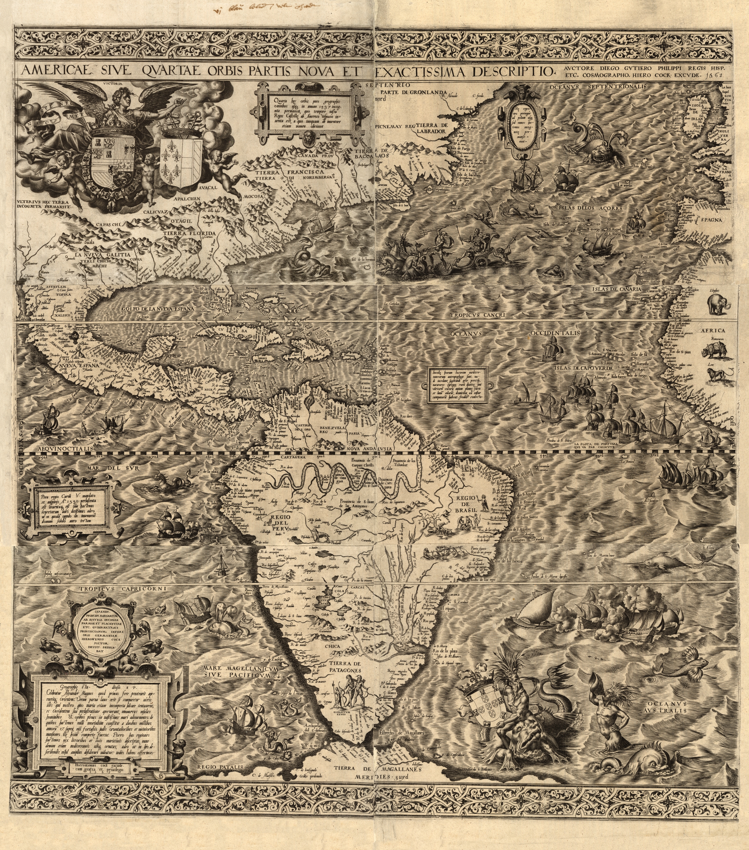
| Description | Americae sive quartae orbis partis nova et exactissima descriptio, the first map of the Americas to use the name California. (Note the horizontally oriented, small-script word, "California," placed in the Sea of Cortez, adjacent to the small portion of Baja California showing on the map.) |
| Date | |
| Source | https://www.loc.gov - CD containing MrSID files |
| Author | Gutiérrez |
| Permission (Reusing this file) |
PD |
[Map of America].
Licensing[edit]
|
This work is in the public domain in its country of origin and other countries and areas where the copyright term is the author's life plus 100 years or fewer. | |
| This file has been identified as being free of known restrictions under copyright law, including all related and neighboring rights. | |
File history
Click on a date/time to view the file as it appeared at that time.
| Date/Time | Thumbnail | Dimensions | User | Comment | |
|---|---|---|---|---|---|
| current | 17:35, 20 July 2008 | | 2,623 × 2,977 (9.2 MB) | Joopr (talk | contribs) | {{Information |Description=First map of America which mentions California |Source=http://www.loc.gov/ CD met MrSID bestanden. |Date=1562 |Author=Guitérrez |Permission= |other_versions= }} Category:America Category:Old maps Category:Antwerpen |
| 06:05, 26 November 2006 |  | 640 × 654 (122 KB) | Jmabel (talk | contribs) | {{Information |Description=''Americae sive quartae orbis partis nova et exactissima descriptio'', the first map of the Americas to use the name California |Source=http://www.loc.gov/exhibits/1492/invent.html, map itself at http://www.loc.gov/exhibits/1492 |
You cannot overwrite this file.
File usage on Commons
There are no pages that use this file.
File usage on other wikis
The following other wikis use this file:
- Usage on br.wikipedia.org
- Usage on ca.wikipedia.org
- Usage on de.wikipedia.org
- Usage on en.wikipedia.org