File:Infoschild Ernsthof Oberbarnimer Feldsteinroute.jpg
Jump to navigation
Jump to search
Size of this preview: 800 × 592 pixels. Other resolutions: 320 × 237 pixels | 640 × 473 pixels | 1,024 × 757 pixels | 1,280 × 947 pixels | 2,560 × 1,894 pixels | 3,488 × 2,580 pixels.
Original file (3,488 × 2,580 pixels, file size: 2.78 MB, MIME type: image/jpeg)
Captions
Captions
Add a one-line explanation of what this file represents
Summary[edit]
| Description |
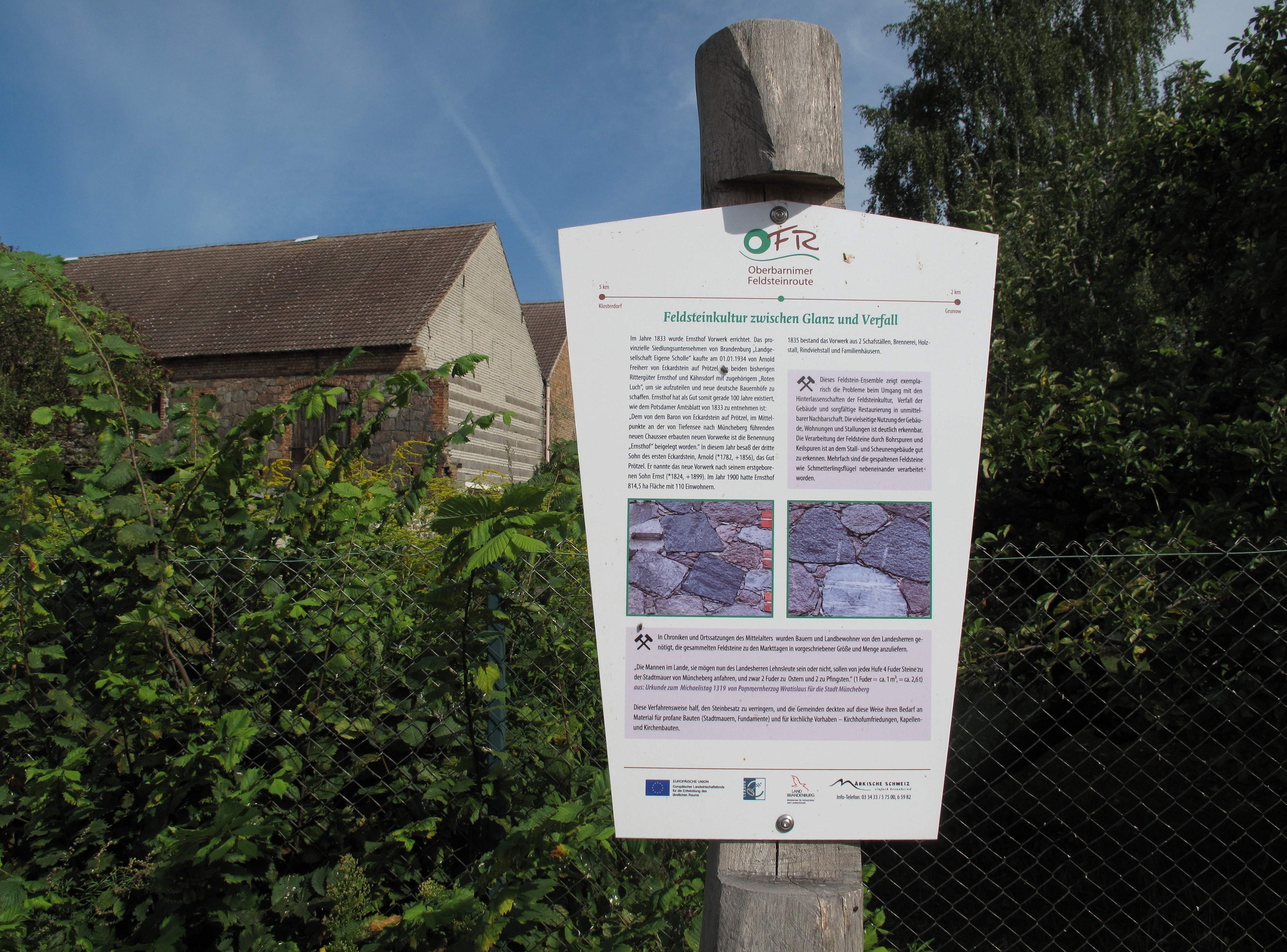
Deutsch: Informationstafel der Oberbarnimer Feldsteinroute in Ernsthof, einer Ortslage des Dorfes Grunow, einem Ortsteil der Gemeinde Oberbarnim. Die Oberbarnimer Feldsteinroute ist eine 41,5 Kilometer lange kultur- und bauhistorische Wander- und Fahrrad-Route auf den Spuren des Baumaterials Feldstein im Brandenburger Landkreis Märkisch-Oderland. Sie verläuft auf dem Barnimplateau und weitgehend über Dörfer im Naturpark Märkische Schweiz.
English: Information board of the Oberbarnimer Feldsteinroute in Ernsthof, place of Grunow, a village of the municipality Oberbarnim. The Oberbarnimer Feldsteinroute is a 41,5 kilometers long walking and bike trail in the traces of the building material fieldstone in the District Märkisch-Oderland, Brandenburg, Germany. It runs on the Barnim Plateau and mainly through villages in the Märkische Schweiz Nature Park. |
| Date | Taken on 18 August 2012 |
| Source | Own work |
| Author | Lienhard Schulz |
Licensing[edit]
I, the copyright holder of this work, hereby publish it under the following license:
This file is licensed under the Creative Commons Attribution-Share Alike 3.0 Unported license.
- You are free:
- to share – to copy, distribute and transmit the work
- to remix – to adapt the work
- Under the following conditions:
- attribution – You must give appropriate credit, provide a link to the license, and indicate if changes were made. You may do so in any reasonable manner, but not in any way that suggests the licensor endorses you or your use.
- share alike – If you remix, transform, or build upon the material, you must distribute your contributions under the same or compatible license as the original.
File history
Click on a date/time to view the file as it appeared at that time.
| Date/Time | Thumbnail | Dimensions | User | Comment | |
|---|---|---|---|---|---|
| current | 08:47, 15 September 2012 | | 3,488 × 2,580 (2.78 MB) | Lienhard Schulz (talk | contribs) | {{Information |Description= {{de|Informationstafel der Oberbarnimer Feldsteinroute in Ernsthof, einer Ortslage des Dorfes Grunow, einem Ortsteil der Gemeinde Oberbarnim. Die [... |
You cannot overwrite this file.
File usage on Commons
There are no pages that use this file.