File:Karte Goldberggruppe.png
Jump to navigation
Jump to search
Size of this preview: 496 × 600 pixels. Other resolutions: 198 × 240 pixels | 397 × 480 pixels | 635 × 768 pixels | 847 × 1,024 pixels | 1,694 × 2,048 pixels | 4,271 × 5,164 pixels.
Original file (4,271 × 5,164 pixels, file size: 3.09 MB, MIME type: image/png)
Captions
Captions
Add a one-line explanation of what this file represents
Summary[edit]
| Description |
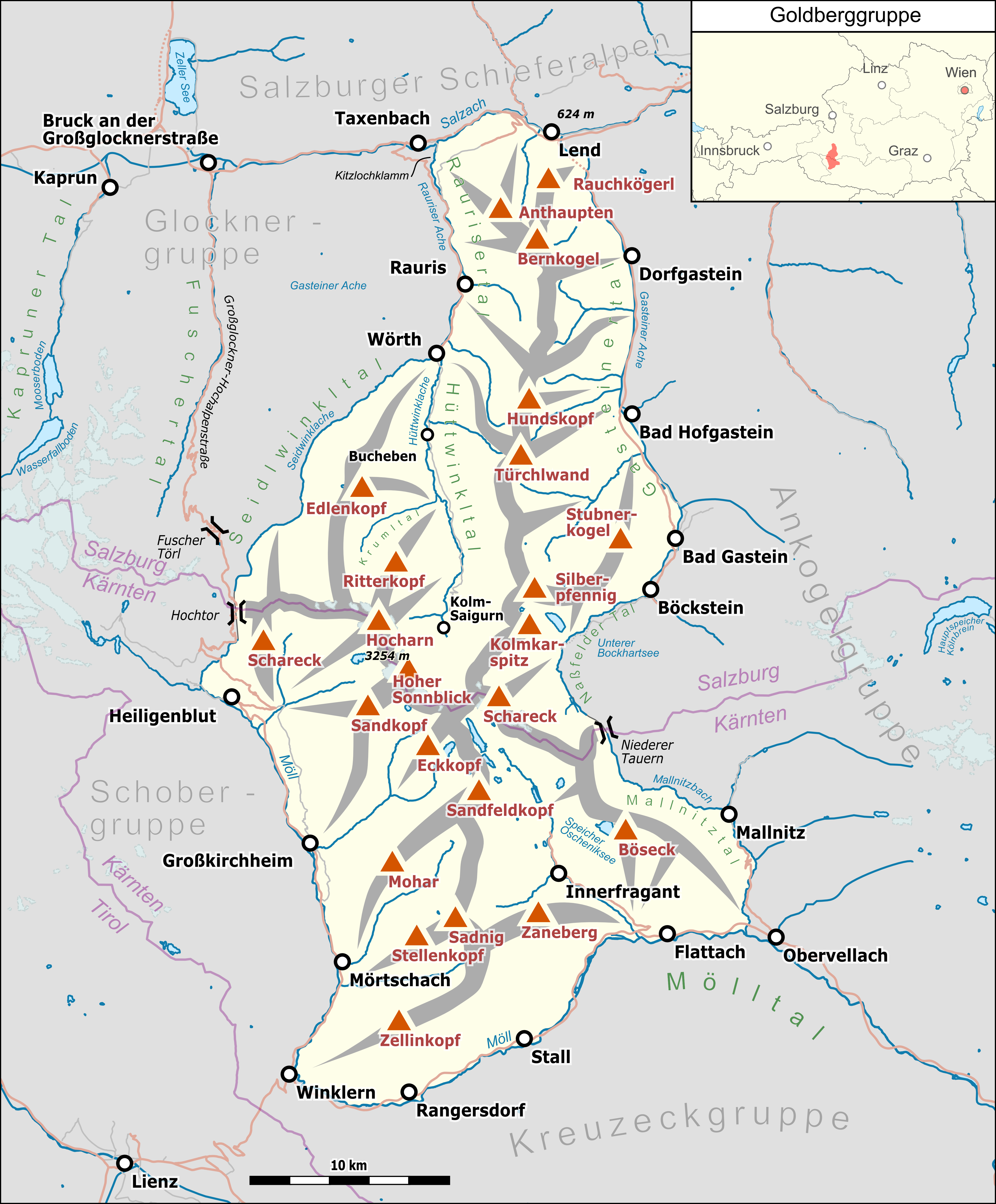
Deutsch: Übersichtskarte der Goldberggruppe. |
|||||||||
| Date | ||||||||||
| Source |
Own work Map was created using:
|
|||||||||
| Creator |
|
|||||||||
| Permission (Reusing this file) |
Map data (c) OpenStreetMap (and) contributors, CC-BY-SA | |||||||||
| Geotemporal data | ||||||||||
| Bounding box |
|
|||||||||
| Georeferencing | ||||||||||
| This work is licensed under the Open Database License (summary). |
File history
Click on a date/time to view the file as it appeared at that time.
| Date/Time | Thumbnail | Dimensions | User | Comment | |
|---|---|---|---|---|---|
| current | 00:10, 10 February 2019 | | 4,271 × 5,164 (3.09 MB) | Pechristener (talk | contribs) | niedrigster Pkt hinzu, Korr an Gipfeln |
| 03:13, 22 December 2018 |  | 4,271 × 5,164 (3.02 MB) | Pechristener (talk | contribs) | Beschriftung Großglockner-Hochalpenstraße, Fuscher Törl und Stauseen im Kaprun Tal hinzu. | |
| 15:08, 21 December 2018 |  | 4,271 × 5,164 (2.96 MB) | Pechristener (talk | contribs) | == {{int:filedesc}} == {{Map |Description={{de|1=Übersichtskarte der {{w|Goldberggruppe||de}}. }} |Source ={{own}} Map was created using: *[http://www.openstreetmap.org/ Open Street Map] Data *{{w|Austria location map.svg}} for location map |Author = *Hauptkarte: Pechristener *{{w|Austria location map.svg}} : NordNordWest, {{u|Lencer}} |Date =2018-12-21 |Permission =Map data (c) OpenStreetMap (and) contributors, CC... |
You cannot overwrite this file.
File usage on Commons
The following 3 pages use this file:
File usage on other wikis
The following other wikis use this file:
- Usage on arz.wikipedia.org
- Usage on de.wikipedia.org
- Usage on it.wikipedia.org
- Usage on www.wikidata.org