File:Karte der Innenstadt von Freiburg im Breisgau (OSM-Derivat).svg
Jump to navigation
Jump to search

Size of this PNG preview of this SVG file: 800 × 590 pixels. Other resolutions: 320 × 236 pixels | 640 × 472 pixels | 1,024 × 755 pixels | 1,280 × 944 pixels | 2,560 × 1,888 pixels | 1,669 × 1,231 pixels.
Original file (SVG file, nominally 1,669 × 1,231 pixels, file size: 2.45 MB)
Captions
Captions
Add a one-line explanation of what this file represents
Summary[edit]
| Description |
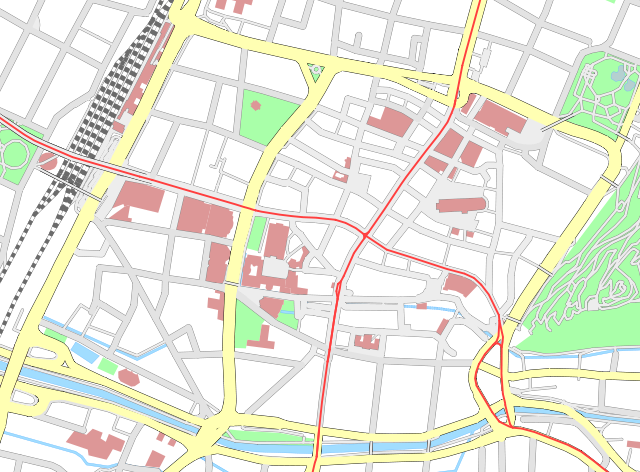
Deutsch: Karte der Innenstadt von Freiburg im Breisgau. Erstellt auf Basis eines pdf-Exports aus OpenStreetMap (Maßstab 1:5000). Die Straßenlinien wurden mit einer größeren Breite versehen, um so mehr Platz für das vorgesehene Hinzufügen der "Bächle" zu schaffen. |
||||||||||||
| Date | |||||||||||||
| Source | Self made, using data from OpenStreetMap | ||||||||||||
| Author |
Maximilian Dörrbecker (Chumwa)
|
||||||||||||
| Permission (Reusing this file) |
Sie dürfen das Bild zu den folgenden Bedingungen nutzen:
|

.svg&action=edit§ion=1)
File history
Click on a date/time to view the file as it appeared at that time.
| Date/Time | Thumbnail | Dimensions | User | Comment | |
|---|---|---|---|---|---|
| current | 05:18, 18 June 2009 | | 1,669 × 1,231 (2.45 MB) | Chumwa (talk | contribs) | noch etwas an den Brücken im sichtbaren Bereich gearbeitet |
| 04:49, 17 June 2009 |  | 1,669 × 1,231 (3.97 MB) | Chumwa (talk | contribs) | {{Information |Description= {{ de }} Karte der Innenstadt von Freiburg im Breisgau. Erstellt auf Basis eines pdf-Exports aus OpenStreetMap (Maßstab 1:5000). Die Straßenlinien wurden mit einer größeren Breite versehen, um so mehr Platz für das vorgese |
You cannot overwrite this file.
File usage on Commons
The following page uses this file:
File usage on other wikis
The following other wikis use this file:
- Usage on de.wikipedia.org
.svg&oldid=476021601)