File:Keisei-kanamachi-line-1989.jpg
Jump to navigation
Jump to search

Size of this preview: 352 × 599 pixels. Other resolutions: 141 × 240 pixels | 282 × 480 pixels | 451 × 768 pixels | 601 × 1,024 pixels | 2,079 × 3,540 pixels.
Original file (2,079 × 3,540 pixels, file size: 2.94 MB, MIME type: image/jpeg)
Captions
Captions
Add a one-line explanation of what this file represents
| Description |
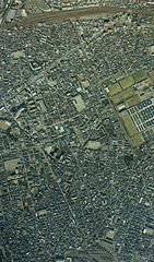
English: Keisei Kanamachi Line from satellite. Taken in 1989 日本語: 京成金町線の衛星写真。1989年(平成元年)撮影 한국어: 게이세이 가나마치 선 인공위성 사진. 1989년 찍음 |
|||||
| Date | ||||||
| Source | here | |||||
| Author | The Ministry of Land, Infrastructure and Transport of Japan | |||||
| Permission (Reusing this file) |
|


File history
Click on a date/time to view the file as it appeared at that time.
| Date/Time | Thumbnail | Dimensions | User | Comment | |
|---|---|---|---|---|---|
| current | 08:13, 26 December 2006 | | 2,079 × 3,540 (2.94 MB) | LERK (talk | contribs) | {{Information| Description={{en|Keisei Kanamachi Line from satellite. Taken in 1989}}{{ja|京成金町線の衛星写真。1989年(平成元年)撮影}}{{ko|게이세이 가나마치 선 인공위성 사진. 1989년 찍음}}| Source=[http://w3land.mli |
You cannot overwrite this file.
File usage on Commons
There are no pages that use this file.
File usage on other wikis
The following other wikis use this file:
- Usage on ja.wikipedia.org
- Usage on ko.wikipedia.org
- Usage on zh.wikipedia.org