File:Kinmen.svg
Jump to navigation
Jump to search

Size of this PNG preview of this SVG file: 705 × 506 pixels. Other resolutions: 320 × 230 pixels | 640 × 459 pixels | 1,024 × 735 pixels | 1,280 × 919 pixels | 2,560 × 1,837 pixels.
Original file (SVG file, nominally 705 × 506 pixels, file size: 293 KB)
Captions
Captions
Add a one-line explanation of what this file represents
Summary[edit]
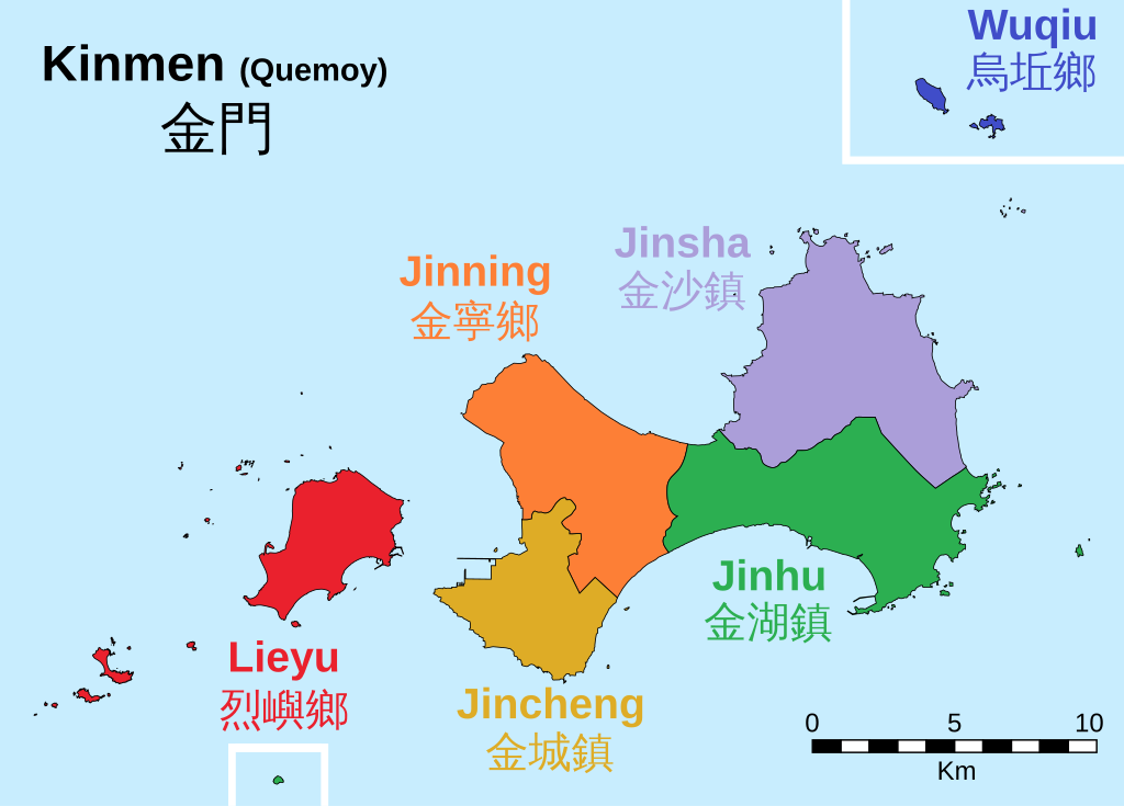
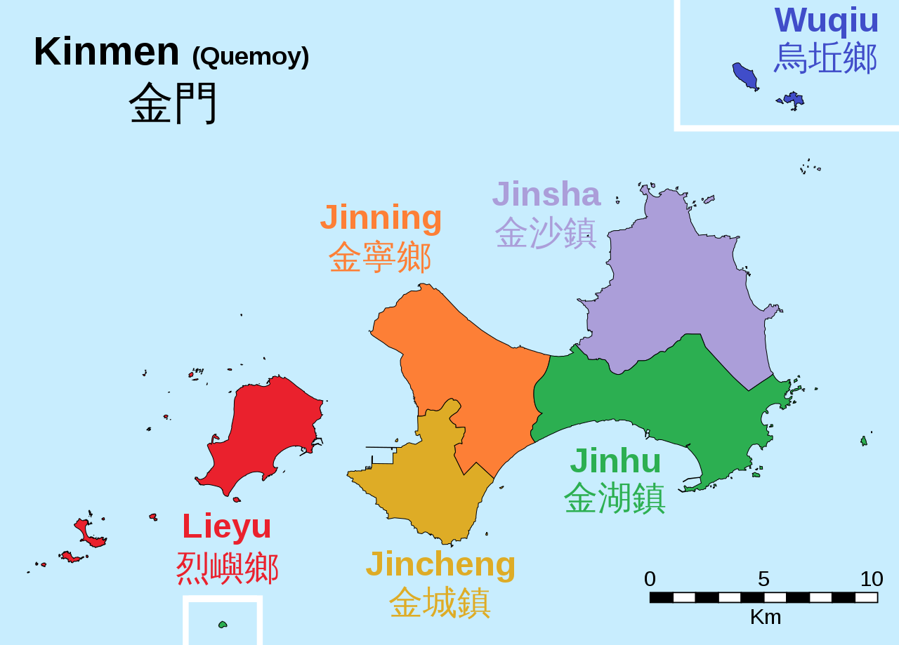
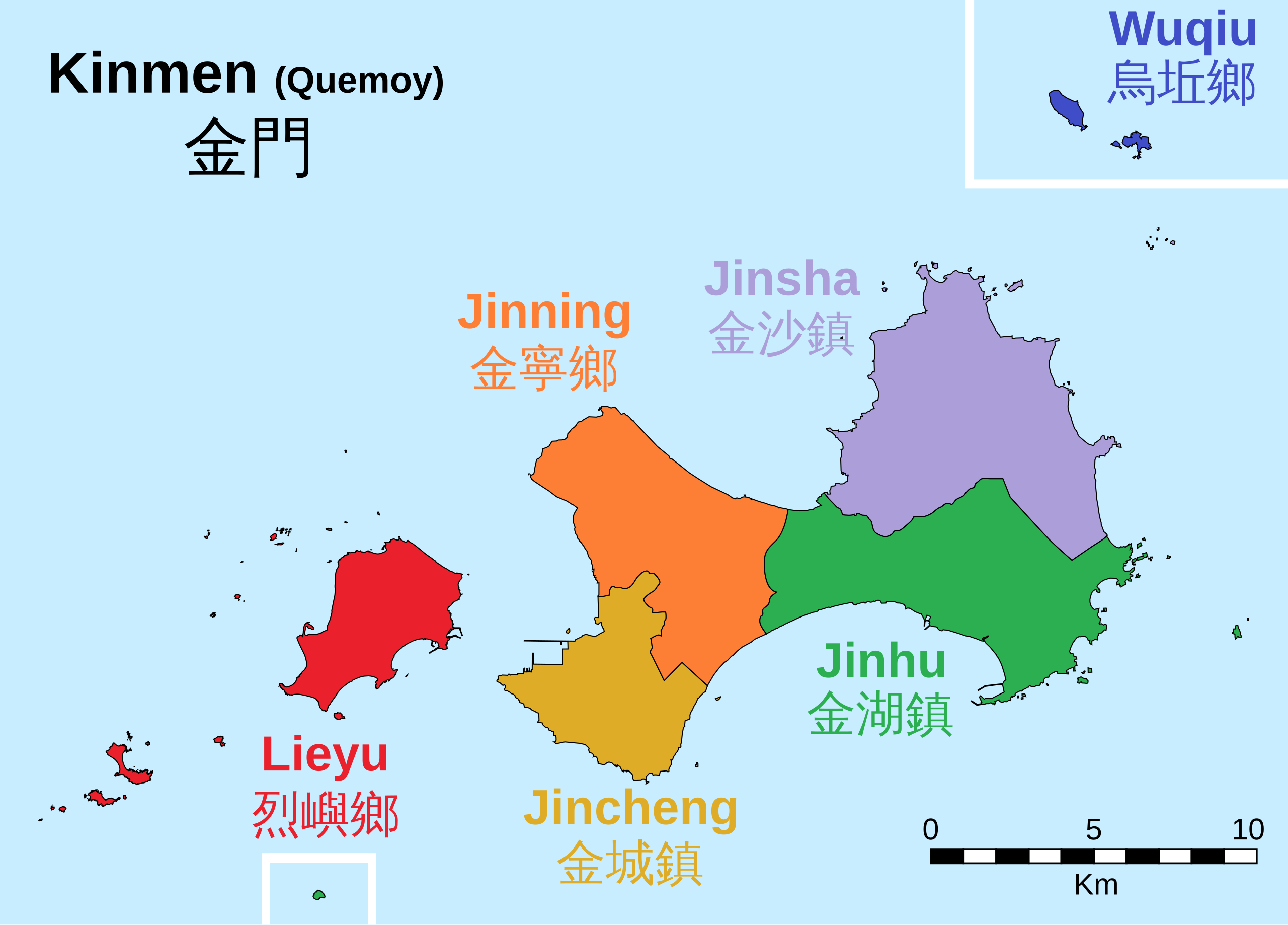
| Description |
Deutsch: Gemeinden im Landkreis Kinmen. English: Townships of Kinmen County. |
||
| Date | |||
| Source | Own work, based on Openstreetmap and File:Kinmen.PNG by Guss | ||
| Author | Furfur | ||
| Permission (Reusing this file) |
I, the copyright holder of this work, hereby publish it under the following licenses:
This file is licensed under the Creative Commons Attribution-Share Alike 4.0 International license.
You may select the license of your choice. |
||
| SVG development | This map was created with Adobe Illustrator. |

File history
Click on a date/time to view the file as it appeared at that time.
| Date/Time | Thumbnail | Dimensions | User | Comment | |
|---|---|---|---|---|---|
| current | 05:10, 12 August 2020 | | 705 × 506 (293 KB) | Nv7801 (talk | contribs) | Alignment of title |
| 20:47, 11 August 2020 |  | 705 × 506 (293 KB) | Nv7801 (talk | contribs) | Jincheng> Jinhu | |
| 20:29, 11 August 2020 |  | 705 × 506 (293 KB) | Nv7801 (talk | contribs) | Dongding Island: Lieyu>Jincheng | |
| 12:21, 11 August 2020 |  | 705 × 506 (293 KB) | Nv7801 (talk | contribs) | Dongding Island | |
| 07:05, 19 September 2019 |  | 705 × 506 (288 KB) | Furfur (talk | contribs) | Lieyu | |
| 19:53, 11 August 2018 |  | 705 × 506 (288 KB) | Furfur (talk | contribs) | typo: Wuqiu | |
| 23:38, 26 May 2018 |  | 705 × 506 (288 KB) | Furfur (talk | contribs) | + Maßstab | |
| 21:03, 21 May 2018 |  | 627 × 450 (137 KB) | Furfur (talk | contribs) | bold | |
| 20:50, 21 May 2018 |  | 627 × 450 (136 KB) | Furfur (talk | contribs) | == {{int:filedesc}} == {{Information |Description= {{de|1=Gemeinden im Landkreis Kinmen.}}{{en|1=Townships of Kinmen County.}} |Source={{Own}}, based on Openstreetmap and File:Kinmen.PNG by {{U|Guss}} |Date=2018-05-21 |Permission={{self|GFDL|cc-by-sa-4.0}} |Author={{U|Furfur}} }} Category:Maps of townships of Kinmen County = |
You cannot overwrite this file.
File usage on Commons
The following page uses this file:
File usage on other wikis
The following other wikis use this file:
- Usage on de.wikipedia.org
- Usage on de.wikivoyage.org
- Usage on en.wikipedia.org
- Usage on he.wikipedia.org
- Usage on ja.wikipedia.org
- Usage on ms.wikipedia.org
- Usage on zh.wikipedia.org