File:Kliuchevskoi volcanic group topo.jpg
Jump to navigation
Jump to search
Size of this preview: 550 × 600 pixels. Other resolutions: 220 × 240 pixels | 440 × 480 pixels | 704 × 768 pixels | 939 × 1,024 pixels | 1,874 × 2,044 pixels.
Original file (1,874 × 2,044 pixels, file size: 522 KB, MIME type: image/jpeg)
Captions
Captions
Add a one-line explanation of what this file represents
Summary[edit]
| Description |
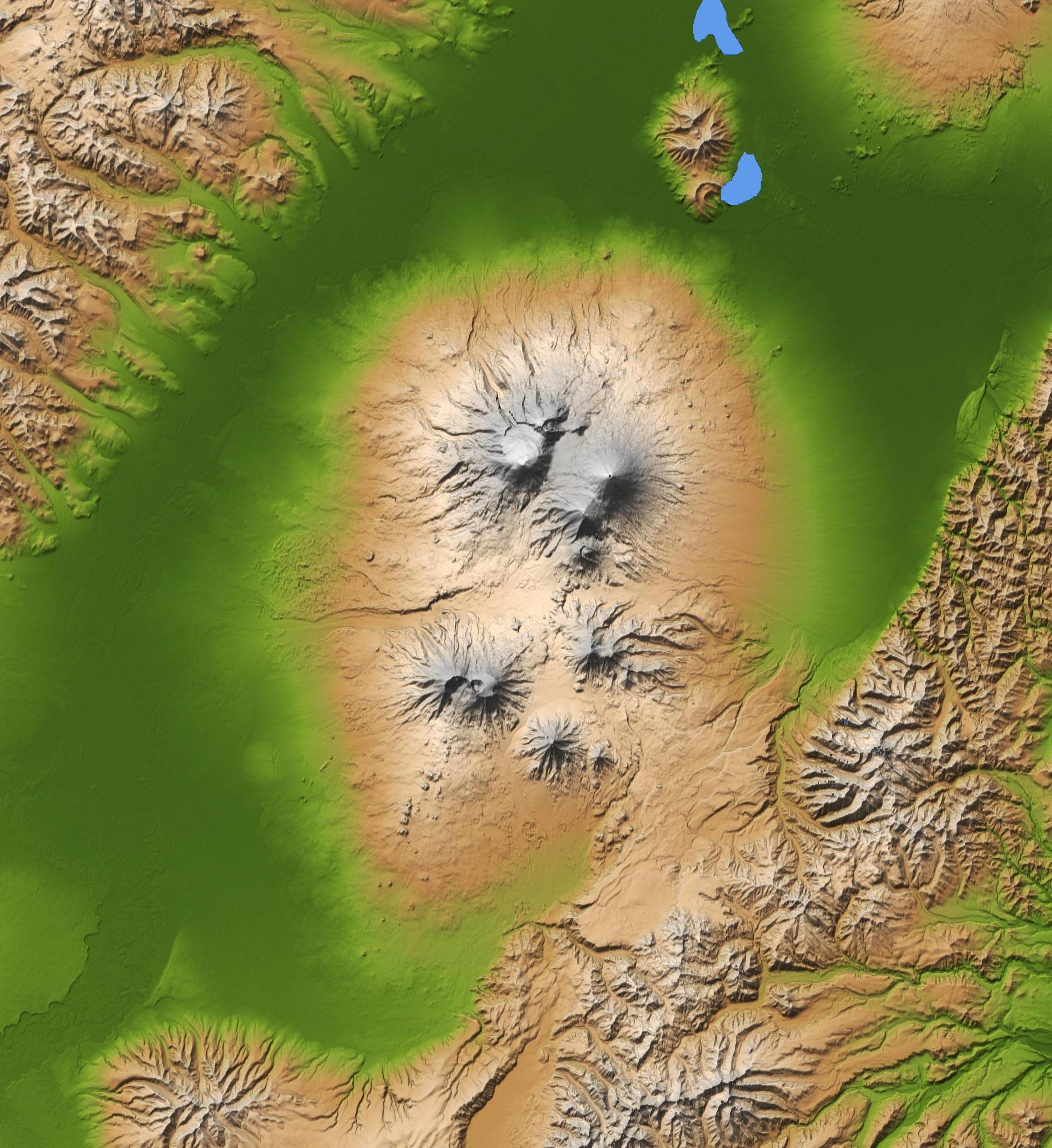
Français : Carte topographique du groupe volcanique du Klioutchevskoï, péninsule du Kamtchatka, Russie English: Topographic map of Kliuchevskoi volcanic group, Kamchatka peninsula, Russia |
| Date | |
| Source | Cropped version of File:Kamchatka peninsula topo.jpg |
| Author | NASA/JPL/NIMA |
| Other versions | File:Kamchatka peninsula topo.jpg |
Licensing[edit]
This image uses high-resolution digital topography data from NASA's Shuttle Radar Topography Mission (SRTM) at JPL-Caltech [1]. It is in the public domain in the United States.
|
 | |
| Annotations | This image is annotated: View the annotations at Commons |
File history
Click on a date/time to view the file as it appeared at that time.
| Date/Time | Thumbnail | Dimensions | User | Comment | |
|---|---|---|---|---|---|
| current | 09:51, 2 February 2012 | | 1,874 × 2,044 (522 KB) | Rémih (talk | contribs) |
You cannot overwrite this file.
File usage on Commons
There are no pages that use this file.
File usage on other wikis
The following other wikis use this file:
- Usage on fr.wikipedia.org
- Usage on he.wikipedia.org
- Usage on hu.wikipedia.org
Categories:
- Topographic maps of volcanoes in Russia
- Bezymianny
- Kamen volcano
- Klyuchevskaya Sopka
- Shiveluch
- Tolbachik volcanic complex
- Udina volcano
- Ushkovsky volcano
- Zimina volcano
- Volcanic complexes
- Kliuchevskoi volcanic group
- Maps of Shiveluch volcano
- Central Kamchatka Depression
- Maps of volcanoes in Kamchatka
- Grabens (geology)
- Radial valleys
- Volcanoes (annotated) in Russia
- SRTM images of volcanoes in Russia