File:Lake Abitibi 79.72W 48.75N.jpg
Jump to navigation
Jump to search

Size of this preview: 778 × 599 pixels. Other resolutions: 312 × 240 pixels | 623 × 480 pixels | 997 × 768 pixels | 1,280 × 986 pixels.
Original file (1,280 × 986 pixels, file size: 510 KB, MIME type: image/jpeg)
Captions
Captions
Add a one-line explanation of what this file represents
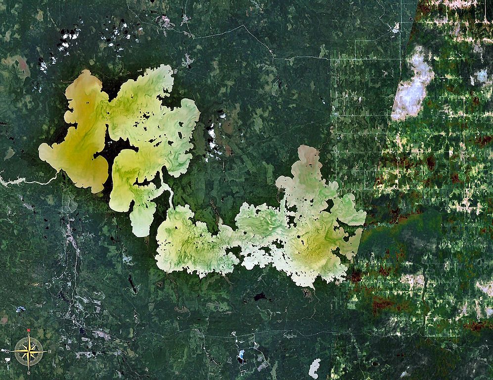
| Description | Lake Abitibi, Ontario and Quebec, Canada. The border between the 2 provinces is visible as a vertical line between undeveloped terrain in Ontario and the rectangular agricultural patterns in Quebec (the right/east third of photo). |
| Source | NASA WorldWind |
| Author | NASA |
| This image is in the public domain because it is a screenshot from NASA’s globe software World Wind using a public domain layer, such as Blue Marble, MODIS, Landsat, SRTM, USGS or GLOBE.
|
 |
File history
Click on a date/time to view the file as it appeared at that time.
| Date/Time | Thumbnail | Dimensions | User | Comment | |
|---|---|---|---|---|---|
| current | 17:23, 22 January 2007 | | 1,280 × 986 (510 KB) | P199 (talk | contribs) | {{Information |Description=Lake Abitibi, Ontario and Quebec, Canada |Source=NASA WorldWind |Date= |Author= |Permission= |other_versions= }} {{PD-WorldWind}} Category:Lakes of Ontario Category:Lakes of Québec |
You cannot overwrite this file.
File usage on Commons
The following page uses this file:
File usage on other wikis
The following other wikis use this file:
- Usage on arz.wikipedia.org
- Usage on bg.wikipedia.org
- Usage on ceb.wikipedia.org
- Usage on de.wikipedia.org
- Usage on en.wikipedia.org
- Usage on eo.wikipedia.org
- Usage on es.wikipedia.org
- Usage on et.wikipedia.org
- Usage on fr.wikipedia.org
- Usage on hr.wikipedia.org
- Usage on it.wikipedia.org
- Usage on lv.wikipedia.org
- Usage on pl.wikipedia.org
- Usage on pt.wikipedia.org
- Usage on ru.wikipedia.org
- Usage on sv.wikipedia.org
- Usage on te.wikipedia.org
- Usage on uk.wikipedia.org
- Usage on www.wikidata.org
- Usage on zh.wikipedia.org