File:Map 11 - Bosnia - Posavina Corridor - August 1992-January 1993.jpg
Jump to navigation
Jump to search
Size of this preview: 800 × 579 pixels. Other resolutions: 320 × 232 pixels | 640 × 463 pixels | 1,024 × 741 pixels | 1,280 × 927 pixels | 1,794 × 1,299 pixels.
Original file (1,794 × 1,299 pixels, file size: 1.71 MB, MIME type: image/jpeg)
Captions
Captions
Add a one-line explanation of what this file represents
Summary[edit]
| Description |
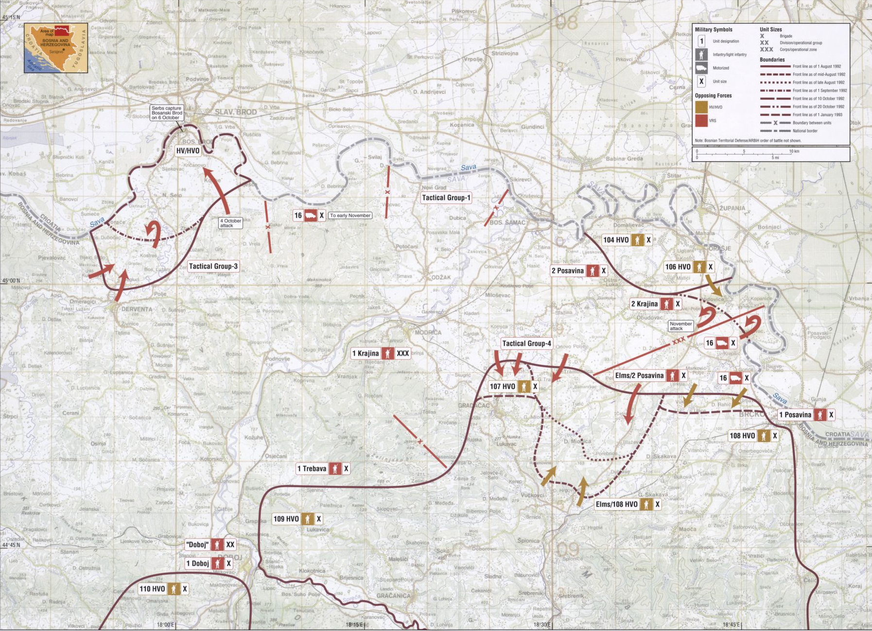
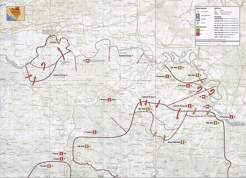
English: Map of the Posavina Corridor (Operation Corridor 92 of the Army of the Republika Srpska) in August 1992-January 1993. Balkan Battlegrounds Map 11 |
| Date | |
| Source | Balkan Battlegrounds: A Military History of the Yugoslav Conflict, 1990-1995, Diane Publishing Company, 2003, ISBN 0756729300, 9780756729301; (https://www.loc.gov/item/2010588135) |
| Author | Central Intelligence Agency |
Licensing[edit]
| This image is a work of a Central Intelligence Agency employee, taken or made as part of that person's official duties. As a Work of the United States Government, this image or media is in the public domain in the United States.
|

|
File history
Click on a date/time to view the file as it appeared at that time.
| Date/Time | Thumbnail | Dimensions | User | Comment | |
|---|---|---|---|---|---|
| current | 20:50, 18 November 2019 | | 1,794 × 1,299 (1.71 MB) | UserNameSRB (talk | contribs) | Reverted to version as of 10:24, 15 November 2013 (UTC) |
| 22:03, 14 November 2019 |  | 2,189 × 1,694 (525 KB) | UserNameSRB (talk | contribs) | Better resolution | |
| 10:24, 15 November 2013 |  | 1,794 × 1,299 (1.71 MB) | Tomobe03 (talk | contribs) | User created page with UploadWizard |
You cannot overwrite this file.
File usage on Commons
The following 2 pages use this file:
File usage on other wikis
The following other wikis use this file:
- Usage on en.wikipedia.org
- Usage on es.wikipedia.org
- Usage on hu.wikipedia.org
- Usage on sr.wikipedia.org