File:Map of Bangladesh-de.svg
Jump to navigation
Jump to search

Size of this PNG preview of this SVG file: 485 × 599 pixels. Other resolutions: 194 × 240 pixels | 388 × 480 pixels | 621 × 768 pixels | 828 × 1,024 pixels | 1,657 × 2,048 pixels | 1,678 × 2,074 pixels.
Original file (SVG file, nominally 1,678 × 2,074 pixels, file size: 3.72 MB)
Captions
Captions
Add a one-line explanation of what this file represents
Summary[edit]
| Description |
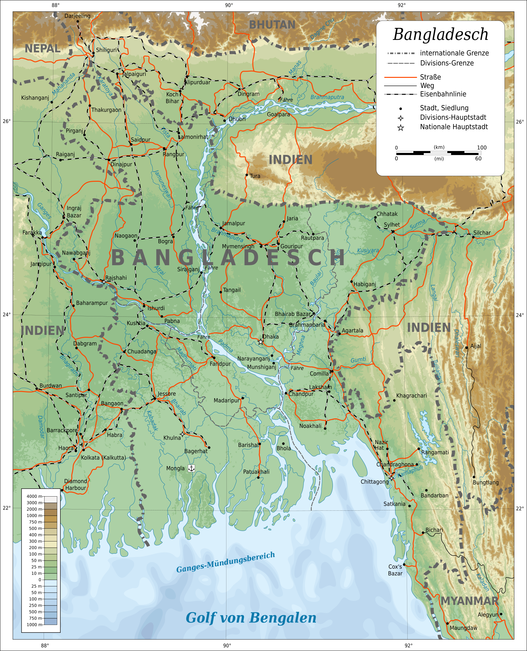
Deutsch: Topografische Karte von Bangladesch. English: Topographic map of Bangladesh. Lambert Conformal Conic projection, standard parallels 22°N/26°N, center longitude 90°E.
Suomi: Bangladeshin topografinen kartta.
Русский: Топографическая карта Бангладеш. |
||
| Date | |||
| Source |
|
||
| Author | Oona Räisänen (Mysid) | ||
| Permission (Reusing this file) |
I, the copyright holder of this work, hereby publish it under the following licenses:
This file is licensed under the Creative Commons Attribution 3.0 Unported license.
You may select the license of your choice. |
||
| Other versions |
[]
|
||
| SVG development | This map was created with Adobe Illustrator. |


|
This SVG file contains embedded text that can be translated into your language, using any capable SVG editor, text editor or the SVG Translate tool. For more information see: About translating SVG files. |
File history
Click on a date/time to view the file as it appeared at that time.
| Date/Time | Thumbnail | Dimensions | User | Comment | |
|---|---|---|---|---|---|
| current | 23:29, 5 April 2018 | | 1,678 × 2,074 (3.72 MB) | Furfur (talk | contribs) | typos |
| 20:03, 3 March 2016 |  | 1,678 × 2,074 (3.72 MB) | Furfur (talk | contribs) | Details | |
| 02:07, 3 January 2016 |  | 1,678 × 2,074 (3.71 MB) | Furfur (talk | contribs) | now valid svg | |
| 01:28, 3 January 2016 |  | 1,678 × 2,074 (3.71 MB) | Furfur (talk | contribs) | Details | |
| 10:15, 31 December 2015 |  | 1,678 × 2,074 (3.71 MB) | Furfur (talk | contribs) | Reverted to version as of 09:47, 31 December 2015 (UTC) - does work file not rendered properly | |
| 10:14, 31 December 2015 |  | 1,678 × 2,074 (3.17 MB) | Furfur (talk | contribs) | neuer Versuch (SVG cleanup) | |
| 09:47, 31 December 2015 |  | 1,678 × 2,074 (3.71 MB) | Furfur (talk | contribs) | new try ... | |
| 22:12, 30 December 2015 |  | 1,678 × 2,074 (3.16 MB) | Furfur (talk | contribs) | rendering the preview is incorrect - the final image is fine, however ... | |
| 21:47, 30 December 2015 |  | 1,678 × 2,074 (3.16 MB) | Furfur (talk | contribs) | the darkening of surrounding India does not make sense in my opinion - the color legend should also be valid for India | |
| 01:56, 24 January 2015 |  | 1,678 × 2,074 (3.75 MB) | Furfur (talk | contribs) | typo |
You cannot overwrite this file.
File usage on Commons
The following 8 pages use this file:
File usage on other wikis
The following other wikis use this file:
- Usage on de.wikipedia.org
- Usage on frr.wikipedia.org
- Usage on he.wikipedia.org
- Usage on ja.wikipedia.org
- Usage on trv.wikipedia.org
- Usage on www.wikidata.org
- Usage on zh.wikipedia.org