File:Mars topography (MOLA dataset) HiRes.jpg
Jump to navigation
Jump to search

Size of this preview: 800 × 457 pixels. Other resolutions: 320 × 183 pixels | 640 × 366 pixels | 1,024 × 585 pixels | 1,280 × 732 pixels | 2,560 × 1,463 pixels | 12,140 × 6,940 pixels.
Original file (12,140 × 6,940 pixels, file size: 17.2 MB, MIME type: image/jpeg)
Captions
Captions
Add a one-line explanation of what this file represents
| Warning | The original file is very high-resolution. It might not load properly or could cause your browser to freeze when opened at full size. |
|---|
Summary[edit]
| Description |
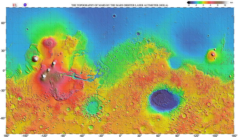
English: Very high resolution topographic shaded relief map of Mars. The map has a resolution 0.125° (300 dots per inch) and is shown as a mercator projection to latitude 70° north and south. The original NASA image has been modified by increasing the font size of the map grid and elevation key labels. |
| Date | |
| Source | http://mola.gsfc.nasa.gov/images.html |
| Author | NASA |
| Other versions |

|
_with_poles_HiRes.jpg)
_HiRes.jpg&action=edit§ion=1)
Licensing[edit]
_HiRes.jpg&action=edit§ion=2)
| This file is in the public domain in the United States because it was solely created by NASA. NASA copyright policy states that "NASA material is not protected by copyright unless noted". (See Template:PD-USGov, NASA copyright policy page or JPL Image Use Policy.) | ||
 |
Warnings:
|
| Annotations | This image is annotated: View the annotations at Commons |
_HiRes.jpg)
File history
Click on a date/time to view the file as it appeared at that time.
| Date/Time | Thumbnail | Dimensions | User | Comment | |
|---|---|---|---|---|---|
| current | 07:35, 23 May 2014 | | 12,140 × 6,940 (17.2 MB) | WolfmanSF (talk | contribs) | further increase font size for map grid & color key labels |
| 07:37, 19 May 2014 |  | 12,032 × 6,912 (17.88 MB) | WolfmanSF (talk | contribs) | Increase font size on map grid labels | |
| 03:44, 11 March 2009 |  | 12,032 × 6,912 (17.6 MB) | Masur (talk | contribs) | {{Information |Description={{en|1=Very high resolution topographic shaded relief map of Mars. The map has a resolution 0.125° (300 dots per inch) and is shown as a mercator projection to latitude 70° north and south.}} |Source=http://mola.gsfc.nasa.gov/ |
You cannot overwrite this file.
File usage on Commons
The following 2 pages use this file:
File usage on other wikis
The following other wikis use this file:
- Usage on fr.wikipedia.org
- Usage on ja.wikibooks.org
- Usage on ru.wikipedia.org
- Usage on uk.wikipedia.org
- Usage on zh.wikipedia.org
_HiRes.jpg&oldid=481666240)