File:Mexico states evolution.gif
Jump to navigation
Jump to search

Size of this preview: 626 × 599 pixels. Other resolutions: 251 × 240 pixels | 502 × 480 pixels | 1,000 × 957 pixels.
Original file (1,000 × 957 pixels, file size: 331 KB, MIME type: image/gif, looped, 26 frames, 1 min 18 s)
Captions
Captions
Add a one-line explanation of what this file represents
|
Summary
[edit]
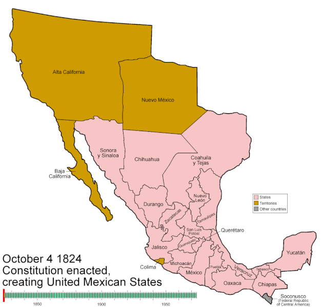
| Description | Animated map/timeline of the territorial evolution of Mexico. |
| Date | |
| Source | Own work |
| Author | User:Golbez |
| Camera location | | View this and other nearby images on: OpenStreetMap |
|---|
Licensing
[edit]
I, the copyright holder of this work, hereby publish it under the following licenses:

|
Permission is granted to copy, distribute and/or modify this document under the terms of the GNU Free Documentation License, Version 1.2 or any later version published by the Free Software Foundation; with no Invariant Sections, no Front-Cover Texts, and no Back-Cover Texts. A copy of the license is included in the section entitled GNU Free Documentation License. |
| This file is licensed under the Creative Commons Attribution-Share Alike 3.0 Unported license. | ||
| ||
| This licensing tag was added to this file as part of the GFDL licensing update. |
This file is licensed under the Creative Commons Attribution-Share Alike 2.5 Generic, 2.0 Generic and 1.0 Generic license.
- You are free:
- to share – to copy, distribute and transmit the work
- to remix – to adapt the work
- Under the following conditions:
- attribution – You must give appropriate credit, provide a link to the license, and indicate if changes were made. You may do so in any reasonable manner, but not in any way that suggests the licensor endorses you or your use.
- share alike – If you remix, transform, or build upon the material, you must distribute your contributions under the same or compatible license as the original.
You may select the license of your choice.
File history
Click on a date/time to view the file as it appeared at that time.
| Date/Time | Thumbnail | Dimensions | User | Comment | |
|---|---|---|---|---|---|
| current | 12:16, 24 March 2007 | | 1,000 × 957 (331 KB) | Golbez (talk | contribs) |
You cannot overwrite this file.
File usage on Commons
The following 4 pages use this file:
File usage on other wikis
The following other wikis use this file:
- Usage on bg.wikipedia.org
- Usage on bn.wikipedia.org
- Usage on cs.wikipedia.org
- Usage on en.wikipedia.org
- Portal:North America/Selected picture
- Wikipedia:Featured pictures thumbs/06
- User talk:Golbez/Archive 2
- Portal:Maps/Selected picture
- Wikipedia:Featured picture candidates/March-2007
- Wikipedia:Featured picture candidates/Mexico states evolution
- Territorial evolution of Mexico
- Wikipedia:Wikipedia Signpost/2007-04-02/Features and admins
- Wikipedia:Wikipedia Signpost/2007-04-02/SPV
- Template:POTD/2007-08-01
- Wikipedia:Today's featured picture (animation)/August 1, 2007
- Portal:Mexico/Selected picture
- Portal:Maps/Selected picture/13
- Portal:Mexico/Selected picture/1
- Wikipedia:Featured pictures/Diagrams, drawings, and maps/Maps
- Portal:North America/Selected picture/11
- User talk:Golbez/Archive 3
- History of the Texas Ranger Division
- Wikipedia:Featured picture candidates/November-2009
- Wikipedia:Featured picture candidates/Non-Native American Nations Control over N America 1750-2008.gif
- List of conflicts in Mexico
- User:SomeGuyWhoRandomlyEdits/List of conflicts in Mexico
- Wikipedia:Wikipedia Signpost/Single/2007-04-02
- Usage on en.wikibooks.org
- Usage on es.wikipedia.org
- Usage on fa.wikipedia.org
- Usage on fr.wikipedia.org
- Usage on pam.wikipedia.org
- Usage on ps.wikipedia.org
- Usage on pt.wikipedia.org
- Usage on sr.wikipedia.org
- Usage on th.wikipedia.org
- Usage on yo.wikipedia.org