File:Middle East location map.svg
Jump to navigation
Jump to search

Size of this PNG preview of this SVG file: 250 × 160 pixels. Other resolutions: 320 × 205 pixels | 640 × 410 pixels | 1,024 × 655 pixels | 1,280 × 819 pixels | 2,560 × 1,638 pixels.
Original file (SVG file, nominally 250 × 160 pixels, file size: 258 KB)
Captions
Captions
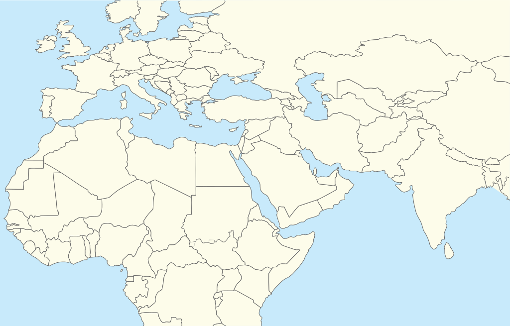
A map of Middle East, Africa and Europe.
| Description | Location map for Middle East (Greater Middle East) |
| Date | (UTC) |
| Source | |
| Author |
|
| This is a retouched picture, which means that it has been digitally altered from its original version. The original can be viewed here: World location map.svg:
|
I, the copyright holder of this work, hereby publish it under the following license:
| I, the copyright holder of this work, release this work into the public domain. This applies worldwide. In some countries this may not be legally possible; if so: I grant anyone the right to use this work for any purpose, without any conditions, unless such conditions are required by law. |
Original upload log
[edit]
This image is a derivative work of the following images:
- File:World_location_map.svg licensed with PD-self
- 2010-04-18T18:53:02Z STyx 800x400 (599024 Bytes) {{Information |Description={{en|1=?}} |Source=? |Author=? |Date= |Permission= |other_versions= }} == {{int:filedesc}} == {{Information |Description={{en}}Blank world map for location map templates ([[:en:Equirectangular proje
Uploaded with derivativeFX
File history
Click on a date/time to view the file as it appeared at that time.
| Date/Time | Thumbnail | Dimensions | User | Comment | |
|---|---|---|---|---|---|
| current | 16:52, 11 April 2024 | | 250 × 160 (258 KB) | Iktsokh (talk | contribs) | Clearing the map |
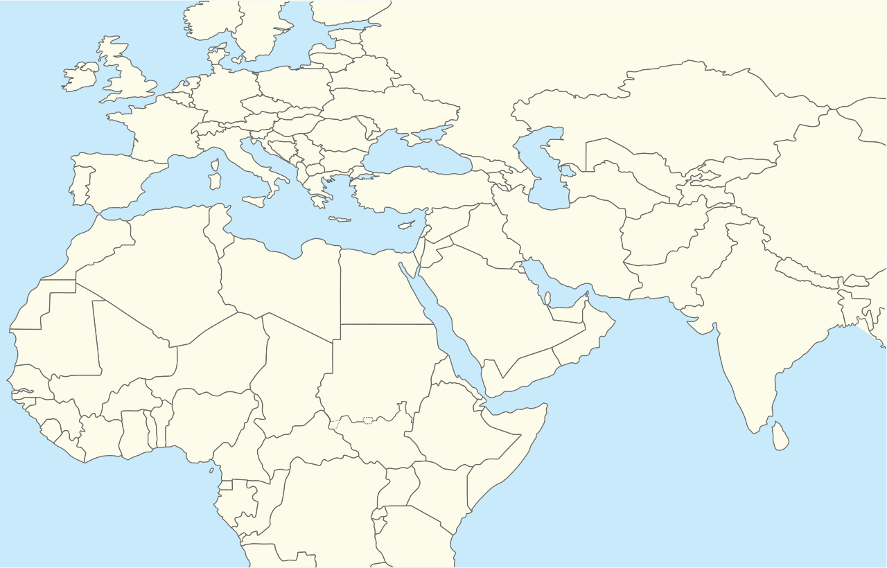
| 20:12, 5 April 2014 |  | 250 × 160 (258 KB) | RicHard-59 (talk | contribs) | Sudan divided, Cyprus has been missing | |
| 13:06, 28 October 2010 |  | 250 × 160 (250 KB) | 배우는사람 (talk | contribs) | {{Information |Description=Location map for Middle East (Greater Middle East) |Source=*File:World_location_map.svg |Date=2010-10-28 13:06 (UTC) |Author=*File:World_location_map.svg *derivative work: ~~~ |Permission= |other_versions= }} {{Reto |
You cannot overwrite this file.
File usage on Commons
There are no pages that use this file.
File usage on other wikis
The following other wikis use this file:
- Usage on ar.wikipedia.org
- Usage on azb.wikipedia.org
- Usage on bn.wikipedia.org
- Usage on ceb.wikipedia.org
- Usage on ckb.wikipedia.org
- Usage on da.wikipedia.org
- Usage on en.wikipedia.org
- Khuriya Muriya Islands
- Shiraz
- Abarim
- Sea of Galilee
- Dubai International Airport
- Taba, Egypt
- Taif
- Dubai
- Al Ain
- Midian
- Prophet's Mosque
- Kuwait International Airport
- Sharjah International Airport
- King Khalid International Airport
- Zayed International Airport
- Fujairah International Airport
- Jebel Akhdar (Oman)
- Salman Pak
- Doha International Airport
- Mount Arafat
- 1973 Rome airport attacks and hijacking
- Safa and Marwa
- Dhaid
- King Abdulaziz International Airport
- Wadi Qada'ah
- Nizwa
- Shibam
- Sohar
- Seeb
View more global usage of this file.