File:Návěst před křižovatkou s názvy ulic.jpg
Jump to navigation
Jump to search
Size of this preview: 800 × 600 pixels. Other resolutions: 320 × 240 pixels | 640 × 480 pixels | 1,024 × 768 pixels | 1,280 × 960 pixels | 2,048 × 1,536 pixels.
Original file (2,048 × 1,536 pixels, file size: 1.49 MB, MIME type: image/jpeg)
Captions
Captions
Add a one-line explanation of what this file represents
Summary[edit]
| Description |
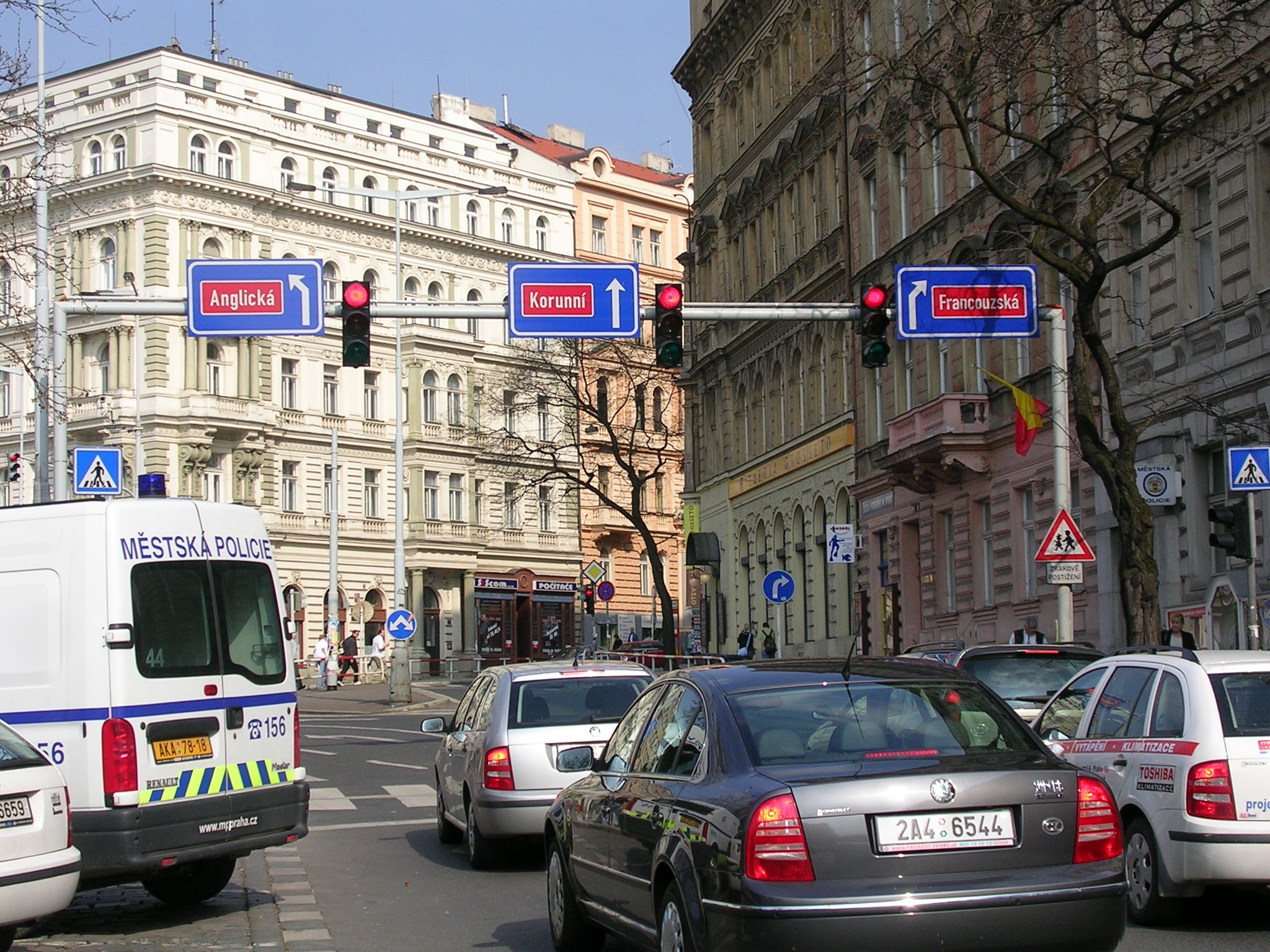
Čeština: Praha, náměstí Míru, prodloužení Rumunské ulice před křižovatkou s Francouzskou. Dopravní značka č. IS 6f podle vyhlášky 30/2001 Sb., varianta s označením názvu ulice.
English: Street names in Prague, Náměstí Míru, Rumunská street ahead of crossing with Francouzská street, marked with traffic sign IS 6f with street names. |
| Date | |
| Source | Czech Wikipedia |
| Author | cs:Wikipedista:ŠJů |
| Permission (Reusing this file) |
released into public domain by author |
| Camera location | | View this and other nearby images on: OpenStreetMap |
|---|
Licensing[edit]
| |
This work has been released into the public domain by its author, ŠJů, at the English Wikipedia project. This applies worldwide. In case this is not legally possible: |
File history
Click on a date/time to view the file as it appeared at that time.
| Date/Time | Thumbnail | Dimensions | User | Comment | |
|---|---|---|---|---|---|
| current | 11:37, 13 November 2006 | | 2,048 × 1,536 (1.49 MB) | Mormegil (talk | contribs) | {{Information |Description= *{{cs|Praha, náměstí Míru, prodloužení Rumunské ulice před křižovatkou s Francouzskou. Dopravní značka č. IS 6f podle vyhlášky 30/2001 Sb., varianta s označením názvu ulice.}} *{{en|Street names in [[Pragu |
You cannot overwrite this file.
File usage on Commons
The following 6 pages use this file:
File usage on other wikis
The following other wikis use this file:
- Usage on cs.wikipedia.org
- Usage on www.wikidata.org