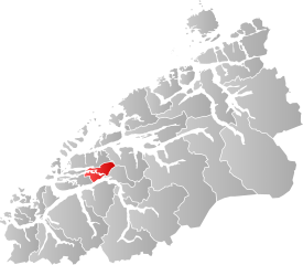
File:NO 1529 Skodje.svg
Jump to navigation
Jump to search

Size of this PNG preview of this SVG file: 617 × 538 pixels. Other resolutions: 275 × 240 pixels | 551 × 480 pixels | 881 × 768 pixels | 1,174 × 1,024 pixels | 2,349 × 2,048 pixels.
Original file (SVG file, nominally 617 × 538 pixels, file size: 319 KB)
Captions
Captions
Add a one-line explanation of what this file represents
| Description | |||
| Date | |||
| Source | Own work | ||
| Author | Jon Harald Søby | ||
| Permission (Reusing this file) |
|
||
| SVG development |
File history
Click on a date/time to view the file as it appeared at that time.
| Date/Time | Thumbnail | Dimensions | User | Comment | |
|---|---|---|---|---|---|
| current | 01:45, 19 May 2019 | | 617 × 538 (319 KB) | Jay1279 (talk | contribs) | . |
| 00:02, 19 May 2019 |  | 654 × 538 (321 KB) | Jay1279 (talk | contribs) | fix Grip islands | |
| 02:00, 17 May 2019 |  | 617 × 538 (163 KB) | Jay1279 (talk | contribs) | improved accuracy | |
| 07:10, 27 January 2019 |  | 515 × 402 (84 KB) | Bjarkan (talk | contribs) | Border update (Rindal). | |
| 19:35, 22 January 2007 |  | 546 × 402 (108 KB) | Jon Harald Søby (talk | contribs) | {{User:Jon Harald Søby/Kartlisens|Skodje|Møre og Romsdal}} |
You cannot overwrite this file.
File usage on Commons
The following 4 pages use this file:
File usage on other wikis
The following other wikis use this file:
- Usage on ar.wikipedia.org
- Usage on bpy.wikipedia.org
- Usage on ca.wikipedia.org
- Usage on da.wikipedia.org
- Usage on en.wikipedia.org
- Usage on eo.wikipedia.org
- Usage on es.wikipedia.org
- Usage on eu.wikipedia.org
- Usage on fa.wikipedia.org
- Usage on fi.wikipedia.org
- Usage on fr.wikipedia.org
- Usage on hu.wikipedia.org
- Usage on hy.wikipedia.org
- Usage on it.wikipedia.org
- Usage on ka.wikipedia.org
- Usage on la.wikipedia.org
- Usage on li.wikipedia.org
- Usage on nds.wikipedia.org
- Usage on nl.wikipedia.org
- Usage on nn.wikipedia.org
- Usage on no.wikipedia.org
- Usage on pl.wikipedia.org
- Usage on pnb.wikipedia.org
- Usage on pt.wikipedia.org
- Usage on ro.wikipedia.org
- Usage on ru.wikipedia.org
- Usage on se.wikipedia.org
- Usage on sl.wikipedia.org
- Usage on sq.wikipedia.org
- Usage on sv.wikipedia.org
- Usage on th.wikipedia.org
- Usage on tr.wikipedia.org
- Usage on ur.wikipedia.org
- Usage on vi.wikipedia.org
- Usage on www.wikidata.org
- Usage on zh-min-nan.wikipedia.org