File:Neuenstadt a.K. - Stein a.K. - Hohe Straße - Feldhecke (1).jpg
Jump to navigation
Jump to search

Size of this preview: 800 × 543 pixels. Other resolutions: 320 × 217 pixels | 640 × 434 pixels | 1,024 × 695 pixels | 1,280 × 869 pixels | 2,560 × 1,738 pixels | 9,122 × 6,192 pixels.
Original file (9,122 × 6,192 pixels, file size: 26.98 MB, MIME type: image/jpeg)
Captions
Captions
Add a one-line explanation of what this file represents
Summary
[edit].jpg&action=edit§ion=1)
| Description |
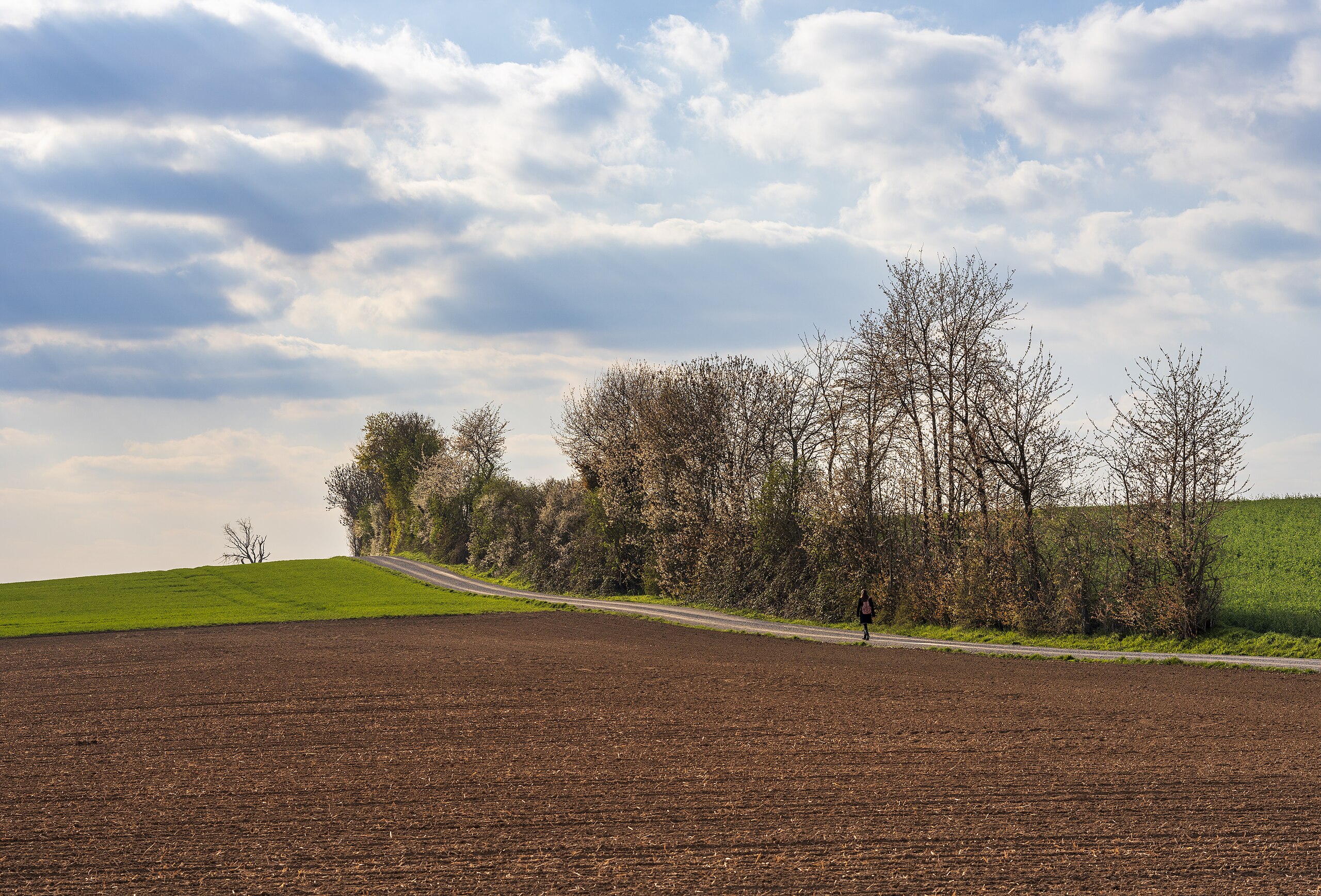
Deutsch: Feldhecke an der Hohen Straße nördlich des Buchhofs bei Stein am Kocher, Teilort von Neuenstadt am Kocher (Landkreis Heilbronn). Ansicht von Ost-Südosten im April. Die Person wurde absichtlich als Maßstab ins Bild genommen, um die Höhe der Hecke zu verdeutlichen. Die Hecke bildet den Rand des Landschaftsschutzgebietes Jagsttal mit angrenzenden Gebietsteilen zwischen Neudenau-Siglingen und Bad Friedrichshall-Jagstfeld und Sülztal bei Neudenau-Siglingen (LSG Nr. 1.25.058, WDPA-ID 321991). Vermutlich gehört sie außerdem zum geschützten Biotop Feldhecke an der Hohen Straße (Biotop-Nr. 167211250200, Datenblatt). Als ich die Aufnahme machte, war diese Feldhecke im Daten- und Kartendienst des LUBW als Teil dieses Biotops markiert. Kurz darauf wurden laut dem Datenblatt „Sachdaten und Geometrie überarbeitet“, wobei aber kein Teil des Biotops entfallen zu sein scheint, vielmehr wurden drei Feldhecken zu einem Biotop zusammengefasst. Die Karte des LUBW markiert nun aber nur den östlichen Teil der Feldhecke als Biotop. Ich vermute, dass ein Fehler in den Geodaten vorliegt (da das Datenblatt ja nicht von einer Verkleinerung, sondern von einer Zusammenfassung des Biotops spricht), sodass auch dieser westliche Teil der Hecke zum Biotop gehört – er wird in der Beschreibung erwähnt: „Die westliche Hecke ist schmaler (3 Meter) […] und weist einen spontan entstandenen Kern aus Schlehe und Holunder auf.“ Aber das ist natürlich schwer zu beweisen. |
| Date | Taken on 8 April 2021, 17:42:56 |
| Source | Own work |
| Author | Roman Eisele |
| Camera location | | View this and other nearby images on: OpenStreetMap |
|---|
.jpg¶ms=049.269907_N_0009.271527_E_globe:Earth_type:camera_heading:300.00&language=en)
| Object location | | View this and other nearby images on: OpenStreetMap |
|---|
.jpg¶ms=049.270691_N_0009.269043_E_globe:Earth_class:object_type:object__&language=en)
| Color space | This image file uses the Adobe RGB colour space. (Fortunately today most systems and applications respect colour spaces and ICC profiles. But there may still be some exceptions: outdated or misconfigured software can display wrong colours. If you see strange colours or if the picture appears flat and low in contrast, you should try another application or device for viewing it.) |
| Personal photo ID | RQCA0382 (This is the reference number of this photograph in my archive. Please do not delete it, it is very useful for me! You may use this ID if you need to refer to one of my photographs.) |
| Attribution (required by the license) | © Roman Eisele / CC BY-SA 4.0 |
| Using this picture | You can use this picture free of charge under the terms of the free license CC BY-SA 4.0. In particular, this means:
|
| Editing this picture | If you want to edit this picture for Commons, please upload your edited version using a new file name. My own version of this picture should be preserved and must be easily accessible. Please add the template {{Derived from}} or {{Extracted from}} to your version and use it to link to my original version of the picture. Thank you very much! |
This image was uploaded as part of Wiki Loves Earth 2024.
|
 |
Licensing
[edit].jpg&action=edit§ion=2)
I, the copyright holder of this work, hereby publish it under the following license:
This file is licensed under the Creative Commons Attribution-Share Alike 4.0 International license.
- You are free:
- to share – to copy, distribute and transmit the work
- to remix – to adapt the work
- Under the following conditions:
- attribution – You must give appropriate credit, provide a link to the license, and indicate if changes were made. You may do so in any reasonable manner, but not in any way that suggests the licensor endorses you or your use.
- share alike – If you remix, transform, or build upon the material, you must distribute your contributions under the same or compatible license as the original.
File history
Click on a date/time to view the file as it appeared at that time.
| Date/Time | Thumbnail | Dimensions | User | Comment | |
|---|---|---|---|---|---|
| current | 09:21, 29 June 2024 | | 9,122 × 6,192 (26.98 MB) | Aristeas (talk | contribs) | Uploaded own work with UploadWizard |
You cannot overwrite this file.
File usage on Commons
The following page uses this file:
.jpg&oldid=890388407)