File:New York City District Map.svg
Jump to navigation
Jump to search

Size of this PNG preview of this SVG file: 616 × 600 pixels. Other resolutions: 247 × 240 pixels | 493 × 480 pixels | 789 × 768 pixels | 1,052 × 1,024 pixels | 2,104 × 2,048 pixels | 2,652 × 2,582 pixels.
Original file (SVG file, nominally 2,652 × 2,582 pixels, file size: 846 KB)
Captions
Captions
Add a one-line explanation of what this file represents
Summary
[edit]| Description |
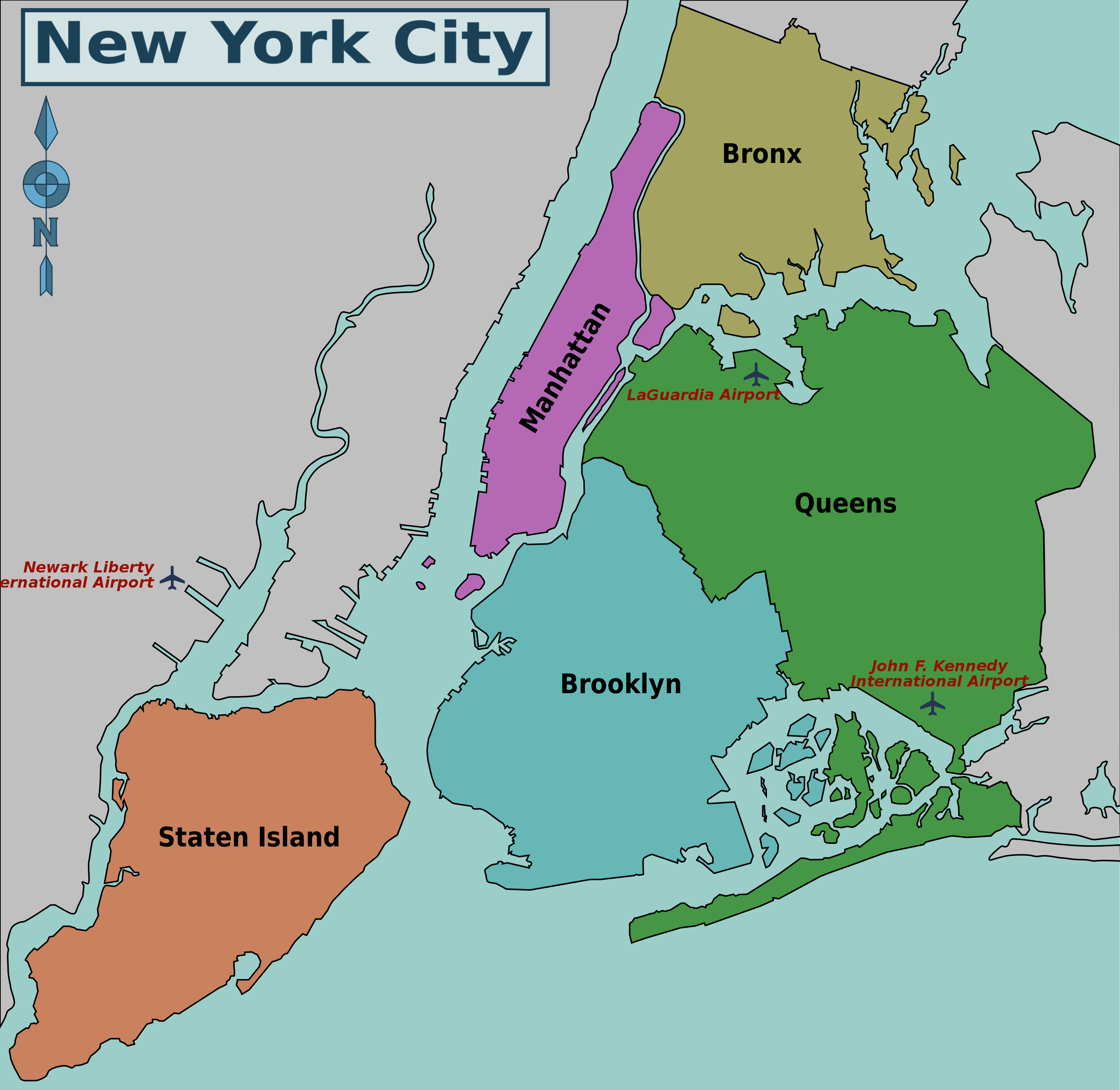
English: New York City Boroughs Map. |
| Date | |
| Source | File:5_Boroughs_Labels_New_York_City_Map_Julius_Schorzman.png |
| Author | User PerryPlanet |
| Other versions |
File:New York City District Map.png
|


Licensing
[edit]
This file is licensed under the Creative Commons Attribution-Share Alike 2.5 Generic license.
- You are free:
- to share – to copy, distribute and transmit the work
- to remix – to adapt the work
- Under the following conditions:
- attribution – You must give appropriate credit, provide a link to the license, and indicate if changes were made. You may do so in any reasonable manner, but not in any way that suggests the licensor endorses you or your use.
- share alike – If you remix, transform, or build upon the material, you must distribute your contributions under the same or compatible license as the original.
Original upload log
[edit]
| This file was imported from Wikivoyage WTS. |
The original description page was here. All following user names refer to wts.wikivoyage-old.
- 2009-07-12 21:30 (WT-shared) PerryPlanet archive copy at the Wayback Machine 2652×2582 (885608 bytes) {{Imagecredit|credit=User PerryPlanet|captureDate=July 12, 2009|location=New York|source=http://commons.wikimedia.org/wiki/File:5_Boroughs_L (Import from wikitravel.org/shared)
File history
Click on a date/time to view the file as it appeared at that time.
| Date/Time | Thumbnail | Dimensions | User | Comment | |
|---|---|---|---|---|---|
| current | 10:42, 9 December 2019 | | 2,652 × 2,582 (846 KB) | খাঁ শুভেন্দু (talk | contribs) | File uploaded using svgtranslate tool (https://tools.wmflabs.org/svgtranslate/). Added translation for bn. |
| 01:36, 18 November 2012 |  | 2,652 × 2,582 (865 KB) | MGA73bot2 (talk | contribs) | {{BotMoveToCommons|wts.oldwikivoyage|year={{subst:CURRENTYEAR}}|month={{subst:CURRENTMONTHNAME}}|day={{subst:CURRENTDAY}}}} == {{int:filedesc}} == {{Information |description=New York City Boroughs Map. , New York * Map of: New York¤ |date=July 12, 200... |
You cannot overwrite this file.
File usage on Commons
The following 8 pages use this file:
- User:Chumwa/OgreBot/Potential transport maps/2019 December 1-10
- User:Chumwa/OgreBot/Transport Maps/2019 December 1-10
- User:Chumwa/OgreBot/Travel and communication maps/2019 December 1-10
- File:New York City District Map.png
- File:New York City District Map.svg
- File:New York City District Map he.svg
- File:নিউ ইয়র্ক শহরের জেলা মানচিত্র.svg
- Template:Other versions/New York City District Map
File usage on other wikis
The following other wikis use this file:
- Usage on en.wikibooks.org
- Usage on en.wikivoyage.org
- Usage on es.wikivoyage.org
- Usage on fr.wikipedia.org
- Usage on fr.wikivoyage.org
- Usage on ps.wikivoyage.org