File:Ordnance Survey Agricultural Map of Great Britain Sheet 2, South, Published 1942.jpg
Jump to navigation
Jump to search

Size of this preview: 765 × 599 pixels. Other resolutions: 306 × 240 pixels | 613 × 480 pixels | 980 × 768 pixels | 1,280 × 1,003 pixels | 2,560 × 2,006 pixels | 25,014 × 19,597 pixels.
Original file (25,014 × 19,597 pixels, file size: 48.32 MB, MIME type: image/jpeg)
Captions
Captions
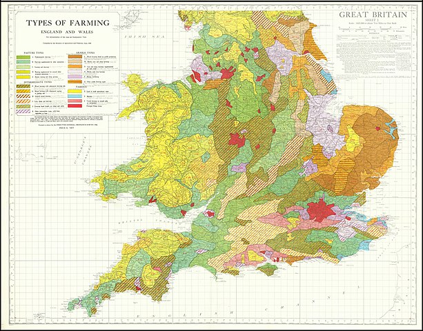
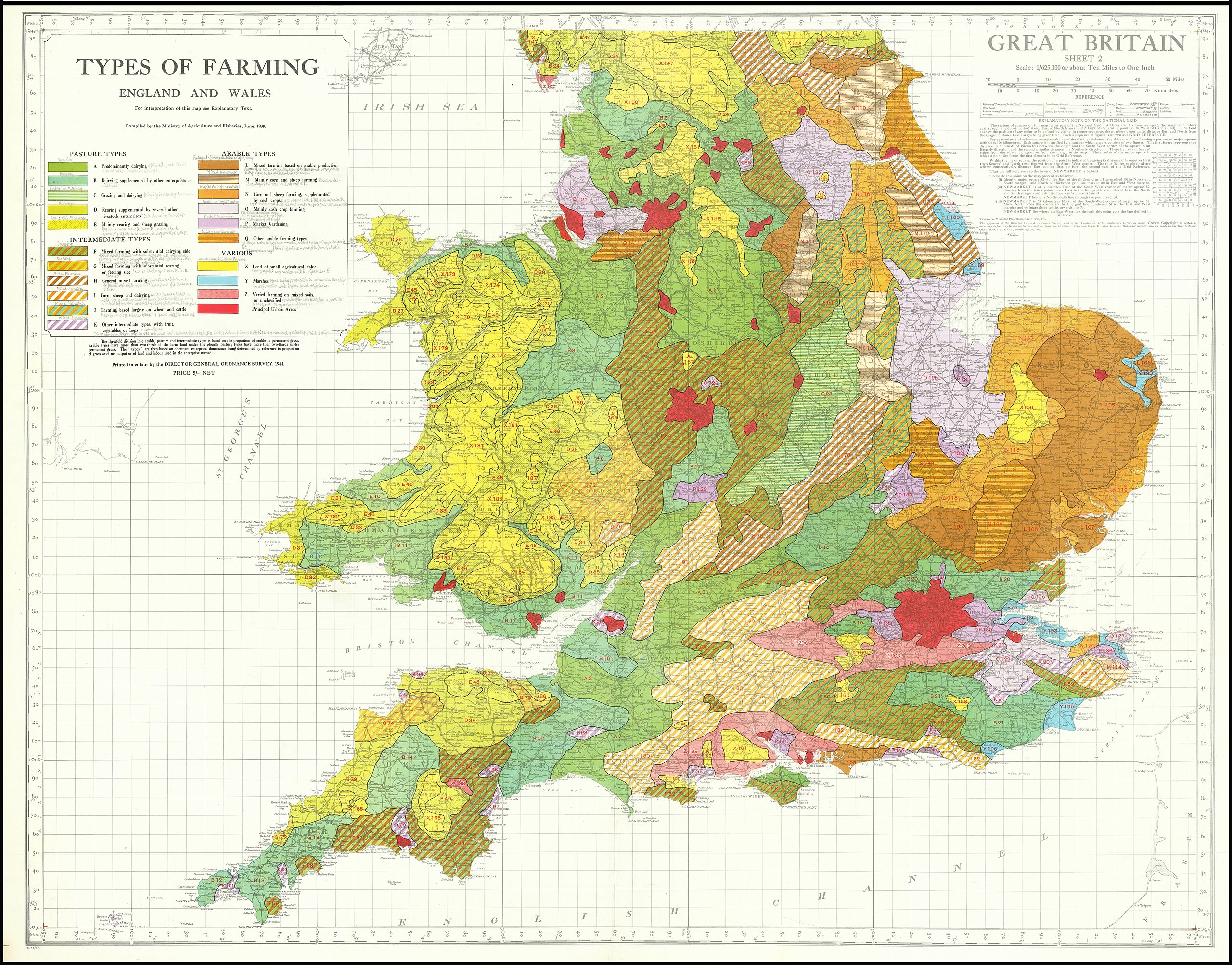
OS agricultural map of Britain, south sheet
Summary[edit]
| Warning | The original file is very high-resolution. It might not load properly or could cause your browser to freeze when opened at full size. |
|---|
| Description |
English: OS agricultural map of Britain, south sheet, at a scale of 1:625,000 |
| Date | |
| Source | https://www.raremaps.com/gallery/detail/68080/two-sheet-detailed-agricultural-map-great-britain-ordnance-survey |
| Author | Director General of the Ordnance Survey, UK |
| Other versions |

Licensing[edit]
This work is an Ordnance Survey map over 50 years old, which is covered by Crown Copyright which in this case expires 50 years after publication. Ordnance Survey does however ask that they be credited and that the date of publication be given.
Any ancillary rights gained through the creation of the electronic version are granted as freely usable under any circumstances.
|
This work created by the United Kingdom Government is in the public domain.
This is because it is one of the following:
HMSO has declared that the expiry of Crown Copyrights applies worldwide (ref: HMSO Email Reply)
|
 |
File history
Click on a date/time to view the file as it appeared at that time.
| Date/Time | Thumbnail | Dimensions | User | Comment | |
|---|---|---|---|---|---|
| current | 11:09, 2 August 2020 | | 25,014 × 19,597 (48.32 MB) | Kognos (talk | contribs) | Uploaded a work by Director General of the Ordnance Survey, UK from Cropped from File:Agricultural Map of Great Britain.jpg with UploadWizard |
You cannot overwrite this file.
File usage on Commons
The following page uses this file: