File:Ordnance Survey Drawings - Redruth (OSD 4&5).jpg

Original file (3,630 × 4,000 pixels, file size: 5.15 MB, MIME type: image/jpeg)
Captions
Captions
| Title |
Ordnance Survey Drawings: Redruth (OSD 4&5) |
|||||||||||||||||||||||
| DescriptionOrdnance Survey Drawings - Redruth (OSD 4&5).jpg |
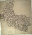
English: The contouring technique used by Robert Dawson on this map precedes the introduction of obligatory contouring on Ordnance Survey maps in 1839-40. Short watercolour lines ('hachures'), drawn with a brush, follow the direction of slope and are paced to indicate the steepness of relief. Colour washes are steadily built up, giving realism to the depiction of hills, mountains and, in particular, the thickly wooded valleys descending from the moors and downs towards the sea. Tin and copper mining is evident around Redruth and Camborne. A triangulation diagram is inscribed on the reverse of the manuscript but is now obscured by backing material..
This image has been georeferenced.
|
|||||||||||||||||||||||
| Date | ||||||||||||||||||||||||
| Source |
|
|||||||||||||||||||||||
| Creator |
Dawson, Robert - Draughtsman |
|||||||||||||||||||||||
| Credit line | British Library | |||||||||||||||||||||||
| Permission (Reusing this file) |
|
|||||||||||||||||||||||
| Geotemporal data | ||||||||||||||||||||||||
| Bounding box |
|
|||||||||||||||||||||||
| Georeferencing | View the georeferenced map in the Wikimaps Warper | |||||||||||||||||||||||
| Archival data | ||||||||||||||||||||||||
| Collection |
institution QS:P195,Q23308 |
|||||||||||||||||||||||
| Accession number |
Maps OSD 4&5 |
|||||||||||||||||||||||
| Dimensions | 280 × 260 mm (11.02 × 10.23 in) | |||||||||||||||||||||||
| Medium | Pen and ink on paper | |||||||||||||||||||||||
| Notes |
Scale 2 inches : 1 mile ( 1: 31680). Please note that the British Library provides these digital files "as-is"; materials will not be rephotographed under this programme. If resupply of files is required, the requestor will be required to purchase them at the standard rate. |
|||||||||||||||||||||||
File history
Click on a date/time to view the file as it appeared at that time.
| Date/Time | Thumbnail | Dimensions | User | Comment | |
|---|---|---|---|---|---|
| current | 21:30, 27 September 2013 |  | 3,630 × 4,000 (5.15 MB) | LibraryBot (talk | contribs) | {{subst:User:Andrew Gray/OSD|ID= 002OSD000000003U00003000 |OSD_NUM= OSD 4&5 |MEDIUM= Pen and ink on paper |TITLE= Redruth |CREATOR= Dawson, Robert - Draughtsman |YEAR= 1809 |DESCRIPTION= The contouring technique used by Robert Dawson on this map preced... |
You cannot overwrite this file.
File usage on Commons
The following page uses this file:
File usage on other wikis
The following other wikis use this file:
- Usage on www.wikidata.org


