File:Père-Lachaise - Division 31 - Morisot 01.jpg
Jump to navigation
Jump to search

Size of this preview: 800 × 533 pixels. Other resolutions: 320 × 213 pixels | 640 × 427 pixels | 1,024 × 683 pixels | 1,280 × 853 pixels | 2,560 × 1,707 pixels | 3,798 × 2,532 pixels.
Original file (3,798 × 2,532 pixels, file size: 7.64 MB, MIME type: image/jpeg)
Captions
Captions
Add a one-line explanation of what this file represents
Summary
|
This building is inscrit au titre des monuments historiques de la France. It is indexed in the base Mérimée, a database of architectural heritage maintained by the French Ministry of Culture, under the reference PA00086780
|
Object
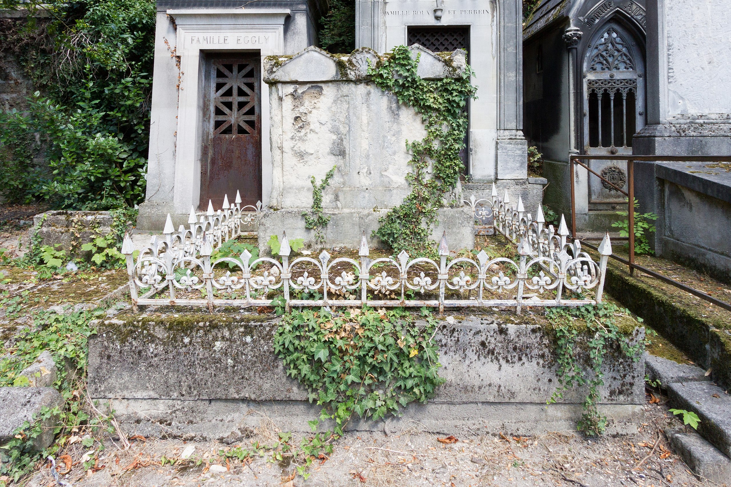
| Grave of Morisot
|
||||||||||||||||||||||||
|---|---|---|---|---|---|---|---|---|---|---|---|---|---|---|---|---|---|---|---|---|---|---|---|---|
| Title |
Tomb of Morisot |
 | ||||||||||||||||||||||
| Object type | tomb | |||||||||||||||||||||||
| Genre |
funerary art |
|||||||||||||||||||||||
| Description |
Français : Sépulture des peintres Paule Gobillard (1867-1946) et Edma Morisot (1839-1921), ainsi que Edmé Tiburce (1804-1874), Marie Joséphine Cornélie (1819-1876), Hippolyte Adolphe Samuel Pontillon (1832-1894), Jeanne Pontillon (1870-1921).
English: Tomb of Tiburice-Pierre Morisot (died and/or buried 1827) and the painters Paule Gobillard (1867-1946) and Edma Morisot (1839-1921), and Edmé Tiburce (1804-1874), Marie Joséphine Cornélie (1819-1876), Hippolyte Adolphe Samuel Pontillon (1832-1894), Jeanne Pontillon (1870-1921). |
|||||||||||||||||||||||
| Collection |
|
|||||||||||||||||||||||
| Current location |
Division 31, chemin de Labédoyère, line 1, Salomon: Ee227, Mairie de Paris: 1/21 22/36 Tomb on the left : Blanchard, on the right : Sevin-Hernas |
|||||||||||||||||||||||
| Object location |
|
|||||||||||||||||||||||
| Inscriptions |
Paule GOBILLARD artiste peintre 1867-1946
|
|||||||||||||||||||||||
| Notes | See also category: Grave of Édouard Manet. | |||||||||||||||||||||||

Photograph
| Date | |
| Source | Own work |
| Author | Pierre-Yves Beaudouin |
| Attribution (required by the license) | Pierre-Yves Beaudouin / Wikimedia Commons / |
| Object location | | View this and other nearby images on: OpenStreetMap |
|---|
Licensing
I, the copyright holder of this work, hereby publish it under the following license:
This file is licensed under the Creative Commons Attribution-Share Alike 4.0 International license.
- You are free:
- to share – to copy, distribute and transmit the work
- to remix – to adapt the work
- Under the following conditions:
- attribution – You must give appropriate credit, provide a link to the license, and indicate if changes were made. You may do so in any reasonable manner, but not in any way that suggests the licensor endorses you or your use.
- share alike – If you remix, transform, or build upon the material, you must distribute your contributions under the same or compatible license as the original.
This document was produced using the pack Atget lent by Wikimédia France.
|
This picture as been uploaded as part of L'Été des régions Wikipédia.
|
File history
Click on a date/time to view the file as it appeared at that time.
| Date/Time | Thumbnail | Dimensions | User | Comment | |
|---|---|---|---|---|---|
| current | 10:28, 3 August 2018 | | 3,798 × 2,532 (7.64 MB) | Pyb (talk | contribs) | Uploaded with LrMediaWiki 0.8.0, LR 7.0 Win |
You cannot overwrite this file.
File usage on Commons
The following 8 pages use this file:
- Chemin de Labédoyère (Père-Lachaise)
- Père-Lachaise Cemetery - Division 31
- User:Paris 16/Recent uploads/2018 August 3-4
- File:Père-Lachaise - Division 31 - Morisot 01.jpg
- Category:Edma Morisot
- Category:Edmé Tiburce Morisot
- Category:Grave of Morisot (Père-Lachaise, division 31)
- Category:Paule Gobillard
File usage on other wikis
The following other wikis use this file:
- Usage on fr.wikipedia.org
- Usage on www.wikidata.org