File:PIA21572 - The Splitting of the Dunes.jpg

Original file (2,880 × 1,800 pixels, file size: 881 KB, MIME type: image/jpeg)
Captions
Captions
Summary[edit]
| Description |
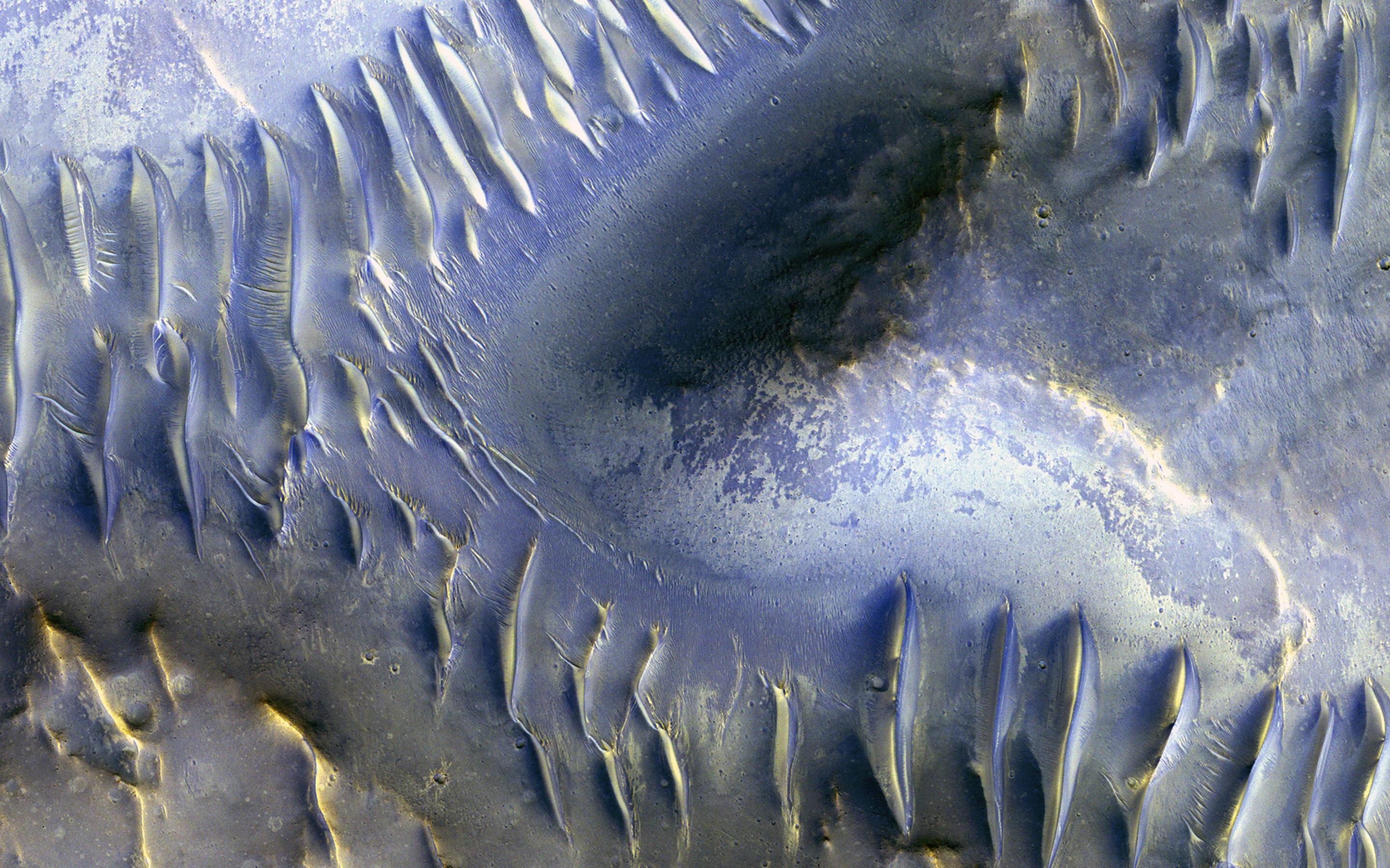
English: The mound in the center of this image appears to have blocked the path of the dunes as they marched south (north is to the left in this image) across the scene. Many of these transverse dunes have slipfaces that face south, although in some cases, it's hard to tell for certain. Smaller dunes run perpendicular to some of the larger-scale dunes, probably indicating a shift in wind directions in this area.
Although it might be hard to tell, this group of dunes is very near the central pit of a 35-kilometer-wide impact crater. Data from other instruments indicate the presence of clay-like materials in the rock exposed in the central pit. This is a stereo pair with ESP_013319_1685. The map is projected here at a scale of 50 centimeters (9.8 inches) per pixel. [The original image scale is 52 centimeters (20.5 inches) per pixel (with 2 x 2 binning); objects on the order of 156 centimeters (61.4 inches) across are resolved.] North is up. The University of Arizona, Tucson, operates HiRISE, which was built by Ball Aerospace & Technologies Corp., Boulder, Colo. NASA's Jet Propulsion Laboratory, a division of Caltech in Pasadena, California, manages the Mars Reconnaissance Orbiter Project for NASA's Science Mission Directorate, Washington. |
| Date | 27 April 2009 (published 27 March 2017) |
| Source | Catalog page · Full-res (JPEG · TIFF) |
| Author | NASA/JPL-Caltech/Univ. of Arizona |
| Location on Mars | View this and other nearby images on: Google Maps |
|---|
This image or video was catalogued by Jet Propulsion Laboratory of the United States National Aeronautics and Space Administration (NASA) under Photo ID: PIA21572. This tag does not indicate the copyright status of the attached work. A normal copyright tag is still required. See Commons:Licensing. Other languages:
|
 |
This media is a product of the Mars Reconnaissance Orbiter mission Credit and attribution belongs to the High Resolution Imaging Science Experiment (HiRISE) team, NASA/JPL-Caltech/Univ. of Arizona |
Licensing[edit]
| This file is in the public domain in the United States because it was solely created by NASA. NASA copyright policy states that "NASA material is not protected by copyright unless noted". (See Template:PD-USGov, NASA copyright policy page or JPL Image Use Policy.) | ||
 |
Warnings:
|
File history
Click on a date/time to view the file as it appeared at that time.
| Date/Time | Thumbnail | Dimensions | User | Comment | |
|---|---|---|---|---|---|
| current | 00:20, 28 March 2017 | | 2,880 × 1,800 (881 KB) | PhilipTerryGraham (talk | contribs) | User created page with UploadWizard |
You cannot overwrite this file.
File usage on Commons
The following page uses this file: