File:Palaeolithic end scraper (terminal, plan, profile and reverse). (FindID 962472).jpg

Original file (5,669 × 3,924 pixels, file size: 5.38 MB, MIME type: image/jpeg)
Captions
Captions
Summary[edit]
._(FindID_962472).jpg&action=edit§ion=1)
| Palaeolithic end scraper (terminal, plan, profile and reverse). | |||
|---|---|---|---|
| Photographer |
Birmingham Museums Trust, Angie Bolton, 2019-07-12 15:57:59 |
||
| Title |
Palaeolithic end scraper (terminal, plan, profile and reverse). |
||
| Description |
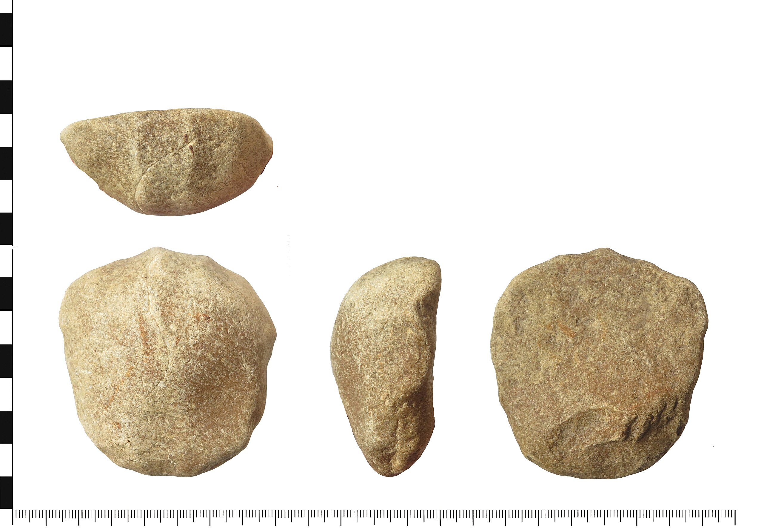
English: Lower Palaeolithic end scraper knapped from a quartzite Bunter cobble from the Triassic period. The scraper is a sub-oval with the ventral surface having a possibly two flake scars at the proximal end, the scar has a step fracture. The dorsal surface has flake removal at the distal end which abrupt re-touch with at least four flake removals to form the scraping edge.
There are no visible hammerstone marks on the surface, but the scraper is heavily rolled, therefore the flake scar edges are very blunt and curved. The scraper measures 72.99mm long, 68.01mm wide, 33.47mm thick and weighs 228g. The object has been identified as an end scraper and dating it is difficult as the area it was found in is on the edge of three glacial zones MIS 10, 8 and 6 and may be pre-Anglian stage, therefore there is a broad date range of before 480,000 BC to c. 193,000 BC. However, there is the possibility that this was also knapped and used in a later period so a the Lower Paleolithic date is only a probable date. |
||
| Depicted place | (County of findspot) Staffordshire | ||
| Date | between 480000 BC and 193000 BC | ||
| Accession number |
FindIdentifier: 962472 |
||
| Credit line |
|
||
| Source |
https://finds.org.uk/database/ajax/download/id/1065086 Catalog: https://finds.org.uk/database/images/image/id/1065086/recordtype/artefacts archive copy at the Wayback Machine Artefact: https://finds.org.uk/database/artefacts/record/id/962472 |
||
| Permission (Reusing this file) |
Attribution License | ||
| Object location | | View this and other nearby images on: OpenStreetMap |
|---|
._(FindID_962472).jpg¶ms=052.621100_N_-001.731080_E_globe:Earth_class:object_type:object__&language=en)
Licensing[edit]
._(FindID_962472).jpg&action=edit§ion=2)
- You are free:
- to share – to copy, distribute and transmit the work
- to remix – to adapt the work
- Under the following conditions:
- attribution – You must give appropriate credit, provide a link to the license, and indicate if changes were made. You may do so in any reasonable manner, but not in any way that suggests the licensor endorses you or your use.
File history
Click on a date/time to view the file as it appeared at that time.
| Date/Time | Thumbnail | Dimensions | User | Comment | |
|---|---|---|---|---|---|
| current | 07:18, 12 December 2020 | | 5,669 × 3,924 (5.38 MB) | Fæ (talk | contribs) | Portable Antiquities Scheme, WAW, FindID: 962472-1065086, palaeolithic, page 1778, batch count 5489 |
You cannot overwrite this file.
File usage on Commons
The following page uses this file:
._(FindID_962472).jpg)
._(FindID_962472).jpg&oldid=631607689)