File:Palk Strait (MODIS 2018-07-27).jpg
Original file (1,847 × 1,326 pixels, file size: 223 KB, MIME type: image/jpeg)
Captions
Captions
Summary[edit]
.jpg&action=edit§ion=1)
| Description |
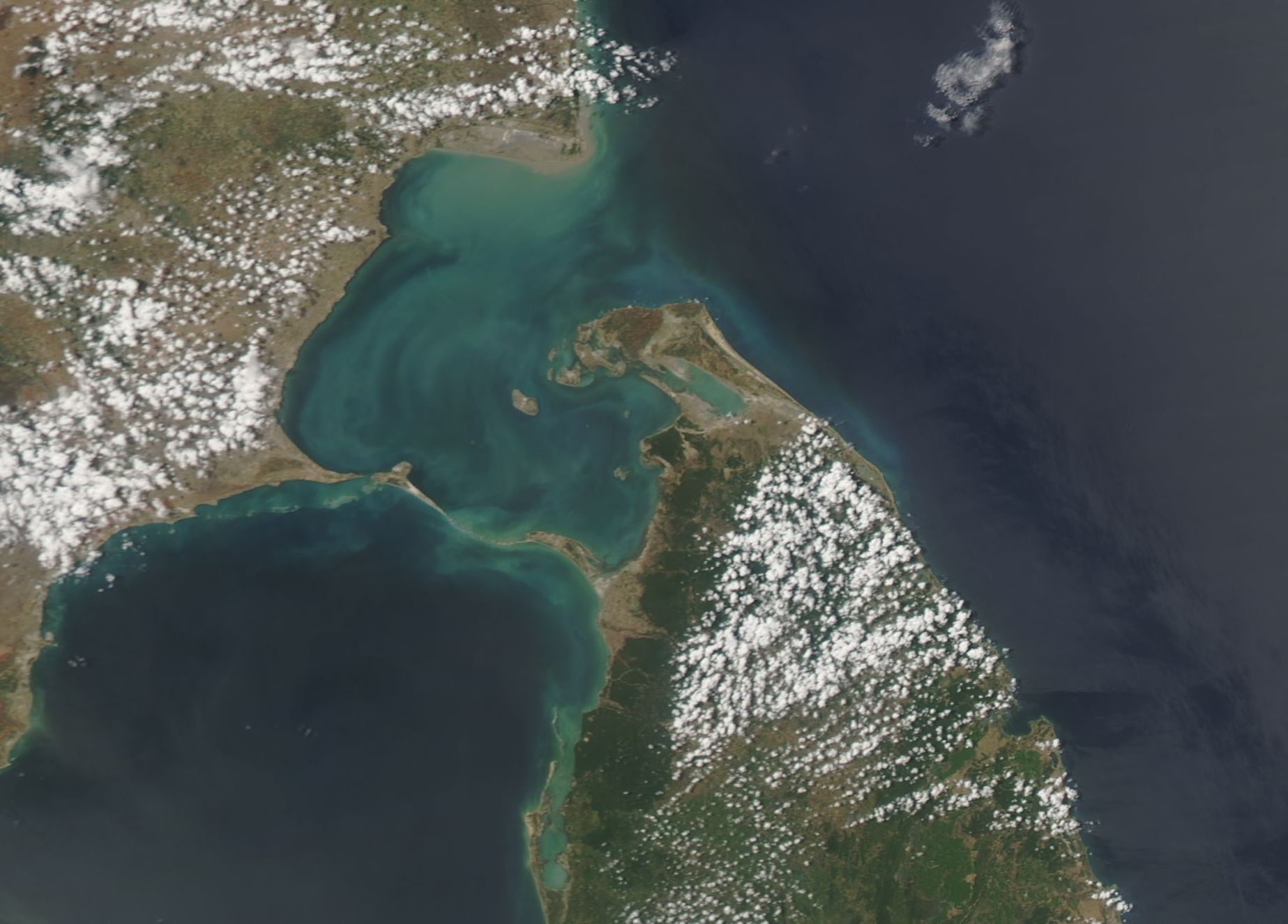
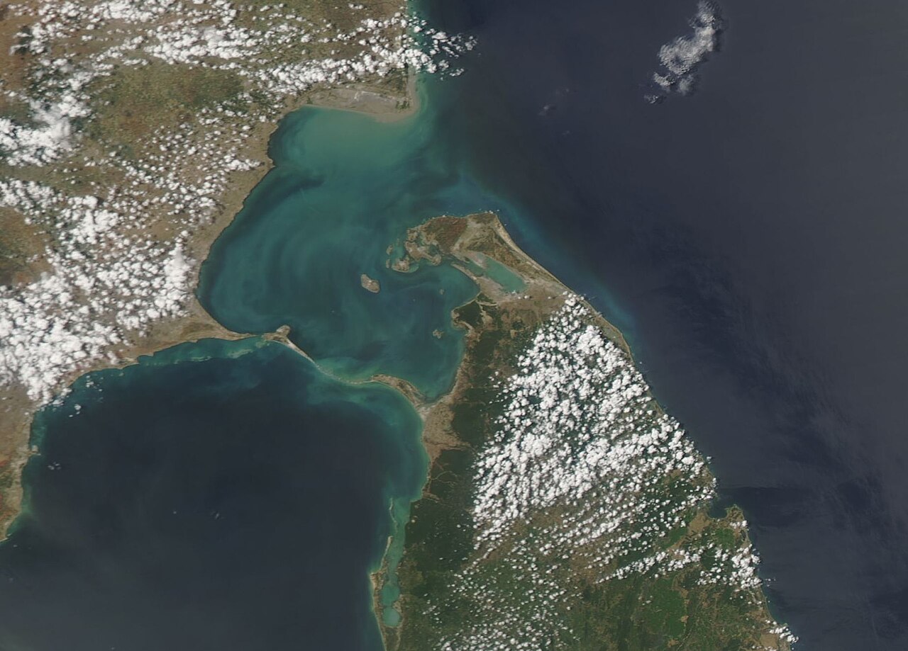
English: The waters of the Palk Strait separate Sri Lanka from the tip of India. At the narrowest point, the Palk Strait measures about 33 miles (53 km) wide.
A chain of islands and coral reef stretches across the southern end of the strait. Most often called Adam’s Bridge, this feature is also called “the Bridge of Rama’. Sacred to the Hindu religion, the bridge was said to be built by Lord Rama, who visited many towns in the region. The shoals are primarily limestone and the waters in this location are quite shallow – some data suggests the “bridge” may be the remnants of a true land bridge that once stretched between India and Sri Lanka. On July 23, 2018, NASA’s Aqua satellite passed over the Palk Strait, allowing the Moderate Resolution Imaging Spectroradiometer (MODIS) flying aboard to acquire a true-color image of the region. Swirls of greens, milky-blue, and tan float in the waters of the Palk Strait. These colors are likely created by a combination of sediment, which flows into the Strait from large rivers several rivers, and phytoplankton. Phytoplankton are microscopic plant-like organisms that frequently flourish in these waters and – in very large numbers – can be easily seen from space. |
||
| Date | Taken on 23 July 2018 | ||
| Source |
|
||
| Author | Jeff Schmaltz, MODIS Land Rapid Response Team, NASA GSFC |
| This media is a product of the Aqua mission Credit and attribution belongs to the mission team, if not already specified in the "author" row |
Licensing[edit]
.jpg&action=edit§ion=2)
| This file is in the public domain in the United States because it was solely created by NASA. NASA copyright policy states that "NASA material is not protected by copyright unless noted". (See Template:PD-USGov, NASA copyright policy page or JPL Image Use Policy.) | ||
 |
Warnings:
|
File history
Click on a date/time to view the file as it appeared at that time.
| Date/Time | Thumbnail | Dimensions | User | Comment | |
|---|---|---|---|---|---|
| current | 01:37, 17 February 2024 | | 1,847 × 1,326 (223 KB) | OptimusPrimeBot (talk | contribs) | #Spacemedia - Upload of http://modis.gsfc.nasa.gov/gallery/images/image07272018_250m.jpg via Commons:Spacemedia |
You cannot overwrite this file.
File usage on Commons
There are no pages that use this file.
.jpg&oldid=852774356)