File:Passaic County, NJ municipalities labeled.png
Jump to navigation
Jump to search
Size of this preview: 424 × 600 pixels. Other resolutions: 170 × 240 pixels | 339 × 480 pixels | 543 × 768 pixels | 724 × 1,024 pixels | 2,048 × 2,896 pixels.
Original file (2,048 × 2,896 pixels, file size: 330 KB, MIME type: image/png)
Captions
Captions
Add a one-line explanation of what this file represents
Summary[edit]
| Description |
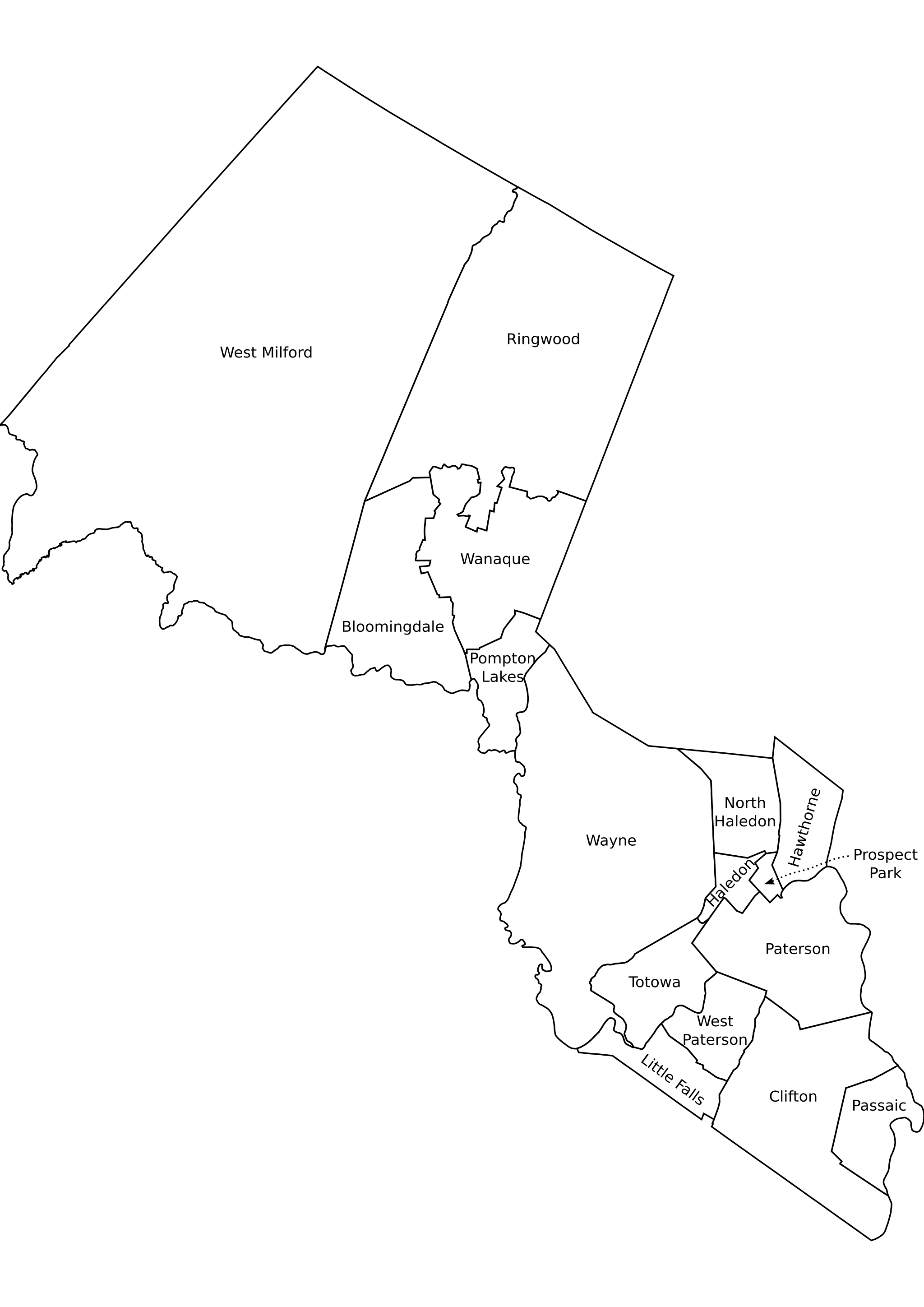
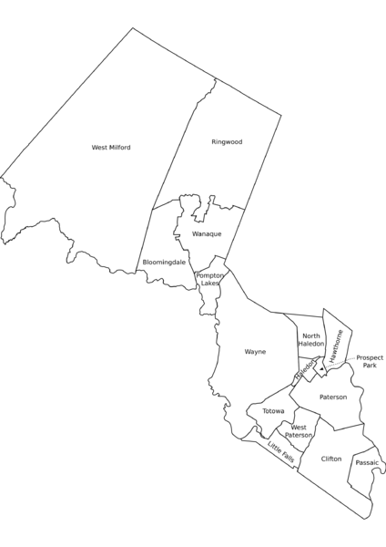
Passaic County, New Jersey outline map of municipalities, labeled. Sources:
|
| Date | 28 November 2005 (original upload date) |
| Source | No machine-readable source provided. Own work assumed (based on copyright claims). |
| Author | No machine-readable author provided. ChrisRuvolo assumed (based on copyright claims). |
Licensing[edit]
| I, the copyright holder of this work, release this work into the public domain. This applies worldwide. In some countries this may not be legally possible; if so: I grant anyone the right to use this work for any purpose, without any conditions, unless such conditions are required by law. |
File history
Click on a date/time to view the file as it appeared at that time.
| Date/Time | Thumbnail | Dimensions | User | Comment | |
|---|---|---|---|---|---|
| current | 21:50, 28 November 2005 | | 2,048 × 2,896 (330 KB) | ChrisRuvolo (talk | contribs) | Passaic County, New Jersey outline map of municipalities, labeled. Sources: * NJDEP publishes Arcview shape format outline maps of counties and municpalities. Believed ((PD-ineligible)). [http://www.state.nj.us/dep/gis/munshp.html] * Converted to SVG, e |
You cannot overwrite this file.
File usage on Commons
The following page uses this file:
File usage on other wikis
The following other wikis use this file:
- Usage on en.wikipedia.org
- Usage on fr.wikipedia.org
- Usage on it.wikipedia.org
- Usage on pt.wikipedia.org
- Usage on sv.wikipedia.org