File:Phillips Farmhouse through driveway trees.jpg
Jump to navigation
Jump to search

Size of this preview: 800 × 533 pixels. Other resolutions: 320 × 213 pixels | 640 × 426 pixels | 1,024 × 682 pixels | 1,280 × 853 pixels | 2,560 × 1,705 pixels | 4,432 × 2,952 pixels.
Original file (4,432 × 2,952 pixels, file size: 3.35 MB, MIME type: image/jpeg)
Captions
Captions
Add a one-line explanation of what this file represents
|
This is an image of a place or building that is listed on the National Register of Historic Places in the United States of America. Its reference number is 98001318. |
| Camera location | | View this and other nearby images on: OpenStreetMap |
|---|
| Description |
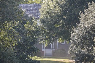
English: Distant view of the Phillips Farmhouse, located at 6353 Godwin Boulevard (State Routes 10/32) in Suffolk, Virginia, United States. Built in 1820, it is listed on the National Register of Historic Places. |
||
| Date | Taken on 30 September 2017 | ||
| Source | Own work | ||
| Author | Nyttend | ||
| Permission (Reusing this file) |
|
||
| Other versions | None |
File history
Click on a date/time to view the file as it appeared at that time.
| Date/Time | Thumbnail | Dimensions | User | Comment | |
|---|---|---|---|---|---|
| current | 03:57, 23 December 2017 | | 4,432 × 2,952 (3.35 MB) | Nyttend (talk | contribs) | Cropping out the trees on the margins |
| 03:56, 23 December 2017 |  | 6,016 × 4,000 (6.33 MB) | Nyttend (talk | contribs) | {{NRHP|98001318}} {{Location|36|52|33.5|N|76|35|2|W}} {{Information |Description={{en|Distant view of the {{w|Phillips Farm|Phillips Farmhouse}}, located at 6353 Godwin Boulevard (State Routes {{w|Virginia State Route 10|10}}/{{w|Virginia State Route 3... |
You cannot overwrite this file.
File usage on Commons
There are no pages that use this file.
File usage on other wikis
The following other wikis use this file:
- Usage on www.wikidata.org